


Interference Analyzer
R&S
®
Cable Rider ZPH
313
User Manual 1321.0950.02 ─ 07
2. Select the "Save" softkey.
The R&S Cable Rider ZPH opens a submenu to select the different geotags saving
options.
3. Select the "Azimuth Only" menu item.
The R&S Cable Rider ZPH opens an input field to change the azimuth (the GPS
data itself is not changed). Note that the azimuth line is updated in real time when
you change its angle.
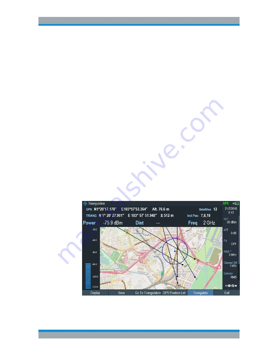
Perform triangulation
Triangulation is performed to calculate and determine the source of interference.
1. Select the "GPS Position" softkey.
2. Select the "GPS Position List" softkey.
The R&S Cable Rider ZPH opens the "GPS position list" dialog box.
3. Select two or three geotags and display them on the map.
See
Figure 13-7
.
4. Select the "GPS Position" softkey.
5. Select the "Triangulation" softkey.
The R&S Cable Rider ZPH calculates the intersection point of the geotags you
have selected. The result is displayed on the map as a dot that is surrounded by a
circle. See
Figure 13-2
.
By default, the dot and circle are blue. However, you can assign a different color to
the triangulation results. See
"Default behavior of geotags in triangulation "
on page 301.
Figure 13-7: Triangulation result
Working with Maps


