


Interference Analyzer
R&S
®
Cable Rider ZPH
308
User Manual 1321.0950.02 ─ 07
You can save a geotag of your current position or create a geotag of any other position
that you would like to save.
Creating geotags manually
1. Press the [MEAS] key.
2. Select "GPS Position" softkey.
3. Select "Save" softkey.
The R&S Cable Rider ZPH opens a submenu to select the different geotags saving
options.
4. Select the "Current Position" menu item.
The R&S Cable Rider ZPH creates a geotag of your current position. A geotag cre-
ated this way is based on the coordinates of the GPS receiver and it includes the
azimuth.
Alternatively, create a geotag of an arbitrary location.
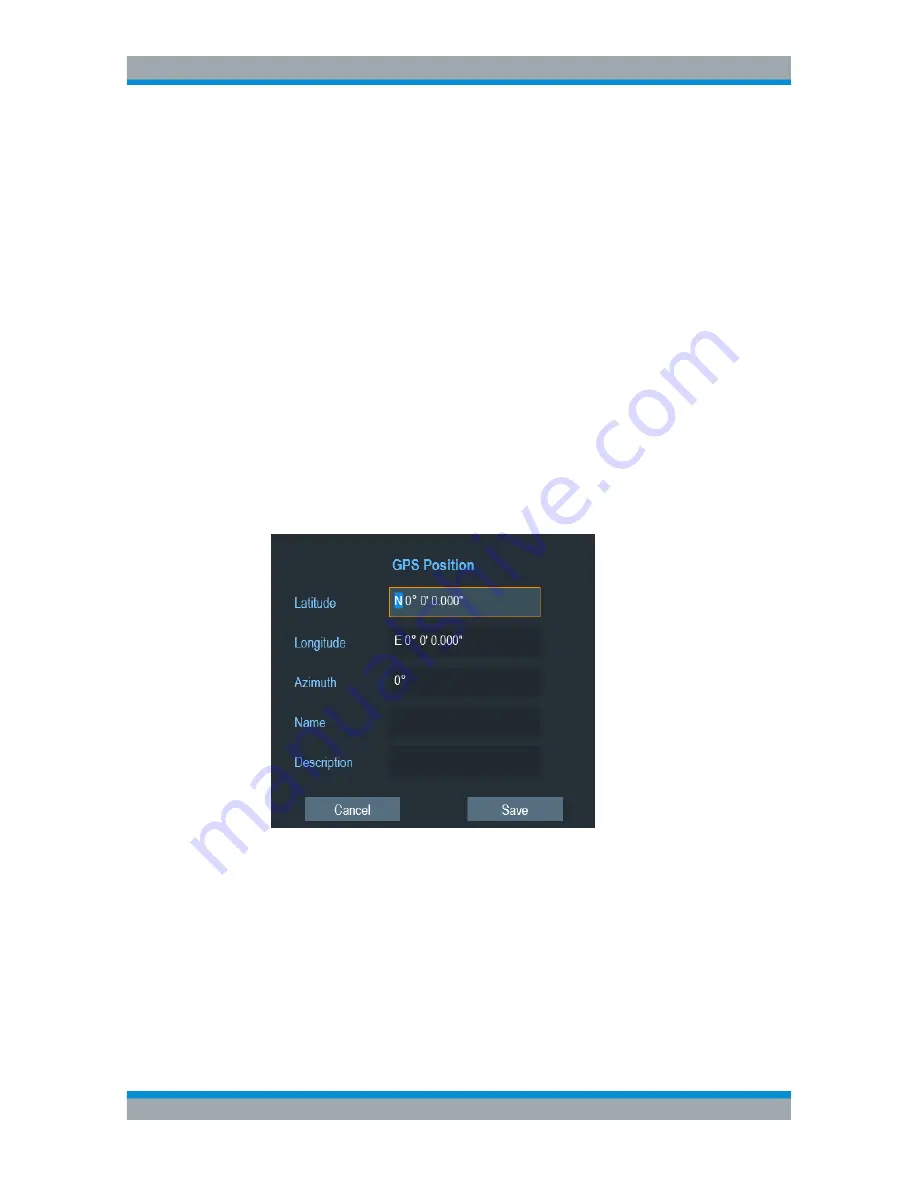
1. Select "Manual Position and Azimuth" menu item.
The R&S Cable Rider ZPH displays the "GPS Position" dialog box.
2. Enter the GPS data and location information.
The R&S Cable Rider ZPH creates a geotag with the geographic data you have
entered.
Creating geotags automatically
The R&S Cable Rider ZPH is able to save geographic information automatically if you
are using the "Save on Event" functionality. Depending on the trigger event (time, limit
failure, distance, every sweep event), geographic information with measurement are
saved on the map for further analysis. See
Figure 13-4
.
For more information, see
Chapter 5.7, "Saving On Events"
,
on page 102.
Working with Maps


