Garmin G1000 NXi Pilot’s Guide for the Cessna NAV III
190-02177-02 Rev. A
SY
STEM
O
VER
VIEW
FLIGHT
INSTRUMENTS
EIS
AUDIO P
ANEL
& CNS
FLIGHT
MANA
GEMENT
HAZARD
AV
OID
ANCE
AFCS
ADDITIONAL FEA
TURES
APPENDICES
INDEX
408
ADDITIONAL FEATURES
Once the desired chart is selected, the chart scale can be changed and the chart page can be scrolled using
the
Joystick
. Pushing the
Joystick
centers the chart on the screen.
The aircraft symbol is shown on the chart only if the chart is to scale and the aircraft position is within the
boundaries of the chart. The aircraft symbol is not displayed when the Aircraft Not Shown Icon appears. If
the Chart Scale Box displays a banner NOT TO SCALE, the aircraft symbol is not shown. The Aircraft Not
Shown Icon may appear at certain times, even if the chart is displayed to scale.
Selecting the
Charts
Softkey switches between the ChartView diagram and the associated map in the MAP
page group. Selecting the
Info
Softkey returns to the airport diagram when the view is on a different chart.
If the displayed chart is the airport diagram, the
Info
Softkey has no effect. The aircraft position is shown in
magenta on the ChartView diagrams when the location of the aircraft is within the chart boundaries.
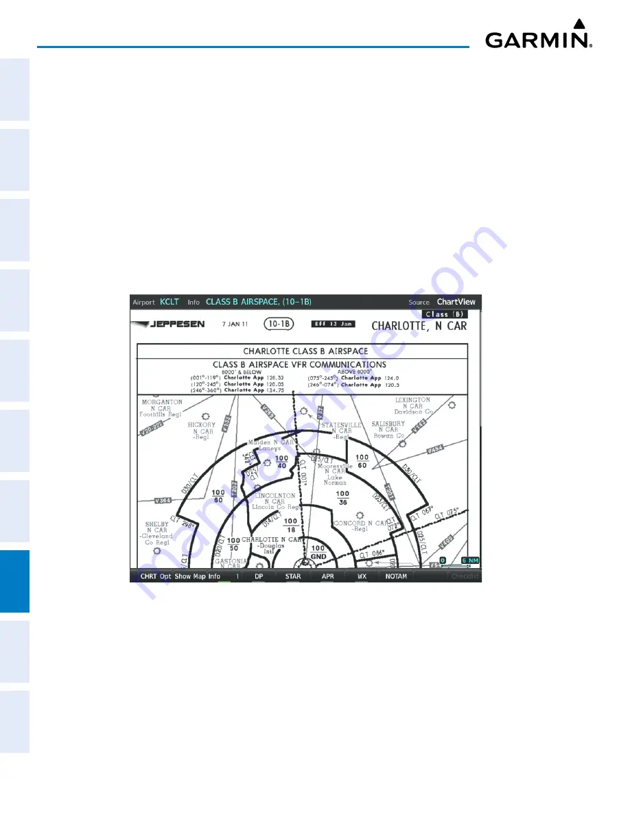
The Charlotte, NC airport has five additional charts offering information; the Airport Diagram, Take-off
Minimums, Class B Airspace, Airline Parking Gate Coordinates, and Airline Parking Gate Location. (The
numbers in parentheses after the chart name are Jeppesen designators.) In the example shown in following
figure, the Class B Chart is selected. Pressing the
ENT
Key displays the Charlotte Class B Airspace Chart.
Figure 8-9 Airport Information Page, Class B Chart Selected from INFO View


