Garmin G1000 NXi Pilot’s Guide for the Cessna NAV III
190-02177-02 Rev. A
SY
STEM
O
VER
VIEW
FLIGHT
INSTRUMENTS
EIS
AUDIO P
ANEL
& CNS
FLIGHT
MANA
GEMENT
HAZARD
AV
OID
ANCE
AFCS
ADDITIONAL FEA
TURES
APPENDICES
INDEX
278
HAZARD AVOIDANCE
Strobes and spurious radar data
Sun strobes (when the radar antenna points directly at the sun)
Interference from buildings or mountains, which may cause shadows
Metallic dust (chaff) from military aircraft, which can cause alterations in radar scans
PRECIPITATION (GARMIN CONNEXT)
NOTE:
Precipitation data cannot be displayed at the same time as terrain data.
The Precipitation weather product provides radar precipitation information in selected radar coverage areas.
This information comes from individual weather radar sites and weather data sources such as government
agencies. Each radar site or source may provide weather data at differing rates and times. Periodically, the
Garmin Connext Weather service compiles the available information to form a composite image, and assigns
a single time to indicate when it created the image. This image becomes the Precipitation weather product.
Individual images--gathered from each radar site--differ in age, and are always older than the displayed
Precipitation weather product age.
Because of the time required to detect, assemble, and distribute the Precipitation weather product, the
displayed weather information contained within the product may be significantly older than the current
radar synopsis and may not depict the current weather conditions. The Precipitation weather product should
never be used as a basis for maneuvering in, near, or around areas of hazardous weather regardless of the
information it contains.
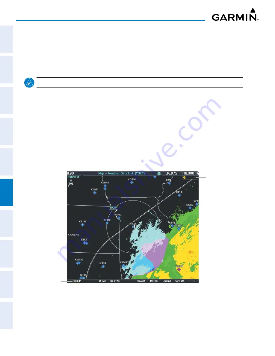
Figure 6-18 Precipitation Weather Product on the ‘Map - Weather Data Link (CNXT)’ Page
Boundary of
weather data
request
Precipitation
Weather Product
Icon and Age
Precipitation
Weather Product
enabled
Displaying Precipitation weather information:
1)
Press the
Map Opt
Softkey (for PFD maps, press the
Map/HSI
or
Map Opt
Softkey). This step is not necessary
on the ‘Map - Weather Data Link (CNXT)’ Page.
2)
Press the
PRECIP
Softkey.


