190-02177-02 Rev. A
Garmin G1000 NXi Pilot’s Guide for the Cessna NAV III
SY
STEM
O
VER
VIEW
FLIGHT
INSTRUMENTS
EIS
AUDIO P
ANEL
& CNS
FLIGHT
MANA
GEMENT
HAZARD
AV
OID
ANCE
AFCS
ADDITIONAL
FEA
TURES
APPENDICES
INDEX
319
HAZARD AVOIDANCE
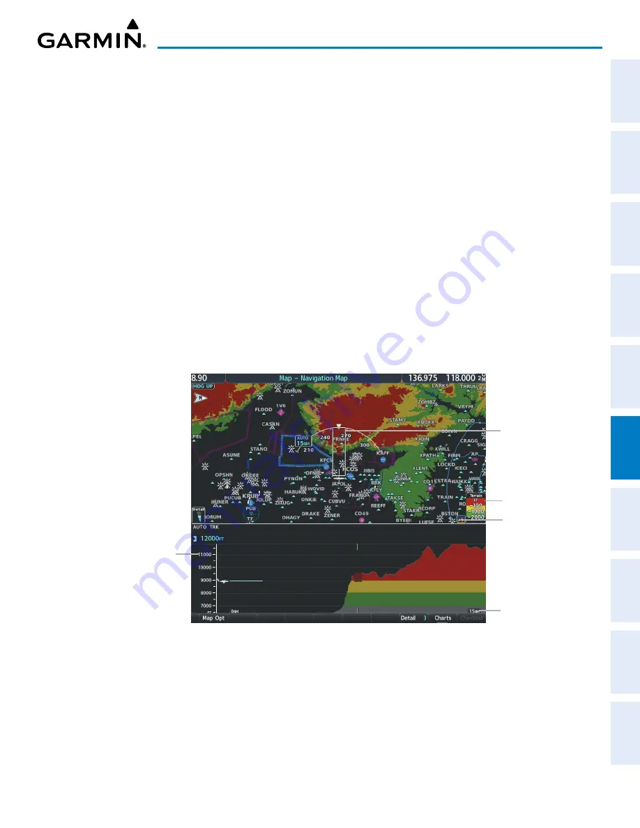
The forward looking swath of terrain is based on the selected VSD Mode, annunciated in the top-left corner
of the VSD Inset Window. In Flight Plan Mode, the contour follows the active flight plan, and if no active
flight plan is present, the VSD Inset Window displays ‘Flight Plan Not Available’. In Track Mode, the contour
is based on the aircraft ground track. In Auto Mode, the contour is based on the active flight plan, when
available, otherwise, it is based on the ground track.
Selecting a VSD Mode:
1)
Select the ‘Map - Navigation Map’ Page.
2)
Press the
Map Opt
Softkey.
3)
Press the
Inset
Softkey.
4)
Press the
VSD
Softkey displaying the VSD mode in cyan. Each press of the softkey cycles through a mode
selection: FPL (flight plan), TRK (track), or Auto.
When the Navigation Map range is adjusted with the
Joystick
, the horizontal distance of the VSD is adjusted
to match the distance shown on the map range arc, down to one nautical mile. If the Navigation Map range is
adjusted below one nautical mile, the VSD range remains at one nautical mile. When Navigation Map range
is adjusted to remove altitude-correlated colored terrain data (as shown in the Terrain Legend) or obstacles
from the Navigation Map, these items are also removed from the VSD; only an outline of the terrain will be
displayed in black in the VSD Inset Window.
Figure 6-64 Terrain Information on the ‘Map - Navigation Map’ Page
Terrain Legend
Terrain Display
Enabled Icon
Track Mode Boundary
enabled
Altitude Scale
VSD Range


