background image

6.5 Creating an app page

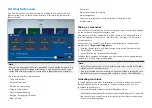
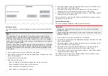
New app pages can be created in the blank spaces available on the
homescreen.

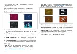
1. Press and hold on a blank space on the onscreen.
2. Select the

[Layout:]

option and choose the desired page layout.

Some apps are restricted to certain layouts.

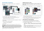
3. Select the icons for the Apps that you want to be displayed on the page.
4. Select

[Next]

.

5. Enter a name for your new app page.

A default name will be suggested.

6. Select

[Save]

.

The app page is saved and the new app page icon will be shown on the
homescreen.

Note:

If your system includes hardware for third party integration partners the
Interface shortcuts for these will also be listed.

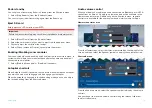
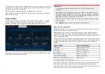
Additional mode icon steps

When the Homescreen is set to use Mode icons there are additional steps
required when creating an app page which includes the Chart app or
Fishfinder app.

1.

When creating a Chart app page you will need to also select the chart
app mode that you want to use.

2. When creating a Fishfinder app page you will need to also select the

channel and if applicable the transducer that you want to use.

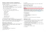
Customizing an existing app page

You can rename, change the apps or delete existing app pages.
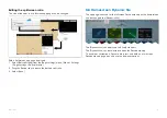
1. Select and hold on an existing app page icon on the homescreen.
2. Select from the following options:

[Customize]

— Selecting Customize will open the page creation page

where you can select the layout and which apps you want on the app
page.

[Delete]

— Selecting delete will delete the page from the homescreen.

The delete action cannot be undone.

[Rename]

— Selecting Rename will open the onscreen keyboard so

that you can change the name of the app page.

80

Summary of Contents for LIGHTHOUSE 4

Page 1: ...2023 Raymarine UK Limited 81406 Rev 7 Document number 03 2023 Date English en US OPERATION INSTRUCTIONS LIGHTHOUSE 4 MULTIFUNCTION DISPLAY OPERATING SYSTEM v4 4 70...

Page 2: ......

Page 3: ...FLIR Systems Inc All other trademarks trade names or company names referenced herein are used for identification only and are the property of their respective owners This product is protected by pate...

Page 4: ......

Page 5: ...moval 28 3 4 Compatible peripheral product software 29 3 5 Legacy eS and gS Series compatibility with Axiom displays 29 3 6 Software updates 30 Checking current software 30 Updating software 31 Updati...

Page 6: ...2 Axiom Axiom Axiom XL and Axiom 2 XL controls 52 Axiom 2 Pro controls 52 Axiom Pro controls 53 RMK controls 54 iKey bluetooth keyboard controls 55 5 3 Initial setup 56 First power up 56 First power u...

Page 7: ...board and Engine apps 77 Entertainment apps 78 YachtSense and DockSense apps 78 Other apps 79 6 5 Creating an app page 80 Additional mode icon steps 80 Customizing an existing app page 80 Editing the...

Page 8: ...TOPILOT INTEGRATION 116 8 1 Commissioning Evolution autopilot system 117 Commissioning pre requisites 117 Commissioning steps 117 Vessel hull type selection 117 Using the Dockside wizard 117 Compass l...

Page 9: ...terns 145 10 3 Expanding square search pattern 146 Creating an expanding square search pattern 146 Drift effects on expanding square search patterns 148 10 4 Creeping line Parallel line search pattern...

Page 10: ...lot 171 Automatic turning 172 Following a Route using automatic turning 173 11 7 Rudder bar indicator 175 11 8 Depths and contours 175 Depth soundings 175 Depth contours 176 RealBathy depth contours 1...

Page 11: ...s 218 CHAPTER 15 CHART APP RACING MODE 219 15 1 Racing mode 220 15 2 Racing mode main menu 220 15 3 Laylines 220 Laylines system requirements 221 Layline profiles 221 Fixed angles laylines 221 Polar l...

Page 12: ...3 Using animation controls 249 18 4 Setting a specific date for animations 249 18 5 Tide station information 249 18 6 LightHouse charts dynamic tide graphic 250 18 7 Navionics dynamic tide graphic 25...

Page 13: ...Page settings menu 275 CHAPTER 20 RADAR APP 276 20 1 Radar app overview 277 Radar app controls 277 Radar app context menu 278 Camera tracking 278 20 2 Compatible Radar scanners 278 20 3 Radar feature...

Page 14: ...Responder setup 307 21 2 Heading and SOG Homescreen status 308 21 3 Settings password protection 308 21 4 Depth data monitor 309 21 5 Data logging 309 21 6 Waypoint at Range and Bearing from location...

Page 15: ...5 Sailing page 335 Sailing dials 336 22 6 Race start page 337 22 7 Navigation page 338 Close hauled angle indicators 338 22 8 Rolling road page 339 22 9 Fuel page 339 22 10 Tanks page 340 22 11 Bidat...

Page 16: ...361 CHAPTER 24 YAMAHA APP 362 24 1 Yamaha engine gateway selection 363 Compatible Yamaha gateways 363 24 2 Yamaha HDMI overview 363 24 3 Yamaha app overview 363 Requirements 363 Yamaha app controls 36...

Page 17: ...on Linearization 400 Magnetic deviation 401 AR200 calibration settings 401 Continual monitoring and adaptation 401 Compass lock 402 CHAPTER 27 AUDIO APP 403 27 1 Audio app overview 404 Compatible ente...

Page 18: ...T 430 30 1 Raymarine mobile apps 431 30 2 Connecting an Android device to the display 431 30 3 Connecting an iOS device to the display 432 30 4 Raymarine app 432 LightHouse charts 432 Account settings...

Page 19: ...stic product information 456 Saving product information 456 33 3 Power up troubleshooting 457 Performing a power on reset on touch only displays 457 Performing a power on reset on an Axiom Pro display...

Page 20: ...APPENDIX C HARDWARE AND SOFTWARE COMPATIBILITY 478 APPENDIX D DOCUMENT CHANGE HISTORY 480 20...

Page 21: ...nt watch puts yourself your vessel and others at serious risk of harm Warning Autopilot usage Autopilots navigate a preset course and do NOT respond to hazards automatically The operator must remain a...

Page 22: ...ymarine website www raymarine com manuals Regulatory approvals Regulatory approvals are available to view on your display from the settings menu Homescreen Settings Regulatory approvals Warranty regis...

Page 23: ...CHAPTER 2 DOCUMENT INFORMATION CHAPTER CONTENTS 2 1 Product documentation page 24 2 2 Document conventions page 24 2 3 Document illustrations and screenshots page 25 Document information 23...

Page 24: ...o your door visit http www raymarine co uk view id 5175 For further information about the Print Shop please visit the Print Shop FAQ pages http www raymarine co uk view id 5751 Note Accepted methods o...

Page 25: ...Sounder The internal GPS can be switched off from the GPS settings menu Homescreen Status area Satellites Settings Internal GPS 2 3 Document illustrations and screenshots Note Whilst care is taken to...

Page 26: ...oftware version page 27 3 2 Compatible displays page 27 3 3 New software features and improvements page 28 3 4 Compatible peripheral product software page 29 3 5 Legacy eS and gS Series compatibility...

Page 27: ...regularly to add new features and improve existing functionality Check the website to obtain the latest software and user manuals www raymarine com software www raymarine com manuals 3 2 Compatible di...

Page 28: ...details refer to p 266 Zoom mode view Updated Tune frequency control to enable frequency selection in kHz for single frequency channels For details refer to p 268 Frequency tuning Added support for di...

Page 29: ...when downloading the LH4 4 68 option which includes networked products 3 5 Legacy eS and gS Series compatibility with Axiom displays As Raymarine continues to develop new features and capabilities fo...

Page 30: ...improved performance and usability It s important to ensure that you have the latest software for your products by regularly checking the Raymarine website for new software releases www raymarine com...

Page 31: ...display will check your MicroSD card for available software updates and display a list of devices for which software updates are available 8 Ensure that the relevant products in the list are selected...

Page 32: ...Networked MFDs will all display a software update in progress screen until all software updates are complete During this time you will not be able to interact with your MFDs 32...

Page 33: ...4 2 Applications and integrations page 37 4 3 Menu types page 38 4 4 Setting controls page 39 4 5 Alarm and information notifications page 40 4 6 Sidebar page 41 4 7 Data overlays page 42 4 8 Display...

Page 34: ...apacity 4GB to 32GB FAT32 NTFS FAT32 exFAT MicroSDXC Micro Secure Digital eXtended Capacity 32GB to 2TB exFAT NTFS FAT32 exFAT Speed class rating For best performance it is recommended that you use Cl...

Page 35: ...D card Axiom 2 Pro displays 1 Open the card reader door 2 Pull down the card slot cover 3 Insert the card s into a card slot and push until they clicks into place Important The upper card slot require...

Page 36: ...the card reader door Inserting memory card into external storage devices 1 Open the card reader door 2 Insert the storage device into a card slots as follows RCR SDUSB slot 1 With the contacts facing...

Page 37: ...een App page icons can contain one fullscreen app or multiple apps in a splitscreen arrangement For more details about LightHouse MFD apps refer to p 74 MFD Apps LightHouse third party apps LightHouse...

Page 38: ...a right arrow will open a settings page or other menu options related to that item Settings pages Settings pages are fullscreen pages containing settings and menu options Settings pages are usually la...

Page 39: ...more options will display further menu options Selecting X Close or selecting an area of the screen away from the menu will close the menu Pop over menus Pop over menus are available on the homescree...

Page 40: ...ions and external devices connected to the MFD Multifunction Displays Alarm and warning notifications are displayed on all networked MFDs Standard colors are used to signify the notification type Alar...

Page 41: ...the sidebar cannot be closed by swiping and must be unpinned before you can close the sidebar Selecting the X located on the top right of the sidebar closes the sidebar and sidebar menu The Sidebar i...

Page 42: ...tartup wizard For details of the data and options available refer to p 227 Race sidebar The displayed data and options cannot be customized Audio The Audio sidebar is available when compatible audio e...

Page 43: ...ices that are connected to the same network as the display and data generated by the display can be shown as data items in the Dashboard app the sidebar and as a data overlay Data items are organized...

Page 44: ...display data category is used for voltage detected by the display The following data items are available in the Display category Supply voltage Supply voltage level 1 Note The display category and da...

Page 45: ...PGN 127496 Distance to empty PGN 127496 Fuel flow total PGN 127497 PGN 127489 Fuel used season PGN 127497 Fuel used trip PGN 127497 The data items above will be available for each configured fuel tank...

Page 46: ...vessel heading The following data items are available in the Heading category Steer to layline 1 Heading error Locked heading Heading PGN 127250 Tack heading Locked heading Error 2 Heading Speed 2 Not...

Page 47: ...connected providing time data The display the following data items are available in the Time category Sunset time Sunrise time UTC date Universal Time Coordinated PGN 129033 UTC time Universal Time C...

Page 48: ...Generator line 1 current PGN 127744 Generator line 1 to neutral voltage PGN 127747 Generator line 1 to line 2 voltage PGN 127747 Generator line 1 frequency PGN 127747 Generator line 2 power PGN 12774...

Page 49: ...onics charts the SonarChart Live feature logs vessel depth and position to enable creation of personalized depth contours that can be displayed in realtime For details refer to p 179 SonarChart Live D...

Page 50: ...CHAPTER 5 GETTING STARTED CHAPTER CONTENTS 5 1 Switch on off page 51 5 2 Controls page 52 5 3 Initial setup page 56 5 4 Shortcuts menu page 68 5 5 Device pairing page 71 50...

Page 51: ...s menu is displayed 2 Press and hold the Power symbol until the screen switches off Note When in standby the display may still draw a small amount of power from the battery If this is a concern unplug...

Page 52: ...hed off at the breaker or have the power cable unplugged When the breaker is switched back on or the cable is reconnected the display will resume in the same power state that it was in when it was swi...

Page 53: ...r details refer to p 125 Pilot keypad LED status Axiom 2 Pro only Axiom Pro controls Axiom Pro includes both a touchscreen and physical buttons that can be used to control the display The details belo...

Page 54: ...ss to switch the active pane or to switch the active display in multiple display systems 8 Waypoint MOB press and release to access the waypoint options Press again to place a waypoint Press and hold...

Page 55: ...Trackpad Touchscreen UniControl directions Trackpad Left trackpad button Pan chart area Chart app Trackpad Right trackpad button Pan chart area Chart app Left trackpad button Select OK Press and hold...

Page 56: ...than 1 display 3 Complete the Startup wizard the wizard will not be shown if you are connecting to an existing system that has already been set up 4 Select keypad type Axiom 2 Pro displays only 5 Read...

Page 57: ...d The wizard will guide you through Language selection Boating activity selection Boat details configuration Languages The following user interface languages are available Arabic ar AE Bulgarian bg BG...

Page 58: ...ays or following the selection of a different display as datamaster the keypad type selection screen is displayed By default Axiom 2 Pro displays are fitted with the Pilot Version lower keypad If you...

Page 59: ...approximately 2 to 3 in fresh water compared to seawater Some of the factors that should be taken into account when calculating a safety margin are Vessel maneuvering characteristics A vessel s draft...

Page 60: ...vailing wind strength and direction can affect water level Minimum safe width During the start up wizard you can set a minimum safe width for your vessel The minimum safe width can also be added or ch...

Page 61: ...ectly connected or connected via the ECI 100 available on the MFD Identifying engines If your MFD has mislabelled your engines this can be corrected by running the engine identification wizard When th...

Page 62: ...s a temperature sensor then you can check and calibrate your temperature reading 1 Open the Fishfinder app 2 Open the Transducer settings menu Menu Settings Transducer 3 If you have more than 1 sonar...

Page 63: ...l to disable RealVision AHRS if local sources of magnetic interference are distorting the sonar image RealVision AHRS can be disabled from Settings Menu Settings Sounder AHRS stabilization Note The Ca...

Page 64: ...sed from the transducer s default reading by the offset value you specify The offset should be the distance between the transducer and the bottom of the keel Below waterline The depth reading will be...

Page 65: ...ng speed through water Set STW to SOG Select to apply a scaling factor to all STW readings based on the present difference between STW and SOG Adjust STW Apply a scaling factor to all speed through wa...

Page 66: ...rred data source The currently active data source will be ticked and display its current value in use To manually select a data source enable the Manual selection toggle switch and then select your pr...

Page 67: ...a settings reset From the Homescreen 1 Select Settings 2 Select This display 3 Scroll to the bottom of the This display menu 4 Select Settings reset 5 Select Yes The display will reboot and any setti...

Page 68: ...ected from the This display settings menu Homescreen Settings This display Screenshot file Screenshots are saved in png format in the following location on your memory card Raymarine Image files 1 Use...

Page 69: ...rs or Disable all sounders Autopilot shortcuts When Autopilot control is enabled the shortcuts menu provides an autopilot icon which can be used to engage and disengage your autopilot When the autopil...

Page 70: ...s to reflect the level of ambient lighting in the surrounding environment To allow the display to adjust brightness automatically enable the AUTO toggle switch in the Shortcuts menu Note Auto brightne...

Page 71: ...o unpair ALL RMK keypads currently paired with the MFD Pairing with a Quantum Radar scanner You can connect a Quantum Radar scanner to your MFD using Wi Fi Pre requisites Ensure you have connected you...

Page 72: ...creen overview page 73 6 3 Homescreen app page icons page 74 6 4 MFD Apps page 74 6 5 Creating an app page page 80 6 6 Homescreen Dynamic tile page 81 6 7 Global positioning page 82 6 8 Status area pa...

Page 73: ...ages The center page is shown by default 1 GNSS position fix details Select the text or icon to view GNSS settings and fix accuracy details For details refer to p 84 GNSS GPS Status 2 MOB Man Over Boa...

Page 74: ...uts to user interfaces for integrated partner hardware For details refer to p 439 App launcher 13 Homescreen page navigation Identifies the current homescreen page 14 Alarm manager Select to access th...

Page 75: ...e icon When the Homescreen icons are set to Mode icons this icon is used for charts app pages where the chart app is set to Fish mapping mode When compatible hardware e g SR200 is detected fish mappin...

Page 76: ...the Homescreen icons are set to the default Classic icons and the selected fishfinder channel has been set to a conical beam traditional or CHIRP sonar channel The icon will look slightly differently...

Page 77: ...patible sensors and engines or engine gateways The Dashboard app is also used for controlling configured compatible 3rd party Digital Switching hardware For more information about the Dashboard app re...

Page 78: ...p The Video app allows you to view and record feeds from connected compatible video equipment such as an IP camera or Thermal camera For more information refer to p 373 Video app PDF viewer The PDF Vi...

Page 79: ...icons are set to the default Mode icons Other apps UAV app The UAV Unmanned Aerial Vehicle app provides remote controls settings and video display including flight data for your compatible UAV device...

Page 80: ...use Mode icons there are additional steps required when creating an app page which includes the Chart app or Fishfinder app 1 When creating a Chart app page you will need to also select the chart app...

Page 81: ...esize icon to create the desired split ratio 3 Select Save 6 6 Homescreen Dynamic tile The app page icon used for the fullscreen Dashboard app on the homescreen can be changed to a Dynamic tile The Dy...

Page 82: ...Satellite System GNSS constellations A GNSS constellation is a system of satellites that provides autonomous geospatial positioning that allows electronic devices with compatible receivers to determin...

Page 83: ...refer to p 86 GNSS constellation selection compatible receivers For the settings available on incompatible receivers refer to GNSS settings for incompatible GNSS receivers Satellite based augmentatio...

Page 84: ...hape of the satellite symbols identify which GNSS constellation they belong to Note When using a compatible GNSS receiver ticks are shown next to the symbols to indicate which constellations are curre...

Page 85: ...ayed out when using an incompatible GNSS receiver For a list of compatible GNSS receivers refer to p 86 GNSS constellation selection compatible receivers For the settings available on incompatible rec...

Page 86: ...ellation selection and SBAS selection Axiom display s internal GNSS receiver Axiom display s internal GNSS receiver running LightHouse version 3 13 or below Axiom Pro display s internal GNSS receiver...

Page 87: ...oting purposes you can also Restart the active GNSS receiver 6 8 Status area You can view the status of certain connected devices using the MFD s Status area located at the top right of the Homescreen...

Page 88: ...ceiving AIS receive only e g Silent Mode AIS Error Note The First responder boating activity profile includes an additional AIS icon For details refer to p 305 First responder Autopilot Icon Status Ic...

Page 89: ...elect to cancel synchronisation with the Raymarine app 7 Import export Select to access back up and restore settings 8 Eject SD card Select before ejecting a memory card to ensure it is removed safely...

Page 90: ...our vessel s total fuel capacity and how much fuel is burned by your engine s Incorrect entries will affect the fuel calculations which could result in a shortage of fuel The Fuel remaining calculatio...

Page 91: ...browser can be used to Open and Delete photos images and PDF documents saved to external storage and can also be used to Import or Delete user data and MFD settings files saved to external storage Se...

Page 92: ...from the Info dialog or for display s with only 1 card reader slot select Save 5 Select Save to accept the default filename or use the onscreen keyboard to enter your own filename and then select Save...

Page 93: ...e settings restore Your MFD will reboot to complete the process 6 10 My profiles You can share your MFD with other users by creating user profiles on your MFD Profiles enable you to retain your own pe...

Page 94: ...OT display any real data including safety warnings and messages Any settings changes made will not affect User profiles Demo movie requirements A demo movie file can be set to play when a demo profile...

Page 95: ...Configure preferred units of measurement Configure Bearing mode Configure variation Configure GNSS GPS system datum Set time differentials for Loran C Menu Settings This display Color theme day mode A...

Page 96: ...escreen Settings Getting started Language 2 Select your desired language Languages The following user interface languages are available Arabic ar AE Bulgarian bg BG Chinese Simplified zh CN Chinese Tr...

Page 97: ...essel s bow This measurements is used in Anchor mode and the Anchor drag alarm in the Chart app Option Description Num of engines Select the number of engines on your vessel When connected to a compat...

Page 98: ...A 2000 PGNs onto the same SeaTalkng NMEA 2000 network For information on compatible interfaces refer to your generator s manufacturer Note Each generator generator s NMEA 2000 interface must be config...

Page 99: ...tanks selected during the MFD s initial start up wizard may have been incorrect The tank may not have a compatible sender or sender adaptor There is a problem with the data connection or the tank s s...

Page 100: ...tank shown on the left is rectangular and symmetrical it only requires 2 calibration points to define the bottom and top of the tank 2 The tank shown in the center has a greater volume at the bottom 3...

Page 101: ...fuel tank from the list 3 Select the Used for propulsion tick box so that the tick is removed With the tick removed the selected fuel tank will no longer be used for fuel economy calculations Units se...

Page 102: ...the datum used by your display This should be set to the same datum used by your paper charts List of available datums Variation When set to Auto the display will automatically compensate for the nat...

Page 103: ...le for a full list of screen resolutions Screen resolutions Custom images are unique to each display and are not shared across the network You can reset the Splashscreen and Homescreen images to use d...

Page 104: ...pop over menu The Homescreen will be displayed using your custom image as the background If the images is not the same resolution as your MFD then you can stretch the image by selecting Fill screen f...

Page 105: ...tHouse 4 MFDs LightHouse 3 MFDs using software version 3 4 or greater LightHouse or LightHouse 2 powered MFDs SeaTalkng Instrument displays and Pilot controllers SeaTalkng VHF DSC Radios RMK 9 and RMK...

Page 106: ...SmartCraft helm grouping IP device user interface access The user interface of connected supported IP Internet Protocol devices such as IP cameras can be accessed from the MFD The IP device s user in...

Page 107: ...en Settings This Display Wireless Display Disconnect Unpairing a wireless display With the wireless display connection active 1 Select the connected display from the Wireless display menu Homescreen S...

Page 108: ...o isolated inputs as specified by the NMEA 0183 standard The Single ended mode is required when sending a signal to a single ended receiver device such as a PC for example Refer to the NMEA 0400 Insta...

Page 109: ...cation page 111 7 3 Alarm settings page 111 7 4 External alarm speaker buzzer page 112 7 5 Acknowledging alarms page 113 7 6 YachtSense Link router alarms page 113 7 7 Digital switching alarms page 11...

Page 110: ...ow depth alarm will automatically dismiss when the depth becomes deeper Alarm history Example Alarm history tab All Dangerous Red and Warning Orange alarms will appear in the alarms history list The h...

Page 111: ...time For alarm parameters refer to p 187 Dangerous targets alarm Do not alarm for static AIS targets Enables ability to ignore AIS targets that are considered static travelling under 2 Knots Static ta...

Page 112: ...includes a YachtSense Link router then the router s alarms will be displayed For details of digital switching alarms refer to p 113 Digital switching alarms For details of YachtSense Link router alarm...

Page 113: ...nel 2 An alarm will be triggered when the router s input channel 2 is above or below a specified value YachtSense Link alert 3 Channel 3 An alarm will be triggered when the router s input channel 3 is...

Page 114: ...ins until the MOB alarm is cancelled a MOB warning is displayed in the bottom of the screen which requires acknowledgement the Chart app is placed in a special MOB mode to help you navigate back to th...

Page 115: ...choose from Replace waypoint Selecting Replace waypoint will replace the existing waypoint with a new waypoint using the updated notification details Place new waypoint Selecting Place new waypoint wi...

Page 116: ...utopilot system page 117 8 2 Autopilot control page 122 8 3 Pilot sidebar page 124 8 4 Pilot Version keypad LED status Axiom 2 Pro only page 125 8 5 Pilot pop up page 125 8 6 Autopilot Control Pilot s...

Page 117: ...ompass linearization 6 If required lock the compass Vessel hull type selection The vessel hull type options are designed to provide optimum steering performance for typical vessel s It is important to...

Page 118: ...The drive types available are Type 1 Linear Type 2 Linear Type 2 Hydraulic Linear Type 3 Hydraulic Linear I O Stern Wheel Drive Tiller Sport Drive Verado Rotary Drive Type 1 Rotary Drive Type 2 Hydrau...

Page 119: ...o NOT know the hard over time for your vessel s steering system select Continue proceed with the Checking the rudder drive procedure and complete the Dockside wizard Once the wizard is complete procee...

Page 120: ...ithout a rudder reference transducer 1 Center and let go of the rudder 2 Disengage any rudder drive clutch 3 Select Continue 4 Check it is safe to proceed and then select OK The autopilot will now aut...

Page 121: ...t the EV sensor is moved and re installed in a location which is subject to less magnetic interference Note If is displayed as the Deviation value it means that linearization has not been successfully...

Page 122: ...le option so that it is enabled Green The compass linearization is now locked and automatic linearization will no longer be performed 8 2 Autopilot control Your MFD can be integrated with an Evolution...

Page 123: ...chart app 3 Select the Autopilot icon The Pilot sidebar is displayed 4 Select Steer to Nav 5 Select either Engage pilot or if a cross track error exists then select ALONG route leg or DIRECT from her...

Page 124: ...9 1 Selecting will adjust your locked heading by plus 1 degree 10 10 Selecting will adjust your locked heading by minus 10 degrees 11 10 Selecting will adjust your locked heading by plus 10 degrees 12...

Page 125: ...to the next waypoint disengage the autopilot or to maintain the current course in Locked heading mode 8 6 Autopilot Control Pilot set up menu Menu item and description Options Vessel hull type Selecti...

Page 126: ...has a GPS connected to your data network SeaTalk SeaTalkng or NMEA the autopilot is tuned to the GPS heading while you steer to a known magnetic heading This step provides a rough alignment and minim...

Page 127: ...time Specifies the time it takes for the rudder to move from hard port to hard starboard or vice versa The default value is determined by your Drive type selection 1 to 100 0 seconds Gybe inhibit 2 Wh...

Page 128: ...pact on your autopilot performance If you are unsure as to how to adjust these settings to best suit your autopilot system please refer to your dealer or Raymarine product support The following table...

Page 129: ...ES AND TRACKS CHAPTER CONTENTS 9 1 Waypoints page 130 9 2 Routes page 134 9 3 Tracks page 139 9 4 Sharing Waypoints Routes and Tracks page 140 9 5 Waypoint routes and tracks capacity page 141 Waypoint...

Page 130: ...ea onscreen 2 Select Place waypoint from the context menu 3 Select OK to accept the default waypoint settings or 4 You can select a symbol to use for the waypoint You can either select a recent symbol...

Page 131: ...le on Axiom Pro Axiom 2 Pro display or RMK 9 RMK 10 remote keypads 1 Press and release the Waypoint MOB icon located at the top of MFD app pages or 2 Press the Waypoint MOB physical button from any MF...

Page 132: ...group 2 Waypoints list of waypoints in the group 3 Menu select to open the group pop over menu The following options are available Rename group rename the group Delete group delete the group and all o...

Page 133: ...oint details When accessed via the Chart app the waypoint details page will include the LiveView pane which displays the waypoints on the Chart in the context of the vessel s current location The wayp...

Page 134: ...cation for the first waypoint 2 Select Build route from the context menu 3 Select the location for the second waypoint The 2 waypoints will be joined by a line creating the first leg of your route 4 S...

Page 135: ...sor the route is highlighted to distinguish the selected route from other routes which may be present onscreen Use Autorouting during route creation Whilst building a route you can use Autorouting to...

Page 136: ...route is safe to navigate You MUST review the suggested route carefully and where necessary edit the route before following it If a waypoint within any automatically generated route is added or moved...

Page 137: ...at these legs are checked to ensure that there is sufficient tide to avoid the hazard Width Height clearances Navionics Autorouting and Dock to dock does not use the user defined Minimum safe width or...

Page 138: ...t pane showing the route s location Selecting a waypoint from the list will open the pop over menu From the pop over menu you can Follow from here Follow the route from the selected waypoint Edit wayp...

Page 139: ...ur display each track can contain up to 10 000 points When a track reaches 10 000 points it will be saved and if there is an unused track available a new track will be started automatically If all tra...

Page 140: ...nts used whilst maintaining the actual path taken When set to Time you can choose a specified time period between track points When set to Distance you can choose a specified distance between track po...

Page 141: ...nts which can be sorted into up to 200 waypoint groups Routes Your MFD can store up to 250 routes each route consisting of up to 500 waypoints The route capacity limit is subject to your MFD s 10 000...

Page 142: ...ND RESCUE PATTERNS CHAPTER CONTENTS 10 1 SAR Search and Rescue patterns page 143 10 2 Sector search pattern page 143 10 3 Expanding square search pattern page 146 10 4 Creeping line Parallel line sear...

Page 143: ...rch Patterns are Sector Search Expanding square Creeping line Parallel Line Once a search pattern is created it is saved as a Route and can be managed and navigated in the same manner as any other sav...

Page 144: ...natively you can use your vessel s Heading and SOG to define the set and drift by selecting the 2 Set Drift shortcut icon 4 Set Track spacing Radius Search Speed and Leg time All 3 variables are depen...

Page 145: ...ctor search patterns Set and drift are taken into account when creating sector search patterns Some examples are shown below of what impact set and drift can have on the resulting SAR pattern Example...

Page 146: ...nates a Range and Bearing are displayed to direct your vessel towards it ii Alternatively set the CSP as your vessel s current location by selecting the 1 CSP Shortcut button 3 Set Drift i Drop the Da...

Page 147: ...ing square search pattern 6 Create search route After all the above steps have been completed you can create your SAR pattern i To create a search pattern select Create search route in the bottom righ...

Page 148: ...Drift Direction 0 Speed 0 5 Kts Direction 0 Speed 1 Kts 10 4 Creeping line Parallel line search pattern The Creeping line search pattern and Parallel line search pattern both cover a rectangular area...

Page 149: ...e CSP as your vessel s current location by pressing the 1 CSP Shortcut button 3 Set Search Speed and Track Spacing i Select and edit each variable 4 Define Search Rectangle Define by axes i Define the...

Page 150: ...Note The corner coordinates need to form a rectangle If the coordinates are not suitable then you will not be able to create the search route The CSP must be on one of the sides of the search pattern...

Page 151: ...age 163 11 6 Navigation page 167 11 7 Rudder bar indicator page 175 11 8 Depths and contours page 175 11 9 Target tracking page 180 11 10 Collision avoidance page 187 11 11 Target intercept page 195 1...

Page 152: ...er to p 154 Chart modes For each instance of the chart app you can select which chart mode and which electronic cartography you want to use The selection will be saved and persist over a power cycle T...

Page 153: ...ion i e goto or route follow Only shown during active navigation 5 Pilot Select to open the Pilot sidebar Only displayed when autopilot integration is enabled 6 Menu Select to open the Chart app menu...

Page 154: ...for navigation From the Chart app menu 1 Select the Settings icon 2 Select the cartography that you want to use from the Cartography tab The menu will automatically close and the chart app will refres...

Page 155: ...mode 5 TIDES In tides mode tide station and current station icons are replaced with graphics representing tide and current conditions Animation controls are displayed that enable playback of tide and...

Page 156: ...s orientated in relation to you vessel s direction of travel The following chart orientations are available 1 North up In North up mode the chart is fixed with true north pointing up As your heading c...

Page 157: ...t using Infinite vectors by selecting a Reference period option Vector length is measured in minutes and shows your expected position after the selected time has elapsed Show or hide range rings aroun...

Page 158: ...details on a fullscreen page The Cursor info boxes can be disabled from the Advanced settings menu Menu Settings Advanced Cursor info boxes Full chart information More detailed chart information can b...

Page 159: ...mited to the information available on the equivalent paper chart Electronic Navigational Chart ENC ENCs are Vector based charts and include information that is not available on paper or Raster charts...

Page 160: ...rmap ping com Strike Lines Charts USA only For details visit https strikelines com Imray For details visit https www imray com Note For assistance using these charts refer to the chart vendor End User...

Page 161: ...Store account and be logged in to the account before you can purchase charts in the Chart Store This account can be created during the checkout process if required The Chart Store can be accessed usi...

Page 162: ...a download chart card with a voucher code then the voucher is redeemed from the LightHouse chart store 1 Go to the LightHouse chart store https chartstore raymarine com light house charts 2 Click Red...

Page 163: ...ring and compressing electronic navigational chart ENC data When correctly configured with a valid S 63 MFD activation file your MFD can utilize S 63 Encrypted Charts Advantages of using S 63 encrypte...

Page 164: ...reen Settings Network or from the physical product label Example A Product name B Product number C Serial number 2 Contact your Raymarine dealer or Raymarine technical support and supply them with the...

Page 165: ...3 Select the chart regions you wish to purchase 4 Send your MFD s user permits file to the chart vendor this may be part of the checkout process 5 Download the Cells permits file 6 Download the Base...

Page 166: ...ithin them will render your charts inoperable Installing cumulative updates When purchasing S 63 Encrypted Charts for the first time and as part of regular updates any available cumulative updates req...

Page 167: ...ypted Charts S 63 Encrypted Chart cells expire after a set period of time Once expired the charts must not be used for navigation You will be notified onscreen of the expiration The charts must be upd...

Page 168: ...you to a selected destination Follow the steps below to perform a Goto using manual steering 1 Select and hold on the waypoint or point of interest and select Goto from the context menu 2 Manually na...

Page 169: ...val radius pilot in track mode The Arrival radius pilot in track mode overrides the standard Arrival radius notification 7 Select Disengage pilot from the notification and then Disengage pilot from th...

Page 170: ...the check box and then choose either the desired options to commence active navigation If the selected waypoint is part of more than 1 route then the Route list will be displayed so that you can choos...

Page 171: ...vigation from the next waypoint after the selected route leg Select From this waypoint to commence active navigation from the selected waypoint Note The Reverse route direction option allows you to pe...

Page 172: ...sion 3 14 or later Note Waypoints must be farther apart than the Arrival radius pilot is track mode distance Automatic turning is disabled by default Automatic turning can be enabled and configured fr...

Page 173: ...take manual control of your vessel to navigate the route otherwise waypoints in the route that are too close together will be skipped For further details on route waypoint spacing refer to p 134 Route...

Page 174: ...of more than 1 route then the Route list will be displayed so that you can choose which route you want to follow 4 If required engage the mechanical drive by either engaging the wheel drive s clutch o...

Page 175: ...ater depth measurements displayed on charts are called Depth soundings Usually Depth soundings are shown using major and minor units with minor units being smaller and subscript e g Depending on units...

Page 176: ...only shown from zero to the depth specified in the Zero to option All All Depth contours are displayed Note The Depth contours option does not affect the contour fill color Example LightHouse Charts...

Page 177: ...contours are identified using a line and a blue color fill gradient 3 Deep contour All depths deeper than the depth specified in the Deep contour setting is colored white by default Deep water color T...

Page 178: ...the inserted memory card RealBathy requirements RealBathy requires the following LightHouse vector based charts MicroSD card with sufficient free space to record the bathymetry data Distance between...

Page 179: ...ng Steep drop offs can result in overlapping contour lines lowering the density in these situations provides a clearer contour SonarChart Live You can create personal bathymetry charts using your dept...

Page 180: ...rt app menu Menu Targets and then selecting the relevant tab First responder specific target tracking The following targets can only be tracked when the MFD has been configured using the First respond...

Page 181: ...anced settings menu Menu Settings Advanced Enhanced AIS targets When Enhanced AIS targets is enabled the Enhanced AIS icons are used Enhanced AIS icons Sailing Vessel Commercial High speed vessel Wing...

Page 182: ...the Chart app 1 Selecting an AIS target icon in the Chart app will display an Infobox containing AIS identification and position information The Infobox will close automatically after approximately 5...

Page 183: ...ll revert to using normal AIS target icon Edit buddy name Change the Name of the buddy target Intercept Initiates a Target interception For details see p 195 Target intercept AIS target list The targe...

Page 184: ...nual Green circle with Target ID Acquiring target auto Thick dashed Red circle flashes until acknowledged Unacknowl edged acquired target auto Red circle flashes until ac knowledged Dangerous target R...

Page 185: ...n point between your vessel s current course and the target s Off CPA graphic is not displayed for the target Note CPA graphics are only displayed in the Radar app The Show CPA option is not available...

Page 186: ...approaching objects are displayed in Pink Show sector blanking limits Enables and disables blank sectors on compatible radar scanners For more information on blank sectors refer to 20 14 Blank sector...

Page 187: ...targets alarm Radar targets Enables Radar targets to be included in the dangerous targets alarm If this setting is disabled Radar targets will not trigger the dangerous targets alarm AIS targets Enab...

Page 188: ...rpreting lights and shapes interpreting sound and light signals In the event of conflict the IRPCS regulations must take precedence For more information on IRPCS COLREGS refer to IRPCS Moving target g...

Page 189: ...ted area of danger graphics for detected Radar targets AIS targets Enables and disables Predicted area of danger graphics for AIS targets Show for these targets Determines when Predicted area of dange...

Page 190: ...anoeuvre is not recommended as your vessel will still cross through the target s Interception zone 3 Course alteration to pass astern of the target vessel and its Interception zone This manoeuvre alte...

Page 191: ...ss safely ahead of your vessel Note 1 In this example the paths will still cross within the Intercept distance so the graphics are still displayed 2 In this example the paths will no longer cross with...

Page 192: ...ial bow to bow collision it has created a second Interception zone where the target may now run you down from behind 3 Course alteration to pass between the 2 Interception zones Not recommended Althou...

Page 193: ...artography source it will not trigger the alarm When the Obstructions alarm is triggered an alarm notification is displayed and an audible beep is sounded on the MFD From the onscreen notification you...

Page 194: ...Chart app Chart app Menu Targets Collision Avoidance LightHouse obstruction alarm Note You will not be able to use the Obstruction alarm if the Cartography source has not been set in the Alarms manag...

Page 195: ...uisites It is vital to have a good understanding of the International Regulations for Preventing Collisions at Sea IRPCS COLREGS to ensure all actions taken are in accordance with the IRPCS For more i...

Page 196: ...ted as guidance only as it is subject to change that is not under Raymarine s control When an object is selected the Nearby objects option is available from the object context menu Object selection fi...

Page 197: ...Food Drink LightHouse Charts Toilets LightHouse Charts Beach Swim Recreation LightHouse Charts Search for port LightHouse Charts Legacy LightHouse Charts Navionics C Map Small Craft Facility Legacy L...

Page 198: ...elow 1 Select press and hold any location on the screen The context menu is displayed 2 Select more options 3 Select Measure 4 Select Measure between points from the pop over options 5 Select the loca...

Page 199: ...his setting can be adjusted in the Video app Video settings Camera Setup tab The Augmented Reality Range Limit For more information refer to p 398 Range limit You can also manually specify the maximum...

Page 200: ...by selecting the Red Cancel UAV Goto that is displayed onscreen in the UAV app when a UAV Goto is active Cancelling a UAV Goto will stop the Goto action and the UAV will hover in its current location...

Page 201: ...us p 228 Racing mode settings menus p 233 Fish mapping mode settings menus p 244 Weather mode settings menus p 252 Tides mode settings menus Layers settings menu The layers setting menu contains setti...

Page 202: ...description Options Weather Radar Enables Weather Radar precipitation data overlay in the Chart app Note Only available when connected to a compatible SiriusXM weather receiver with a valid subscripti...

Page 203: ...ect the transparency of the aerial overlay layer This setting is available when using LightHouse Navionics and C MAP charts 0 to 100 Coverage Allows you to select the coverage of the aerial overlay Th...

Page 204: ...and description Options Shallow contour Determines the depth at which the Shallow contour is displayed The Shallow contour cannot be set to a value greater than the Safe contour or Deep contour value...

Page 205: ...ouse vector charts None Tidal Lake level Density Selects the density of available depth contours This setting is available when using LightHouse and legacy LightHouse vector charts Low Medium High Ver...

Page 206: ...he vessel icon remains fixed onscreen and the chart area moves relative to your position In this mode you can adjust your vessel s fixed position using the Boat position setting True motion In True mo...

Page 207: ...p of the screen always points towards north As your vessel s heading changes the vessel icon rotates accordingly Head up In Head up the top of the screen always points towards your vessel s current he...

Page 208: ...seabed areas 7 Buoy names 8 Light desc 8 Menu item and description Options Chart appearance Allows you to change the appearance of the Chart app The settings available are dependent on the cartography...

Page 209: ...e Data Overlays Enables configuration of Data overlays which overlay key information from connected sensors onto the Chart Radar Sonar and Camera apps Edit split ratio Enables you to customize the pos...

Page 210: ...CHAPTER 12 CHART APP NAVIGATE MODE CHAPTER CONTENTS 12 1 Navigate mode page 211 12 2 Navigate mode main menu page 211 12 3 Navigate mode settings menus page 211 210...

Page 211: ...tracks and search patterns Waypoints routes track Opens the My data menu to allow access to waypoints routes and tracks lists For details refer to p 89 My data Targets Provides access to target track...

Page 212: ...G CHART MODE CHAPTER CONTENTS 13 1 Fishing chart mode page 213 13 2 Fishing chart mode main menu page 213 13 3 Fishing intel menu page 213 13 4 SiriusXM layer options page 214 13 5 Fishing chart mode...

Page 213: ...ed at any time by selecting a mode For details of available chart modes refer to p 154 Chart modes Go Provides options to start active navigation New Provides options to create new waypoints routes tr...

Page 214: ...urface temps Enables and disables the Sirius sea surface temperature layer SST visibility Determines the transparency of the sea surface temperature layer Fish Mapping Selecting Configure opens the Fi...

Page 215: ...ART APP ANCHOR MODE CHAPTER CONTENTS 14 1 Anchor mode page 216 14 2 Anchor mode main menu page 217 14 3 Setting up the anchor drag alarm page 217 14 4 Anchor mode settings menus page 218 Chart app Anc...

Page 216: ...ot available you will not be able to start the anchoring wizard Anchor mode uses the following data measurements and calculations 1 Maximum swing radius calculation determined using Boat length Bow to...

Page 217: ...imit distance from anchor 14 2 Anchor mode main menu Anchor mode includes menu items related to the anchoring feature Active navigation and target tracking menus such as Targets Go and New are not ava...

Page 218: ...chain length or re lay the anchor as appropriate 13 Select Done Alarm on 14 The Anchor drag alarm will be triggered if the vessel s antenna drifts outside of the specified Drag limit Once the Anchor...

Page 219: ...ENTS 15 1 Racing mode page 220 15 2 Racing mode main menu page 220 15 3 Laylines page 220 15 4 Sailing data page page 224 15 5 Race Start Line SmartStart and Race Timer page 224 15 6 Racing mode setti...

Page 220: ...80 Target tracking Settings Provides access to the chart app settings menu For details refer to p 228 Racing mode settings menus 15 3 Laylines Laylines are used in sailing to show how far the vessel m...

Page 221: ...nce profile selected laylines will be displayed automatically in the Chart app The following Sail Performance profiles are available Not set Laylines will not be displayed Fixed Angles Layline options...

Page 222: ...on this chart Enables and disables display of laylines the current Chart app instance Adjust for tides When enabled layline calculations will take into account tidal flow Wind shift data As True Wind...

Page 223: ...lines are displayed as a parallelogram under the following conditions The vessel is under active navigation towards a Waypoint or Goto A tack is required to meet an active Waypoint or Goto The direct...

Page 224: ...line line bias and Time to Burn These features can also be used in conjunction with Laylines to further assist you in optimizing your approach to the start line When the Race Start Line Race Timer and...

Page 225: ...Start Line end points can be placed anywhere on the Chart app You can use waypoints or chart objects to place Race Start Line end points at specific coordinates To place an end point on a waypoint or...

Page 226: ...s available to count down until race start To start the Race Timer 1 Open the menu 2 Select Race Timer 3 Select Timer duration to set the countdown time default is 5 minutes 4 Select Start to begin th...

Page 227: ...will begin to count up indicating how long it has been since race start Before Start Start Timer duration During Countdown Sync nearest minute Up 1 minute Down 1 minute Stop reset When Counting Up St...

Page 228: ...ng the port or starboard end points to your current location as well as swap them Ping Port end Ping Stbd starboard end Swap ends Clear Done Dashboard New race start data items are available in the Da...

Page 229: ...g mode main menu page 231 16 3 Fishing recommendations page 231 16 4 Fish mapping layers page 232 16 5 Layer fish type identification page 232 16 6 Limiting data display limits page 233 16 7 Fish mapp...

Page 230: ...gation controls and menus are also not available Fish mapping data is only available in North America and its coastal waters To enter fish mapping mode open the Chart app menu select Mode and then sel...

Page 231: ...Opens the My data menu to allow access to waypoints routes and track lists For details refer to p 89 My data Fishing recommendations Allows you to select which specific fish type layers you want to di...

Page 232: ...oncentration bordering areas with relatively low or no plankton 5 SST Contours Sea Surface Temperature contours View contour lines for sea surface temperatures 6 SST Front Sea Surface Temperature fron...

Page 233: ...to Auto will filter the data according to the data limits received by your Sirius receiver You can revert to displaying the full range of received data by switching the option to Off When manual limit...

Page 234: ...Surface observation stations layers page 239 17 8 Cloud top and Lightning layers page 239 17 9 Sea surface temperature and Surface pressure layers page 240 17 10 Storm cast and Storm tracks layers pa...

Page 235: ...weather mode the Chart orientation is fixed in North Up mode Weather symbols are organized into layers accessible from the chart menu Menu Weather layers Each layer can be enabled and disabled indepen...

Page 236: ...the chart app Menu Settings Subscription Receiver ESN Current billing information if you already have a valid subscription Desired subscription package 1 Obtain your SiriusXM receiver s ESN 2 Visit th...

Page 237: ...or details refer to p 243 Wave direction wave height and wave period layers 17 5 Animated weather In weather mode you can play weather animations of historical weather radar data and forecasted wind w...

Page 238: ...ons open the Menu 17 6 Weather radar layer With the weather radar layer enabled a color coded radar image is displayed This image shows a complete view of any precipitation across North America includ...

Page 239: ...ities The surface observation stations layer can be enabled and disabled from the Weather layers menu Menu Weather layers Surface observation stations 17 8 Cloud top and Lightning layers The cloud top...

Page 240: ...tify surface pressure The legend can be enabled from the main menu Menu Show legend The sea surface temperature layer can be enabled and disabled from the Weather layers menu Menu Weather layers Sea s...

Page 241: ...yer displays arrows that identifies a storm s direction and speed The storm tracks layer identifies a storm s historic current and forecasted path Associated wind fields are also shown for the storm s...

Page 242: ...be enabled and disabled from the Weather layers menu Menu Weather layers Storm cast The storm tracks layer can be enabled and disabled from the Weather layers menu Menu Weather layers Storm tracks 17...

Page 243: ...eceived Watchbox alerts can be enabled and disabled from the Weather settings menu Menu Settings Weather Watchbox alerts You can specify the range from your vessel that will trigger an alerts using th...

Page 244: ...r data Menu item and description Description Wind symbol Determines whether Arrows or Barbs are used for Wind direction graphics in Weather mode Arrows Barbs Marine zone boundaries Determines whether...

Page 245: ...of buildings Considerable damage to shrubbery and trees with some trees blown down Considerable dam age to mobile homes poorly constructed signs and piers Coastal and low lying escape routes flood 2 4...

Page 246: ...orms Super typhoon A typhoon that reaches maximum sustained 1 minute surface winds of at least 65 m s 130 kt 150 mph This is the equivalent of a strong category 4 or 5 hurricane in the Atlantic basin...

Page 247: ...ormation page 249 18 6 LightHouse charts dynamic tide graphic page 250 18 7 Navionics dynamic tide graphic page 250 18 8 Current station information page 250 18 9 LightHouse Charts dynamic current gra...

Page 248: ...the actual date time Position data is required from your GNSS GPS receiver to obtain current date and time 5 Own vessel tide Set and Drift vector 6 Play Pause animation When the animation is playing...

Page 249: ...ation predictions 1 Select Select date from the main menu 2 Use the Up and Down arrows to change the date to the required day 3 Select Save The animation will be set for the specified date 18 5 Tide s...

Page 250: ...maximum predicted tide height for that day 2 Red arrow indicates tide height is increasing 3 Tide height Tide height is displayed in user selected depth units with decimals displayed in subscript Dec...

Page 251: ...ts to 2 0 Knots Government chart style 6 Red large arrow Greater than 2 0 Knots Government chart style 18 10 C Map dynamic current graphic When the Tides layer is enabled or when the Chart app is in T...

Page 252: ...1 Select a tide or current station symbol or dynamic graphic 2 Select more options from the context menu 3 Select Tide station or Current station Note You can also access tide and current graphs by se...

Page 253: ...Waypoint Sonar DownVision and SideVision page 264 19 8 Zoom mode page 265 19 9 Fish detection page 266 19 10 Sonar scroll back history page 267 19 11 Sonar sensitivity controls page 268 19 12 Frequenc...

Page 254: ...t frequency signal covering a wide range of frequencies which produces more accurate images with higher detail than traditional sonar Benefits of CHIRP sonar include improvements to target resolution...

Page 255: ...beam is a water column directly beneath and to the sides of the vessel DownVision beam DownVision is effective at lower vessel speeds In deeper waters the CHIRP bandwidth is automatically optimized t...

Page 256: ...a new line of image data to the top of your display Each new line shows sonar returns from both the port and starboard sides of your vessel As new lines are added with each successive ping older data...

Page 257: ...er It may be possible to identify the transition of bottom material e g where an area of mud meets an area of gravel RealVision 3D overview RealVision 3D and RealVision Max 3Dtransducers produce life...

Page 258: ...Minimum sonar depth alarm is triggered when your vessel reaches or is in water shallower than this depth Below are examples of the Sonar app when it is tracking a false bottom in shallow waters 1 Exam...

Page 259: ...icon Range Zoom In When Auto range is enabled pressing the plus icon activates Zoom mode subsequent presses will increase the Zoom factor When Range is set to Manual pressing the Plus icon decreases...

Page 260: ...the Uni controller s Rotary control or a RMK s Range In and Range Out buttons to Range in and out 19 4 Opening the Fishfinder app The Fishfinder app is opened by selecting a page icon from the Homesc...

Page 261: ...ection check your MFD s network or transducer connection ensuring the connections and cabling is correct and free from damage then power cycle your system If the Sonar module is still not found then r...

Page 262: ...g 2 Below transducer This is the default reading from the transducer zero offset applied 3 Below keel The depth reading will be decreased from the transducer s default reading Setting a depth offset Y...

Page 263: ...to the 1 kW transducer the Ping depth limit control will be available in the Fishfinder app s Transducer settings menu Menu Settings Transducer Ping depth limit Important The Ping depth limit should o...

Page 264: ...sonar channel 4 Alternatively select All channels from the Channel pop over options and then choose your desired sonar module and channel The channel and transducer in use is identified in the bottom...

Page 265: ...resolution Zoom mode is available on down looking sonar channels such as DownVision CHIRP sonar and traditional sonar channels Zoom mode can be activated by using the zoom in pinch to zoom gesture i e...

Page 266: ...n buttons on the Uni controller if available Zoom mode view By default zoom mode uses a 50 50 split for the zoomed area and water column You can change the zoom view so that the water column appears n...

Page 267: ...depth at which the fish detection algorithm will stop being used Using these options allows you to specify a specific depth band of water where you will be fishing and also the size of the fish you w...

Page 268: ...ll target returns above this value are displayed in the strongest color Those with a weaker value are divided equally between the remaining colors The control can be set to Auto or Manual Depending on...

Page 269: ...lists settings applicable to the Fishfinder app and their location within the app Settings menu The settings available are dependant upon the Sonar module in use The following settings menus are prov...

Page 270: ...or palette used for the bottom and bottom structure The following colors are available Day Break RVM transducers only Coho Salmon RVM transducers only Mahi RVM transducers only Snapper RVM transducers...

Page 271: ...creen vertical lines to represent range from your vessel Color threshold select to adjust the color threshold Color threshold determines the signal strength below which target returns are not shown A...

Page 272: ...cope mode provides a splitscreen view that includes the normal scrolling sonar image and a smaller pane which shows a live image of what is directly below your transducer A scope can be set to Center...

Page 273: ...to restrict the transducer s maximum ping rate to suit current conditions 1 to 100 Power mode Adjusts the transducer s signal strength In Auto the sonar module will automatically determine the optima...

Page 274: ...ottom that can be caused by signal reflection Off Low High Setting Options Dual channel ping mode On Axiom Pro and Axiom 2 Pro displays when using multiple transducers at the same time you can balance...

Page 275: ...n Targets returns found in water shallower than the specified depth will not be considered to be fish Note The shallow limit cannot be greater than the deep limit 0 ft to 1000 ft 3 3 ft default or equ...

Page 276: ...et up and configuration page 283 20 6 Radar modes page 285 20 7 Range rings page 286 20 8 Range and bearing page 287 20 9 AIS targets page 288 20 10 Radar targets page 291 20 11 Dangerous targets alar...

Page 277: ...nes are used to represent tracked radar targets 5 Radar return possible target e g vessel 6 SHM Ship heading marker points in the direction of travel on the azimuth ring 7 Own vessel position indicate...

Page 278: ...s or features Select More options to display further options Camera tracking When connected to a compatible Pan and Tilt Thermal camera you can track targets or point your camera at a specific target...

Page 279: ...All Sea Clutter All FTC Fast Time Constant Digital Radome non HD Power Boost Magnum Open array SuperHD Open array Antenna Boost Magnum Open array SuperHD Open array Feature setting Radar type Beam sh...

Page 280: ...ler Radome Quantum Radome Doppler Cyclone Solid state open array Quantum 2 Doppler Radome Feature setting Radar type Dual Range Cyclone Solid state open array Magnum Open array SuperHD Open array HD O...

Page 281: ...d Auto 48 RPM Digital Radome non HD 24 RPM Sea Clutter Curve All Parking Offset Magnum Open array SuperHD Open array HD Open array Feature setting Radar type Antenna Size selection Magnum Open array S...

Page 282: ...tact an authorized Raymarine dealer for advice 2 Ensure you have installed your Radar scanner in accordance with the documentation that was supplied with your Radar The Radar app will open in 1 of 3 s...

Page 283: ...With your radar scanner in standby mode 1 Select the Off icon 2 Select Yes to confirm power down The radar scanner will still consume a small amount of power whilst it is powered off this is to ensure...

Page 284: ...restricted to 3 nm When dual range is enabled on a radar scanner running version 1 xx or 2 xx software the Expansion control will be disabled RangeFusion When using a Cyclone radar scanner the RangeFu...

Page 285: ...hip s heading marker SHM then bearing alignment adjustment is required Adjusting alignment Adjust the Bearing alignment setting until the target object appears under the SHM The Bearing alignment sett...

Page 286: ...weather fronts 20 7 Range rings Range rings are evenly spaced concentric circles displayed on the screen that are centered on your vessel Range rings enable you to easily estimate the distance betwee...

Page 287: ...ur vessel to the top edge of the screen Rings identifies the distance between each Range Ring The displayed range can be adjusted at anytime using the Range controls Range rings can be switched off fr...

Page 288: ...using target symbols Up to 100 AIS targets can be tracked simultaneously If more than 100 targets exist within your range the 100 targets nearest to your vessel will be displayed Target vectors and in...

Page 289: ...es using the Pop over options AIS targets When your MFD is connected to an AIS receiver or AIS transceiver AIS equipped vessels can be displayed as AIS targets in the Chart app and Radar apps Differen...

Page 290: ...tain Dashed outline and Flashes Red Dangerous Flashes Red ATON off position Red border Note When the MFD is configured as First responder and is connected to STEDs compatible AIS hardware Blue Force A...

Page 291: ...be displayed for each target Radar target options are available from the Radar target context menu The Radar target context menu provides options for you to Cancel target Show CPA graphic or display T...

Page 292: ...rue or Orange if values are Relative Target info will turn Red if the target becomes dangerous Acquiring a target manually To acquire a Radar target manually using MARPA Mini Automatic Radar Plotting...

Page 293: ...Target number Range and Bearing from your vessel Where relevant CPA Closest point of approach and TCPA Time to Closest Point of Approach values will also be displayed The Radar target list can be acce...

Page 294: ...e is independent of your vessel s motion mode Target vectors Target vectors show the predicted future course of a target Target vectors for acquired Radar targets are always shown By default target ve...

Page 295: ...can clutter the Radar image reducing its ability to provide a target s path under these circumstances you can remove all existing trails using the onscreen Clear trails option 1 Select the onscreen Im...

Page 296: ...et alarm to trigger for Radar and or AIS targets You can display a Safe distance ring around your vessel in the Radar app using the Show safe distance control 20 12 Guard zone alarms Guard zones alert...

Page 297: ...as altered the frequency of the returned signal the Doppler Radar can interpret the variation to provide highly accurate measurements of an object s direction of travel relative to the Radar scanner D...

Page 298: ...sensor providing Fastheading data e g Evolution EV 1 EV 2 Note A heading data source is not essential for Doppler operation However it will improve the performance of Doppler mode at slower speeds 15...

Page 299: ...e produces more target returns and noise onscreen R Rain Precipitation appears on the Radar screen as lots of small echoes which continuously change size intensity and position The Rain control suppre...

Page 300: ...ted radar scanners List of available Radar scanners Channel shown in this app Determines which channel is shown in the radar app Channel 1 Long range Channel 2 Short range Antenna size selection Open...

Page 301: ...to Full offset Relative motion True motion Boat position The boat position determines the position of your vessel onscreen You can adjust the Boat position to provide a greater distance ahead of your...

Page 302: ...o warm up for at least 10 minutes prior to making adjustments Auto Manual 0 to 100 Radar Rotation Speed Allows you to select the appropriate rotation speed for your range The Auto option provides an i...

Page 303: ...eturns displayed in the immediate vicinity of your vessel When adjusting Zero range it is recommended that MBS is set to Off Off On Menu item and description Options Sea clutter curve Adjusts the Rada...

Page 304: ...Data overlays which overlay key information from connected sensors onto the Chart Radar Sonar and Camera apps Edit split ratio Enables you to customize the position of the partitions in splitscreen ap...

Page 305: ...9 21 5 Data logging page 309 21 6 Waypoint at Range and Bearing from location page 310 21 7 Intel targets page 310 21 8 DSC targets page 311 21 9 Target Of Interest TOI page 313 21 10 First responder...

Page 306: ...will see the other s vessels as a normal AIS target providing they aren t in AIS restricted mode Note On an MFD network only the datamaster MFD needs to be configured First responder features The foll...

Page 307: ...ly deleted the passphrase will be wiped at 00 00 UTC Data logging Data logging Enables and disables Data logging Logging interval Time interval between recording data Save to Select the card slot to u...

Page 308: ...e a Power on reset to remove the password Refer to p 458 Performing a power on reset on an Axiom Pro display If password protection has been activated the following settings cannot be changed without...

Page 309: ...A new CSV file is created every hour up to a maximum of 73 files 72 hours of data after which the first file will be overwritten by the next new Data logging file If the MicroSD card is removed or rea...

Page 310: ...lt Waypoint symbol Group Assign the Waypoint to a Waypoint group Comments Add any additional details To finalize the waypoint creation select Back or Close the dialogue From the Waypoint from range an...

Page 311: ...menu Select the target in the relevant target list or Highlight the target in the list using the Direction controls and press the OK button Intel target options The following options are available fo...

Page 312: ...ols and press the OK button DSC target options The following options are available for DSC targets Designate TOI If your MFD is configured for STEDS you can designate a target as a Target of Interest...

Page 313: ...using a red triangle icon with 2 red dashed rings around it OneShot TOIs will be tracked until the decay period has elapsed See p 313 OneShot TOI decay times Received TOI icon A TOI that has been rec...

Page 314: ...message is transmitted every 600 seconds Medium Target 180 sec repeat TOI message is transmitted every 180 seconds Fast Target 60 sec repeat TOI message is transmitted every 60 seconds Aircraft Target...

Page 315: ...vert to its original target icon TOI description The type of vessel that the TOI target icon represents can be set or updated using the TOI description option Changes are automatically updated for the...

Page 316: ...In this mode your AIS hardware will receive AIS messages and encrypted AIS messages but only transmits encrypted AIS messages no AIS messages are transmitted This means vessels with standard AIS rece...

Page 317: ...other STEDS equipped vessels using the same STEDS passphrase can see your status and you can see their status The current SITREP status is displayed in the Status area of the Homescreen The SITREP sta...

Page 318: ...es the notification The SAR pattern can still be imported from the Messaging app if required Once a SAR pattern is imported it can be followed by selecting Follow route or if the Chart app is open it...

Page 319: ...Send to broadcast the message Note Broadcast messages have a 57 character limit per message New direct message A new direct message can be sent to specific vessel using its MMSI number or to an AIS v...

Page 320: ...ssages that can be quickly added to the message when selected Selecting My Position will enter your vessel s current coordinates into the message Note Coordinates entered into the message display degr...

Page 321: ...NMEA 2000 is used for small batches of less than 150 waypoints The preferred method for importing and exporting larger amounts of waypoint is via memory card transfer Refer to p 91 Import export The...

Page 322: ...or LightHouse 4 operating system from an MFD running the First responder version of the LightHouse 2 operating system Note It may be possible to import waypoints and routes from other NMEA 0183 devic...

Page 323: ...mport export The receiving MFD will be waiting to receive over NMEA 0183 connection 3 On the LightHouse 2 MFD i Select My data from the Homescreen ii Select either Waypoints or Routes iii Select Impor...

Page 324: ...Sending MFD e g Axiom Pro running LightHouse 3 LightHouse 4 2 LightHouse 2 MFD e g eS series 3 Example connection Port 1 positive output Yellow to Port 1 positive input White 4 Example connection Port...

Page 325: ...Select OK on the export complete dialog 5 From the LightHouse 2 MFD i LightHouse 2 MFDs do not allow more than 1 waypoint or routes to have the same name If the MFD detects a waypoint or route with a...

Page 326: ...page 328 22 4 Engine page page 334 22 5 Sailing page page 335 22 6 Race start page page 337 22 7 Navigation page page 338 22 8 Rolling road page page 339 22 9 Fuel page page 339 22 10 Tanks page page...

Page 327: ...ur chosen MFD profile and connected devices Dashboard app onscreen controls MFD app use icons for controls which are permanently onscreen The following control icons are available in the Dashboard app...

Page 328: ...iling page Race start only shown if boating activity is set to Sailing in startup wizard For details refer to p 337 Race start page Navigation For details refer to p 338 Navigation page Rolling road F...

Page 329: ...er to p 42 Data overlays Battery data Batteries are detected automatically by the display The following data items are available in the Battery category Battery voltage PGN 127508 Battery current PGN...

Page 330: ...27489 Coolant pressure PGN 127489 Boost pressure PGN 127488 Fuel pressure PGN 127489 Fuel flow inst PGN 127489 Fuel flow PGN 127489 Tilt position PGN 127488 The data items above will be available for...

Page 331: ...environmental sensors specified in the Boat details settings menu Homescreen Settings Boat details Num of interior environment sensors GPS data The GPS data category contains data items related to th...

Page 332: ...ance To Waypoint Waypoint info 1 CMG DMG 1 Course Made Good Distance Made Good Note 1 Data item is only available in the Dashboard app Pilot data A rudder reference transducer is required for pilot da...

Page 333: ...n the Dashboard app Tank level data Tank level data shows the percentage fill for each detected tank The following data categories are available for tanks Fuel Gasoline Fresh water Live well Grey wate...

Page 334: ...ailing The Cyclops Marine sensors connect wirelessly to the below deck Cyclops Marine Gateway which interfaces with compatible Raymarine MFDs and displays key load bearings at identified stress points...

Page 335: ...data relevant to sailing and includes a graphical sailing dial The apparent wind dial is the default dial displayed on the sailing page When the Sail performance setting has been configured dynamic w...

Page 336: ...WA indicator True Wind Angle 14 TIME TO TACK Time left to tack 15 SAILING WPT TTG Waypoint Time To Go current destination waypoint or goto location 16 TARGET STW Speed Through Water target 17 POLAR PE...

Page 337: ...ade Good VMG when tacking to port upwind 2 Compass dial The compass dial remains fixed and the indicators move around the dial to indicator direction angle 3 AWA indicator Apparent Wind Angle 4 Downwi...

Page 338: ...Provides an indication of rudder position 10 AWA indicator Apparent Wind Angle 11 TWA indicator True Wind Angle 12 BTW Bearing to the active waypoint 13 Tack hdg Tack heading 14 Depth Water depth 15...

Page 339: ...tor Provides steering instruction 13 WPT ETA Estimated time of arrival for the active waypoint location 14 COG SOG Course Over Ground Speed Over Ground The rolling road graphic can be reproduced on cu...

Page 340: ...nk 2 3 GAS 1 Percentage of fuel remaining in Gasoline tank 1 4 FRESH 1 Percentage of fresh water remaining in fresh water tank 1 5 LIVE 1 Percentage of used capacity of the live well 1 6 GREY 1 Percen...

Page 341: ...ailable in the Generator configuration page For details refer to p 98 Generator configuration Example page for single generator The example provided below shows data provided by a Fischer Panada gener...

Page 342: ...play wizard Note The Plug and play process requires a display interface to be present in the CZone configuration file for Raymarine MFDs Only 1 display interface dipswitch number must be used to repr...

Page 343: ...n 3 Select Save 4 Select Yes to auto generate pages 5 Select OK 22 14 App menu Settings for the Dashboard app are accessed by selecting the menu icon located on the top right of the app page From the...

Page 344: ...switching pages configuration For details refer to Exporting digital switching pages Exporting digital switching pages You can export 3rd party digital switching pages and configuration files so that...

Page 345: ...n Homescreen Settings Units or from the Dashboard app Menu Settings Units Units Measurement Units Distance units NM ft Nautical miles Feet NM m Nautical miles Meters mi ft Miles Feet km m Kilometers a...

Page 346: ...ed list of slave stations based on selected chain Measurement Units ASF 1 Additional Secondary Factors 9 9 to 9 9 ASF 2 Additional Secondary Factors 9 9 to 9 9 Advanced settings menu The advanced sett...

Page 347: ...gure data overlays and when applicable adjust the position of the split on pages containing multiple apps 1 Edit data overlays Fore details refer to p 42 Data overlays 2 Edit split ratio Fore details...

Page 348: ...3 2 Mercury sidebar overview page 353 23 3 Autopilot control page 353 23 4 Active Trim page 356 23 5 Troll control page 357 23 6 Cruise control page 358 23 7 Sport exhaust page 359 23 8 Steering angle...

Page 349: ...In 3 engine systems the right dial is also used to display data for the Center engine In 3 and 4 engine configurations the RPM dial and transmission graphics are dynamic and will switch between engine...

Page 350: ...connect gateway Supported features Support for up to 4 engines Mercury app Engine data Fault code notifications Software update Bluetooth and Wi Fi SmartCraft Connect connection to SmartCraft Manager...

Page 351: ...ation is displayed if the engines are turned off or engine data cannot be detected If the system is restarted after a brief time the system scan is not performed Engine warning messages Engine alarms...

Page 352: ...tion requiring user acknowledgement Notices are not accompanied by an audible tone Mercury SmartCraft helm grouping Mercury SmartCraft integration is only available on displays assigned to display gro...

Page 353: ...debars 2 Data sidebar 3 Cruise control sidebar 4 Troll control sidebar 5 Autopilot sidebar 6 Active Trim sidebar An amber circle in the top right of the Mercury icon as shown in 1 in the screenshot sh...

Page 354: ...route you can select Route to engage the autopilot in Route mode In Route mode the boat will follow the route and when a waypoint is reached the boat will automatically proceed to the next waypoint in...

Page 355: ...an Axiom 2 Pro display or pressing and holding the physical STBY Auto button on an Axiom Pro display or RMK remote 5 Adjustments to the heading can be made in 1 and 10 increments using the controls o...

Page 356: ...the Shortcuts menu pressing the physical Standby on an Axiom 2 Pro display or pressing the physical STBY Auto button on an Axiom Pro display or RMK remote 23 4 Active Trim If your Mercury system supp...

Page 357: ...ry app s Advanced settings menu Menu Settings Advanced or select Configure from the Active Trim sidebar 3 Trim all engines to the fully up position 4 Select Next 5 Trim all engines to the fully down p...

Page 358: ...operation When enabled you can adjust the engines RPM using the Plus and Minus buttons Cancelling troll control To regain manual throttle control troll mode must be cancelled Troll control mode can b...

Page 359: ...st feature allows you to change the sound of the outboard idle relief exhaust volume Enabling the sport exhaust feature opens an exhaust passage allowing a more deep exhaust sound Note Mercury Smartcr...

Page 360: ...atible engines the engine data page also provides options to initiate automatic engine oil level and transmission fluid level check procedures 23 10 Faults Fault code history The fault codes tab displ...

Page 361: ...D Notifications and icons will be shown when an OBD fault occurs or is active 1 Splashscreen icon signifying that OBD is supported 2 The Alarms icon on the homescreen will display an OBD icon when a f...

Page 362: ...CHAPTER CONTENTS 24 1 Yamaha engine gateway selection page 363 24 2 Yamaha HDMI overview page 363 24 3 Yamaha app overview page 363 24 4 Customizing Data pages page 364 24 5 Engine page page 368 24 6...

Page 363: ...X 6YG gateway and MFD interface MFDI 24 2 Yamaha HDMI overview The MFD will display the HDMI video input feed from the Yamaha MFDI Control is achieved using the Yamaha supplied handheld controller Ple...

Page 364: ...The Yamaha App contains 3 default data pages Engines Data and Tanks The data items displayed on each page can be changed hidden or reset To customize each page 1 Select and hold the relevant Data item...

Page 365: ...Coolant Pres Alternator Level Alternator Oil Pres Boat Accessory voltage level Accessory voltage Supply voltage level Supply voltage Data Page Data type Data item Data type Data item Battery TTZ SOC...

Page 366: ...t Pos Loran Target Pos Wpt TTG Wpt Rte ETA Next turn angle Origin target distance Next waypoint name BOTW Distance Trip season Trip month Trip day Trip manual Ground Log Trip Log Pilot Rudder Engine R...

Page 367: ...ind Chill True Dew Point Max Air Temp Min Water Temp Water Temp Set Drift Sunrise Sunset Set Drift Wind Max AWA GWD Beaufort TWA TWS TWA CH TWS TWA VMG to Wind AWA AWS AWA CH AWS AWA VMG to Wind GWS G...

Page 368: ...Troll mode can also be enabled from this page Engines The number of Yamaha engines connected to your MFD s network determines how the engine page is displayed The number of engines and their manufactu...

Page 369: ...sion mode your vessel s engine is currently in 1 Neutral 2 Forward 3 Reverse 4 No transmission data detected Note If no transmission information is detected from the CAN bus after 3 seconds it will ti...

Page 370: ...the installation wizard Tanks require calibration for more information refer to Calibrating tanks No more than 6 tanks can be displayed on the engine page If there are more than 6 tanks detected on yo...

Page 371: ...b displays the amount of time since your Yamaha engine s have been serviced The amount of hours since last service will automatically accumulate when your Yamaha engine s are running When your engine...

Page 372: ...1 2 3 All pages reset All data items on each data page are reset to default Fuel flow offset Set the Fuel flow offset value in accordance with your Fuel flow gauge reading Trim Calibration Calibrate...

Page 373: ...ER CONTENTS 25 1 Video app overview page 374 25 2 Thermal camera screen overview page 376 25 3 Opening the Video app page 377 25 4 Video app settings page 379 25 5 Maritime M Series camera compatibili...

Page 374: ...app page icon is opened from the Homescreen If you open the same Video app page from a networked MFD the same feed will be displayed on each MFD You can create additional Video app pages and assign a...

Page 375: ...era Using the touchscreen use a Pinch to Zoom action with your thumb and forefinger to zoom in and out of the video image When not in use place the camera in the Parked position by selecting Park came...

Page 376: ...r details Note Augmented reality If your camera supports Augmented Reality AR flipping the image and or reversing the image will prevent Augmented Reality AR objects appearing correctly onscreen 25 2...

Page 377: ...video feed 8 Zoom out 9 Zoom in 25 3 Opening the Video app The Video app is opened by selecting an app page icon from the Homescreen which includes the Video app Pre requisites 1 Ensure your video fee...

Page 378: ...m If the camera feed is still not displayed refer to your equipment s installation documentation for further troubleshooting information Selecting a video feed You can change the feed that is displaye...

Page 379: ...ur system configuration and connected devices Image tab Settings Options Active feed On cameras with more than 1 payload you can select which feed to display in the Video app Thermal Visible Blending...

Page 380: ...uce blurring caused by camera shake Disable Enable Settings Options Digital Zoom Zooms the camera feed to maximum Disable Enable Roll correction Requires AR200 Accounts for boat tilting and will adjus...

Page 381: ...Note External SD 1 and USB Media are available when using the RCR SDUSB A80440 Accessory SD 1 External SD 1 USB Media ClearCruise tab Augmented Reality Requires AR200 Settings Options Augmented Reali...

Page 382: ...ttings Options Dangerous AIS targets Enables and disables automatic tracking of Dangerous AIS targets The most recent target is tracked Disable Enable Dangerous MARPA targets Enables and disables auto...

Page 383: ...down from the top of the screen or use the power swipe key Disable Enable 25 5 Maritime M Series camera compatibility Support for the various video features and settings as per each M Series camera va...

Page 384: ...feed Disable Enable M400 M500 Digital Zoom Disable Enable M100 M200 M300 M400 M500 Roll correction Requires AR200 Disable Enable M100 M200 M300 Setting Camera setup Compatible cameras Heater Disable E...

Page 385: ...M300 M400 M500 Set forward position M100 M200 M300 M400 M500 Spotlight test M400 M500 Setting Camera setup Compatible cameras Self tests and calibration Thermal feed M100 M200 M300 M400 M500 IR test p...

Page 386: ...Enable M100 M200 M300 Range limit Disable Enable M100 M200 M300 Setting ClearCruise Compatible cameras ClearCruise Object Detection Video Analytics M100 M200 M300 Highlight detected objects Disable E...

Page 387: ...Enable M300 M400 M500 Horizontal stabilization Disable Enable M300 M400 M500 Enable scan Disable Enable M200 M300 M400 M500 Scan width Disable Enable M200 M300 M400 M500 Scan speed Disable Enable M20...

Page 388: ...tup page 390 26 3 AR200 setup for Augmented Reality page 393 26 4 ClearCruise Object Detection Video Analytics overview page 393 26 5 Augmented Reality AR overview page 395 26 6 Augmented Reality flag...

Page 389: ...nge in relation to the background image Therefore the effectiveness of the ClearCruise Object Detection Video Analytics feature for distinguishing targets and non targets is dependent on optimal scene...

Page 390: ...red for accurate camera installation The camera s horizontal field of view can be found in your camera s installation manual specification Fixed camera calibration Fixed mount cameras require calibrat...

Page 391: ...clear sight of the horizon is recommended Pan and Tilt camera calibration Pan and Tilt cameras require calibration for Augmented Reality to function correctly 1 For first time setup either i Select t...

Page 392: ...d directly forward parallel to your vessels forward position Important Calibrating the cameras forward position is essential for accurate Augmented Reality overlay when the camera pans and tilts Calib...

Page 393: ...eatures provide audible and visual alerts when non water objects are identified by connected M100 M200 M300 Series cameras Objects that visually differ from the water will be identified by the camera...

Page 394: ...d in the ClearCruise tab in the Video app Video app Settings ClearCruise Setting Description Highlight detected objects Enables disables object highlighting Beep on detection Enables disables an audib...

Page 395: ...Reality feature serves as an aid to navigation and situational awareness only and should not be solely relied on for precise navigation Always maintain a visual watch Important Rear facing cameras wi...

Page 396: ...n e g AIS target Waypoint or other chart object When a flag is selected the corresponding object is also highlighted in the Chart app Conversely selecting an object in the Chart app highlights the cor...

Page 397: ...me The name of the chart object Target data Lat Lon Rng Brg Goto The Chart app will plot a direct route to the last known location of the target Goto flag Selecting Goto on a selected Augmented Realit...

Page 398: ...isables the display of the Compass bar in the Video app Range limit Sets the maximum range at which the camera will detect and display Augmented Reality flags This range is displayed visually in the C...

Page 399: ...he Video app image when the vessel tilts rolls to port or starboard Note Roll correction is only available with IP cameras Roll Correction can be enabled disabled in the Video app Settings Image When...

Page 400: ...y completing a full 360 turn when travelling at a speed of between 3 to 15 knots The linearization process can also be restarted at anytime In the Video app the Linearization progress bar is displayed...

Page 401: ...the Maximum deviation at last calibration is 45 or above it is recommended that the AR200 unit is moved and re installed in a location which is subject to less magnetic interference Calibration in pro...

Page 402: ...ul for vessels in environments that are exposed to strong magnetic disturbances on a regular basis such as offshore wind farms or very busy rivers for example In these situations it may be desirable t...

Page 403: ...CHAPTER 27 AUDIO APP CHAPTER CONTENTS 27 1 Audio app overview page 404 27 2 Opening the Audio app page 407 27 3 Getting started page 409 27 4 Audio app menu options page 410 Audio app 403...

Page 404: ...nnected entertainment systems Compatible entertainment systems The table below lists compatible entertainment systems which have been approved for use with the MFD Audio app The Audio app can be used...

Page 405: ...controls Icon Description Power Off Powers off the Entertainment system Mute All Mutes all audio zones Icon Description Volume Down Decreases volume for current zone Volume Up Increases volume for cu...

Page 406: ...epeat Off Repeat Track Repeat All Shuffle On Off Play Select to commence playback Pause Select to Pause playback Icon Description Stop Select to Stop Mute Radio devices Like Like a track Pandora only...

Page 407: ...ur audio system from an MFD app The Audio sidebar includes the following controls Audio device selection Zone selection Source selection Track Station selection Volume controls 27 2 Opening the Audio...

Page 408: ...ms Selecting the Power icon will switch your Entertainment system on Selecting the All icon will power on all connected systems No audio devices found If the Audio app is opened soon after powering on...

Page 409: ...t 1 Select an audio source mode icon from the app Menu The currently selected zone will switch to the selected audio source Depending on your entertainment system all zones will change and play the sa...

Page 410: ...nd hold the relevant Preset button for approximately 3 seconds Powering off entertainment systems Connected entertainment systems can be powered off using the Audio app With the Audio app displayed an...

Page 411: ...nly supported audio source will be displayed AM Radio FM Radio Weather Sirius XM Pandora Auxiliary USB Bluetooth Airplay S PDIF Tracks Channels Stations The Tracks menu option is available for USB and...

Page 412: ...will block all audio frequencies below the threshold you specify Selecting APF All Pass Filter will allow all frequencies 60 Hz 80 Hz 120 Hz APF Menu item Description Options Multi zone volume contro...

Page 413: ...ngs menu Menu Audio settings 1 Select the zones you want to include in Multi zone volume control 2 Enable and disable multi zone volume control by selecting the text as shown below 1 To enable multi z...

Page 414: ...414...

Page 415: ...CHAPTER 28 PDF VIEWER APP CHAPTER CONTENTS 28 1 PDF Viewer app overview page 416 28 2 Opening PDF files page 416 28 3 PDF Viewer controls page 416 28 4 Searching a PDF page 417 PDF Viewer app 415...

Page 416: ...external storage device s Select Browse to open a PDF file Recently viewed files are displayed on the right hand side of the initial app start screen for quick access These files can be opened pinned...

Page 417: ...initial PDF Viewer app start screen 12 Settings Displays the Settings menu which allows you to add data overlays to the PDF Viewer app 28 4 Searching a PDF You can search a PDF document for a word or...

Page 418: ...tions page 422 29 6 Getting started page 423 29 7 UAV app page page 423 29 8 Opening the UAV app page 423 29 9 Launching the UAV page 425 29 10 Controlling the UAV in flight page 425 29 11 Retrieving...

Page 419: ...and accept these conditions 29 3 UAV app overview Axiom Axiom Axiom Pro and Axiom XL MFDs include the UAV Unmanned Aerial Vehicle app which enables you to control a DJI Mavic Pro or Mavic Pro Platinu...

Page 420: ...2 Pro by DJI Mavic 2 Zoom by DJI Connection to any other UAV is not approved and is performed at your own risk UAV sport mode When your UAV is in Sport mode S Mode control via your MFD is limited In S...

Page 421: ...ce of launching flying and retrieving your UAV removed the RC cable from the side of your UAV s remote controller ensured the remote controller is not in Sport mode Created a UAV app page icon on the...

Page 422: ...ot and your captain should be ready at the helm to back down or maneuver the vessel to avoid accidental collisions Maintain awareness of your UAV s battery status remaining flight time distance from y...

Page 423: ...he water 6 Wait for successful registration 7 Power on the UAV s remote controller 8 Power on the UAV 9 Wait for the UAV to obtain a GNSS GPS position fix and for the Ready to go message to be display...

Page 424: ...d The registration failed notification is displayed if the DJI servers cannot be reached Registration will be re attempted automatically If the failure persists check your Wi Fi and internet or try ag...

Page 425: ...ntrolling the UAV in flight When in flight you can control the UAV using the onscreen virtual joysticks 1 Select the Controls icon to display the Virtual joysticks 2 The Virtual joysticks include cont...

Page 426: ...ng the camera s video feed Fish on Circle me mode can also be initiated when your UAV is already in flight When your UAV is in Fish on Circle me mode you should ensure your vessel speed does not excee...

Page 427: ...ng saltwater or Retail demonstration is selected then the function is labelled Fish on otherwise the function is labelled Circle me 29 14 UAV Chart integration When a compatible UAV with a GNSS GPS po...

Page 428: ...ng on your selection in the Advanced setting menu Menu Settings Advanced Action if remote control signal lost Hover The UAV will stop and hover in its current location You should maneuver your vessel...

Page 429: ...al joysticks will need to be hidden using the Controls icon before control is returned to the Remote controller Enabling Sport mode on the UAV s Remote controller at any time will override MFD control...

Page 430: ...play page 431 30 3 Connecting an iOS device to the display page 432 30 4 Raymarine app page 432 30 5 Fishidy sync page 435 30 6 Navionics plotter sync page 436 30 7 Controlling your display using RayC...

Page 431: ...ion Note Depending on device type manufacturer and version of the Android operating system in use screens and options may be different than in the example above 1 Enable Wi Fi by setting the toggle to...

Page 432: ...th the Chart Store 3 Define the regions and types of cartographic data you want the chart to contain 4 Download the charts to an SD card inserted in your display or download the chart data directly to...

Page 433: ...exFAT file system format Chart cards purchased from the Raymarine chart store will arrive in this format Ensure that the memory card has been inserted into the display s card reader prior to commenci...

Page 434: ...photos by clicking Add now next to the items you want to include When adding Streets Points of Interest and Aerial photos you can create up to 5 area boxes for each feature per purchased region Follow...

Page 435: ...le in future Fishidy updates Enable sync After connecting your mobile device to your MFD s Wi Fi you can begin syncing waypoints and Fishidy spots with the Fishidy app 1 From the Fishidy app select Mo...

Page 436: ...the Raymarine Sync menu and select Disable Sync ii More Raymarine Sync Disable Sync 2 MFD i Access the My Data page select Mobile sync and select Disable sync ii Homescreen My Data Mobile sync Disabl...

Page 437: ...e RayRemote app 4 Control your display on your mobile device using the on screen equivalents of the physical buttons 30 9 Viewing your MFD screen using RayView The RayView app allows you to remotely v...

Page 438: ...S CHAPTER CONTENTS 31 1 Partner integration page 439 31 2 LightHouse third party apps page 439 31 3 App launcher page 439 31 4 Interface shortcuts on the homescreen page 441 31 5 Internet connection p...

Page 439: ...ing 31 2 LightHouse third party apps LightHouse third party apps are Android APK apps developed by third parties and approved for use on Raymarine displays running the LightHouse 3 or LightHouse 4 ope...

Page 440: ...nt watch puts yourself your vessel and others at serious risk of harm Installing Lighthouse third party apps Additional Lighthouse third party apps can be installed on your MFD via an SD card or USB T...

Page 441: ...reen 1 Select Apps The app launcher is displayed 2 Select the Wi Fi connection status button located on the top right of the app launcher page The Wi Fi settings page is displayed and will scan for av...

Page 442: ...en Settings This display Bluetooth Bluetooth settings Bluetooth Settings 1 Bluetooth options Provides the following options Refresh Selecting refreshes the list of available devices Rename this device...

Page 443: ...red devices list and display the Connected message Bluetooth volume control When your MFD is connected to a Bluetooth speaker controls will be available to adjust speaker volume Homescreen From the Ho...

Page 444: ...ystem page 445 32 2 On boat features page 445 32 3 Off boat premium features page 447 32 4 Raymarine app page 447 32 5 Deleting a boat system page 450 32 6 Unlinking Removing a router page 452 32 7 Ya...

Page 445: ...subscription required for off boat connectivity Axiom display Note The YachtSense Link router must be connected to the same SeaTalkng backbone as the YachtSense Digital Control System and any displays...

Page 446: ...mobile device that is connected to the YachtSense Link router s Wi Fi access point on systems that include a YachtSense Digital Control System Stream and control any display on the network Download a...

Page 447: ...nge of data that can be viewed is dependent on the specific configuration and design of your YachtSense ecosystem and the associated Raymarine app Voltage monitoring of devices connected to the router...

Page 448: ...ouse charts MicroSD card R70795 or R70838 and insert it into your MFD before starting the transfer process 1 Select the Management icon located at the bottom of the screen 2 Select Charts If you have...

Page 449: ...ription Geofence When your boat system includes a YachtSense Link router you can set up geofences 1 Select Add new geofence from the Geofence tab 2 Select Radius A geofence circle is placed over your...

Page 450: ...at the bottom of the screen You can add or change data items at anytime by selecting the Edit icon from the top of the data page User access management You can log out in to your account edit your us...

Page 451: ...4 Select Delete again to confirm 5 Select OK YachtSense ecosystem 451...

Page 452: ...also be unlinked from your account and can now be linked onboarded again to the same account or to a different account 32 6 Unlinking Removing a router You can remove a YachtSense Link router from a b...

Page 453: ...uter account transfer ownership transfer YachtSense Link routers can only be linked to one account at a time To link the router to a different account it must first be removed from the existing accoun...

Page 454: ...remove the router from their account it will NOT be possible for you to link your router If you purchased the router new via either a third party reseller or as a refurbished unit and you receive a m...

Page 455: ...roubleshooting page 458 33 5 GNSS GPS troubleshooting page 460 33 6 Sonar troubleshooting page 460 33 7 Camera troubleshooting page 464 33 8 Augmented Reality AR Troubleshooting page 466 33 9 Wi Fi tr...

Page 456: ...eful links and Raymarine Product Support contact details 33 2 Diagnostic product information Diagnostic product information can be viewed from your MFD for products networked using SeaTalkhs and SeaTa...

Page 457: ...uses Possible solutions Power supply and connection See possible solutions from the table above entitled Product does not turn on or keeps turning off Software corruption 1 In the unlikely event that...

Page 458: ...nd user data to a memory card 1 Switch off power at the breaker to ensure that the display is completely powered off and not in Standby mode Alternatively remove the power cable from the display 2 Wit...

Page 459: ...the Raymarine website www raymarine com software for software compatibility Poor image quality Possible Causes Possible Solution High network bandwidth usage may interfere with a Quantum Radar connec...

Page 460: ...able Incorrect transducer selected Check that the correct transducer is selected in the Fishfinder app s Transducer tab Menu Settings Transducer Damaged cables 1 Check that the transducer cable connec...

Page 461: ...clean or replace your transducer After cleaning or replacement coat the transducer using a water based anti fouling paint Possible causes Possible solutions Damaged cables 1 Check the unit s connecto...

Page 462: ...Fishfinder applications to stop scrolling or the unit to reset turn off replace if necessary Possible causes Possible solutions Transducer location Check that the transducer has been installed in acco...

Page 463: ...o a memory card For details refer to p 309 Data logging Sonar recording The sonar recording feature is for troubleshooting purposes only and records the fishfinder app s scrolling image to a video fil...

Page 464: ...p before your camera to enable the MFD to provide the camera with a valid IP address Camera not compatible Ensure the camera feed and network settings are compatible Camera feed should be set to 720p...

Page 465: ...and power cables in close proximity with each other In certain conditions it may be necessary to fit suppression ferrites to cabling to eliminate interference Image too dark or too light Possible caus...

Page 466: ...tible AIS hardware must be operational and connected to the same network as your MFD AR flags do not appear directly above on screen target Possible causes Possible solutions AIS update rate Depending...

Page 467: ...ot devices and retry the connection Trying to connect to the wrong Wi Fi network Ensure you are trying to connect to the correct Wi Fi network the Wi Fi network s name can be found in the Wi Fi settin...

Page 468: ...r not being able to connect at all Move devices closer together For fixed installations such as a Quantum Radar enable the Wi Fi connection on an display installed closer to the device Interference be...

Page 469: ...devices and trying again Depending on dongle used a factory reset may be required to establish a connection Possible cause Possible solutions Missed confirmation on wireless display Restart connection...

Page 470: ...system data is missing from some but not all displays Possible causes Possible solutions Network connection problem Check that all required equipment is connected to the same network Check correct op...

Page 471: ...CHAPTER 34 TECHNICAL SUPPORT CHAPTER CONTENTS 34 1 Raymarine product support and servicing page 472 34 2 Learning resources page 473 Technical support 471...

Page 472: ...area of the Raymarine website for Manuals and Documents http www raymarine com manuals Technical support forum https raymarine custhelp com app home Software updates http www raymarine com software W...

Page 473: ...emotely connect to and control your MFD over an Internet connection for the purposes of technical support and troubleshooting To get started you will first need to contact Raymarine Product Support If...

Page 474: ...Raymarine website for more information http www raymarine co uk view id 2372 Technical support forum You can use the Technical support forum to ask a technical question about a Raymarine product or to...

Page 475: ...es in View Receive Transmit HDG Heading Deviation Variation Receive Transmit HDM Heading Magnetic Receive Transmit HDT Heading True Receive Transmit MDA Meteorological Composite Receive Transmit MSK C...

Page 476: ...smit 127251 Rate of Turn Receive Transmit 127257 Attitude Receive Transmit 127258 Magnetic Variation Transmit 127488 Engine Parameters Rapid Update Receive 127489 Engine Parameters Dynamic Receive 127...

Page 477: ...ort Part B Receive 129811 AIS Single Slot Binary Message Receive Transmit 129812 AIS Multi Slot Binary Message Receive Transmit 130064 Route and WP Service Database List Receive Transmit 130065 Route...

Page 478: ...test available versions LightHouse 4 version 4 4 70 Axiom 2 XL displays Fischer Panda Communication Interface FP CAN to NMEA 2000 Part number 0031409 running software version 2v11 or later LightHouse...

Page 479: ...st be downgraded to LightHouse v3 11 42 Axiom No NOT compatible with eS gS systems The LightHouse OS cannot be downgraded Axiom XL Yes Software must be downgraded to LightHouse v3 11 42 Axiom 2 XL No...

Page 480: ...4 Expanded details for chart motion chart orientation and vessel icon settings in chart app chapter Document revision and Date Changes The VesselView app has been renamed Mercury app Added details for...

Page 481: ...for NMEA 0183 support Document revision and Date Changes Added Axiom 2 Pro and CAM300 to hardware compatibility list Updated document change history 81406 Rev 05 12 2022 Software version LH4 3 42 Add...

Page 482: ...new regions Document revision and Date Changes 81406 Rev 02 06 2022 Software version LH4 1 65 Beta Updated software references to LH4 1 65 Added VesselView cruise control details Added VesselView tro...

Page 483: ...ocument 81370 which has a longer history and includes a full historical list of changes to the LightHouse 3 software that occurred between versions v3 0 and v3 16 To see this list refer to the followi...

Page 484: ......

Page 485: ...messages 112 Anchor drag 112 Apps and connected devices 112 AX8 camera 112 Battery alarms 112 Cross track error XTE 111 Dangerous 40 Dangerous AIS targets 111 Dangerous Radar targets 111 Deep water a...

Page 486: ...receiver 404 Audio sidebar 407 Augmented Reality 389 AIS targets 398 AR200 setup 393 Camera installation and setup 390 Cartography source 398 ClearCruise settings 398 Compass bar 397 398 Compass lock...

Page 487: ...t length 97 Boat name 96 Boat type 96 Bow to GPS 97 Bright sun 201 Brightness 68 70 105 Buddy add to list from AR flag 397 Buoy mode 286 C Calibration 400 Depth 61 262 iTC 5 63 Linearization 400 RealV...

Page 488: ...c 186 Chart app 75 Cartography selection 154 Context menu 153 Fishing chart mode 213 Laylines 220 Navigate mode 211 Overview 152 RealBathy 178 Rudder bar indicator 175 Chart appearance 208 Chart appOb...

Page 489: ...YachtSense Digital Control System 445 Contact details 472 Context menu 153 Context menus 39 Controls Bluetooth keyboard 55 Chart 153 Dashboard 327 Fishfinder 259 Radar 277 Uni controller 54 Video app...

Page 490: ...43 329 Data logging 49 463 Data overlay Data items 43 329 Data overlays 42 43 329 Data sources 66 Selection 66 Datamaster 104 Designation 105 Multiple 56 Selection 56 Date format 101 345 Day color pa...

Page 491: ...connection wizard 97 Engine data 44 330 364 366 Engine identification wizard 61 Engine manufacturer 97 Engine page Engine dial 334 Engine quad display 97 Engine selection 97 Entertainment systems 404...

Page 492: ...ducer 261 Range 259 Scroll back 267 Sonar recording 463 464 Tune frequency 268 Waypoints 264 Zoom mode 265 Zoom view 266 Fishing AOI 204 Fishing range 206 FOV layer 202 Fuel data 45 330 365 367 368 Fu...

Page 493: ...ce 106 IRPCS COLREGS 188 iTC 5 calibration 63 J JL Audio 405 L Languages 57 96 Selection 96 Lat Long format 102 345 Laylines 220 222 224 displaying and interpreting 223 enabling 221 Fixed angles 221 P...

Page 494: ...Fault codes 360 Information messages 353 Notices 352 Route mode 355 Sidebar 353 Splitscreen pages 350 Steering angle indicator 351 Troll control 357 Warnings 352 Mercury app 77 349 Sport exhaust 359 S...

Page 495: ...information 158 Obstruction alarm 193 Parameters 193 Offboarding 453 Offshore mode 286 P Page settings menu 275 347 Pairing Quantum radar 71 RMK keypad 71 PDF 91 PDF Viewer controls 416 Opening files...

Page 496: ...ngs 294 Timed transmit 284 Transmit 186 Radar app 75 277 Radar Doppler Color palettes 297 Mode 297 Radar PAD 203 Radar settings Advanced menu 303 Antenna size selection 300 Beam sharpening 302 Beam sh...

Page 497: ...w 431 437 RealBathy 49 178 205 463 Record depth data 205 Recording sonar 464 Recovery mode 457 458 Reeds almanac 195 Regulatory approvals 22 Responder Settings 307 Restore 89 Rockford Fosgate 404 Roll...

Page 498: ...s 92 Save to 205 Saving Product information 456 SBAS 85 86 SBAS selection 83 86 Screen mirroring 106 Screen resolutions 103 Screenshot 68 Search and Rescue See SAR Secure messaging 318 Service Center...

Page 499: ...285 System Datum 102 346 System time 73 T Take Screenshot 68 Tank calibration 97 Tank data 48 333 Tanks 99 Black water tanks 99 Calibration 99 Fresh water tanks 99 Fuel gasoline tanks 99 Fuel tanks 99...

Page 500: ...0 U UAV 202 App 424 App overview 419 Assuming control 429 Chart icon 199 427 Chart integration 199 427 Circle me 426 Compatible devices 420 Connection 422 Controller RC Cable 421 Controller signal los...

Page 501: ...W Warranty 22 472 Waterline to tdcr 205 Waypoint 130 capacity 130 Capacity 141 Delete 138 DSC 115 Edit 138 Goto 168 169 List 89 Placement 264 265 Remove from route 138 Waypoint at Range and Bearing 31...

Page 502: ...display 106 Y YachtSense Off boat features 447 On boat features 445 YachtSense app 79 YachtSense ecosystem 445 YachtSense Link Status 88 Yahama app Controls 364 Yamaha app 78 363 364 Advanced 371 data...

Page 503: ......
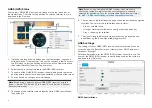
Page 504: ...rine House Cartwright Drive Fareham Hampshire PO15 5RJ United Kingdom Tel 44 0 1329 246 700 www raymarine co uk Raymarine US 110 Lowell Road Hudson NH 03051 United States of America Tel 1 603 324 7900...

Reviews: