Charts
ECDIS900 system supports vector and raster charts. The ECDIS system runs automatically in
RCDS mode when raster charts are used. (see
Chart types
•
ENC format are official Vector charts (see
"Electronic navigation charts (ENC)"
•
ARCS are official Raster charts (see
Brightness control
All system monitors are calibrated according to the standards. It is possible to change
brightness manually, using the monitor buttons. When the brightness settings meet the
calibration values, the monitor indicator is green, otherwise it is red.
Operational area
User operational area is between 85
o
S and 85
o
N. That means there is no possibility to
perform operations with routes beyond this area (close to poles).
Chart database installation
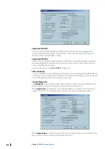
To install chart database and catalogs, click on the
Chart handling
icon from the toolbar
panel.
See
Electronic navigation charts (ENC)
Official vector charts produced by National Hydrographic Offices are called ENC, Electronic
Navigation Charts and delivered in S-57 format.
S-57 is a public format used for data exchange and transfer but the charts in this format
cannot be used directly in ECDIS.
There are several sources providing ENC data: Primar in Stavanger distributes ENC data for
North European countries and France, UKHO for other European countries, Japan HO for
Japanese areas, MPA for Singapore harbor etc.
NAVICO chart service includes several services to help the user including:
•
Delivering charts from different sources
•
Information on ENC availability
•
Quotation and ordering facilities for specific areas or for charts along ship’s routes
•
Handling and sending updates from several sources.
ENC data from one source are delivered on 2 CDs:
•
One base CD containing the charts issued at a certain data
•
An update CD containing updates for the charts, new charts and new edition of charts.
ENC are in general encrypted and chart permits are required to be able to use them. The
permits are ordered directly to NAVICO.
ECDIS operates ENC under a seamless mode and automatically loads new cells when
scrolling or zooming all over the world.
When the chart area cannot be covered with ENC data for the selected navigational purpose,
the remaining part of the chart area is filled with data based on a more navigational general
purpose.
ECDIS900is compliant with IEC61174 ed4 regarding ENC chart Installation and Update from:
•
Single media using multiple exchange data sets
•
Multiple exchange sets across multiple media sets.
Ú
Note:
The chart information to be used in ECDIS should be the latest edition of
information originated by the government HOs and conform to IHO standards.
Using ENC charts
ENC chart display is done according to official Presentation library (see
55). The following actions are available:
•
Zoom and select other scales.
8
54
Charts
| ECDIS900 Operator Manual

