Weather
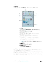
To access to the weather module, click the
Weather
button in the toolbar or select the
Weather
tab on the console.
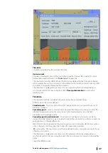
Weather module displays different weather layers including wind force and direction,
pressure, swell, waves, typhoon history and forecasts, and temperature.
Weather forecasts may cover several days depending on the source of the data.
For a detailed overview of the weather module, see
Weather forecast
General
The Weather module is for displaying weather forecasts overlaying navigation charts. The
data can be ordered with MBA (see MBA User manual). Also you can find the Weather service
management on the www.chartservice.maris.no.
The following file formats are supported:
•
grib&grib2 for waves, current, temperature, wind force and direction, pressure, swell, etc.
•
additional data typhoon&ice (proprietary formats of providers)
Ú
Note:
Local area forecasts are 5-7 days only. The 9 days forecasts are for ocean areas.
Ú
Note:
NAVICO disclaims responsibility for grib&grib2 files supplied by the providers
which are not in the recommended list if these data is not displayed correctly.
A weather file includes several layers with data of defined period. For instance 5 days
forecasts for wind and pressure situations, with weather data every 12 hours.
The ECDIS interpolates the data in time and position making possible to display continuously
over a period of time and a geographical area all data included in the file.
Recommended weather providers
•
Sat Ocean
•
Meteo Consult
48
Tools for safe navigation
| ECDIS900 Operator Manual

