Basic Functions
31
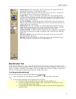
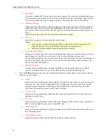
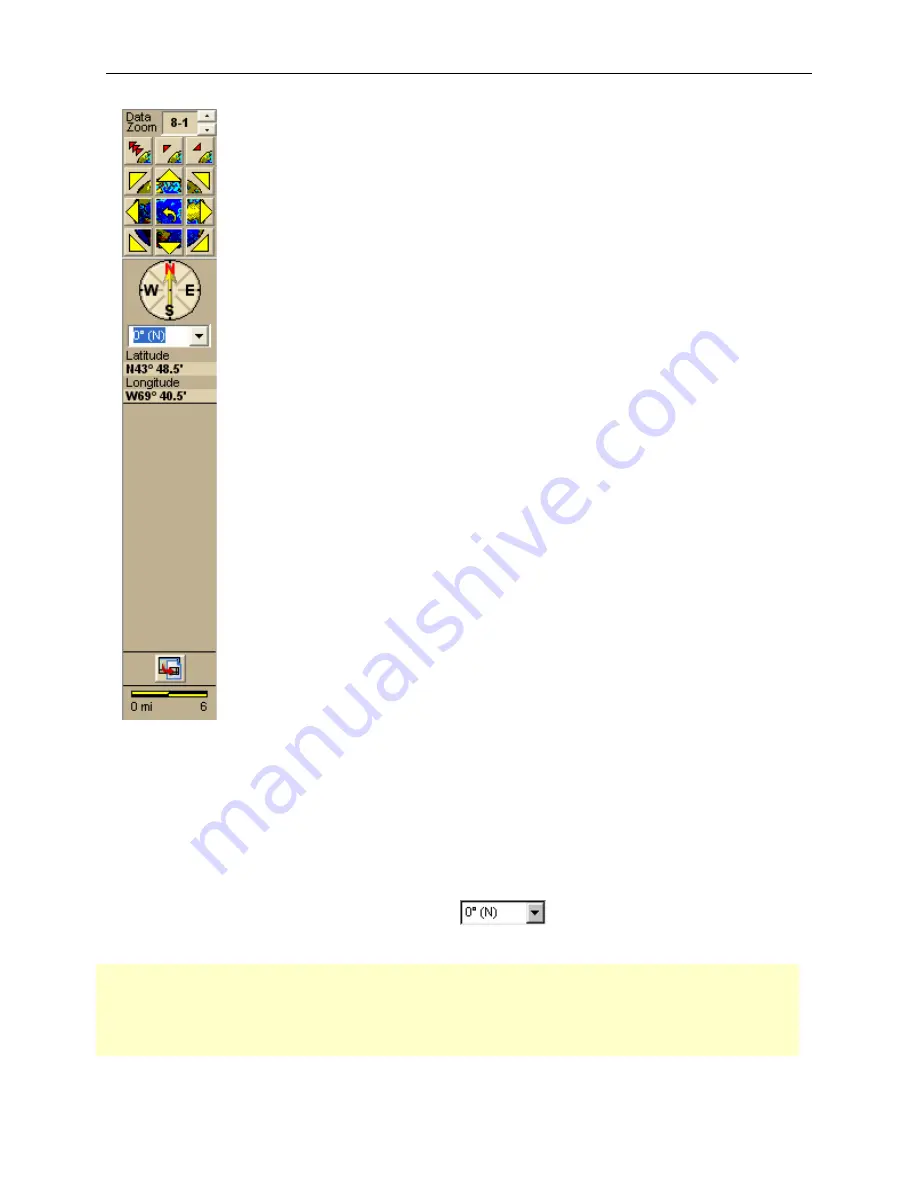
Data Zoom Level—
The current data zoom level of the map view; ranges between 2-0
(maximum zoom-out) and 16-0 (maximum zoom-in).
Zoom Tools—
Buttons that quickly zoom out three levels, out one level, or in one level.
For more information, see
Zooming In and Out
on page 38.
Compass Rose—
A group of nine buttons, eight with yellow arrows pointing outward.
Click one of the arrow buttons to pan the map in that direction. Click the middle button to
center the map on the previous map view. This button performs an undo function for the
last pan or zoom (up to 256 times).
True North Indicator—
Indicates the position of North relative to the current map view.
When the map is rotated using the Map Rotation tool, the True North arrow indicates True
North in relation to the rotated map.
Map Rotation Tool
—This drop-down list is used to change the orientation of the map
display by adjusting the degree of map rotation. The angle of map orientation is directly
related to the degrees of a compass; for example, 90 degrees is always East.
Latitude/Longitude—
Latitidue/longitude coordinates for the current map cursor position
display based on the units chosen under Coordinates on the Units dialog area in the Map
Display tab.
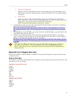
Print Screen Button
—Prints the current view as it displays on the screen (the control
panel, tab area, map view(s), etc.).
Scale Bar
—Indicates the distance one scale bar unit equals in the measurement chosen
under Measures on the Units dialog area in the Map Display tab.
Map Rotation Tool
Street Atlas USA 2005 allows you to change the orientation of the map display by adjusting the degree of map
rotation. The angle of map orientation is directly related to the degrees of a compass; 90 degrees is always East, 135
degrees is Southeast, 180 degrees is South, and so forth. For example, when you select 90 degrees from the drop-
down list, the map rotates so that 90 degrees (East) is at the top of the screen.
To Change the Map Rotation
Use one of the following two methods to change the angle of map rotation.
•
Select an angle from the available drop-down list
(in 45 degree increments)
OR
•
Type a specific angle (from 0 to 359 degrees) in the entry field.
•
The True North Indicator adjusts when a new degree of map rotation is set.
•
The black rectangle in the Overview Map window, indicating the current map view, also
rotates to match the angle of map rotation.
•
A rectangle drawn with the Polygon/Rectangle/Circle tool in the Draw tab is positioned in
relation to North.


