Street Atlas USA 2005 User Guide
92
OR
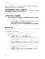
To use the time and date of your choice, clear the
Use Current System
Date/Time
check box, and then:
•
To manually set the time, select the desired time zone from the Zone
drop-down box, and if daylight saving time is currently in effect where
you are, select the
DST
check box. Type the desired time in the
T
text
box.
Note
: Time is displayed in 24-hour format, with Midnight as 00:00:00.
•
To manually set the date, type the desired date in the
D
text box.
Note
: Date format is MM/DD/YY.
v.
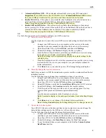
Click
Done
to save changes. The Settings dialog area displays.
4.
Click
Start GPS
. Your GPS receiver begins acquiring satellite data and the GPS Status dialog area
displays.
•
The GPS Status dialog area displays on your screen so that you can view the status of your
GPS connection while your GPS receiver acquires data from the satellites. Once your GPS
receiver acquires a fix on your location, Street Atlas USA 2005 indicates your position on
the map as a yellow or green dot that changes to an arrow as you travel.
•
While your receiver is acquiring data, many red dots display on your map (except with
Magellan receivers). You may have to zoom in to see them clearly. These red dots are
positioned at the readings taken by the GPS receiver as it is acquiring data.
•
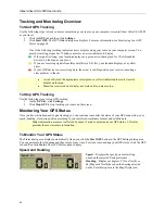
For more information on the GPS Status dialog area, see
Monitoring Your GPS Status
on
page 94.
•
Magellan receivers do not display any data until you are moving.
•
If you have the HotSync
®
manager loaded in the startup (the default configuration), it
reserves the COM port. If that is the one where the GPS receiver is attached, you must exit
HotSync manager to get the GPS receiver to initialize. This can be done by right-clicking
the HotSync icon on the taskbar and selecting the Exit option from the shortcut menu. If
you have two COM ports, verify the correct COM port is selected for use with Street Atlas
USA 2005.
•
Any questions or problems regarding the operation of your GPS receiver should be directed
to its manufacturer.
GPS Settings for Third-Party Devices
A third-party GPS receiver is one which is manufactured by a company other than DeLorme, such as GARMIN,
Magellan, Brunton, Lowrance, Trimble, and so forth.
To Use Recommended Settings for Your Third-Party Receiver
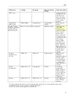
The table below provides information on several GPS receivers. Locate your receiver in the farthest-left column, and
read across for information on settings for Tracking, Waypoints, your DeLorme mapping product, and any
additional information.
GPS Receiver
Tracking
Waypoints DeLorme
Product
Settings
Other Information
Garmin
®
GPS III,
GPS III+, GPS II,
GPS II+,
*Garmin Garmin/Host
Garmin/Garmin
Street Pilot,
ColorPilot, Street
Pilot III
*Garmin Garmin/Slave
Garmin/Garmin
Garmin eTrex
®
series, Geko™,
Rino
®
, 12Map
NMEA/NMEA Garmin/Garmin Garmin
NMEA
(w/wpt)
Garmin eMap,
GPS76 series,
NMEA/NMEA Garmin/Garmin Garmin
NMEA
(w/wpt)
Stores routes and
tracks by name.
Can simulate
bearing and speed
in program (image
does not update in
simulate mode).
Make sure baud
rate on program
matches device.
Tracks

