Street Atlas USA® 2009 User Guide
42
4.
If you want to hear the search results, click the Speech button
.
5.
From the Search Area scroll list, select a distance in miles to limit your
search to a certain driving distance from your current location.
For more information about GPS Radar, see Finding POIs Near Your Current Location
on page 127.
Step 2 — Start the GPS
1.
Connect your GPS device to your portable computer. Ensure the speakers are
turned on and loud enough for you to hear while driving.
2.
Launch Street Atlas USA.
3.
Make sure the NavMode button
on the toolbar is on (appears indented).
4.
Click the GPS button
on the toolbar to start your GPS.
If you are using a GPS device that is not an Earthmate® GPS device, and you
have not initialized it in Street Atlas USA before, you will need to initialize the
device using the GPS Settings tab in the Options dialog box.
Note If you do not see the GPS button on the toolbar, right-click the toolbar
and select the GPS/Exchange option.
Step 3 — Start driving
The computer speaks the route directions as you drive. If you are using speech
recognition software, you can ask the computer questions like, "What is the next
turn?" or "Where am I?"
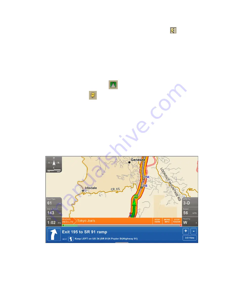
NavMode in 2-D
NavMode Display
•
Compass—The default map setting is North up in 2-D and in the GPS
direction in 3-D. To change the compass, select or clear the Rotate Map in
GPS option on the GPS tab in the Options dialog box.
Summary of Contents for Street Atlas USA 2009
Page 1: ...Street Atlas USA 2009 User Guide ...
Page 2: ......
Page 44: ......
Page 56: ...Street Atlas USA 2009 User Guide 44 NavMode in 3 D ...
Page 74: ...Street Atlas USA 2009 User Guide 62 Step 6 Create your maps Click Next to create the maps ...
Page 78: ......
Page 90: ......
Page 120: ......
Page 146: ......
Page 168: ......
Page 228: ......
Page 271: ...Using Voice Navigation and Speech Recognition 259 Last leg Approaching finish Off route ...
Page 272: ......
Page 290: ......
Page 294: ......
Page 298: ......
Page 376: ......
Page 388: ......


