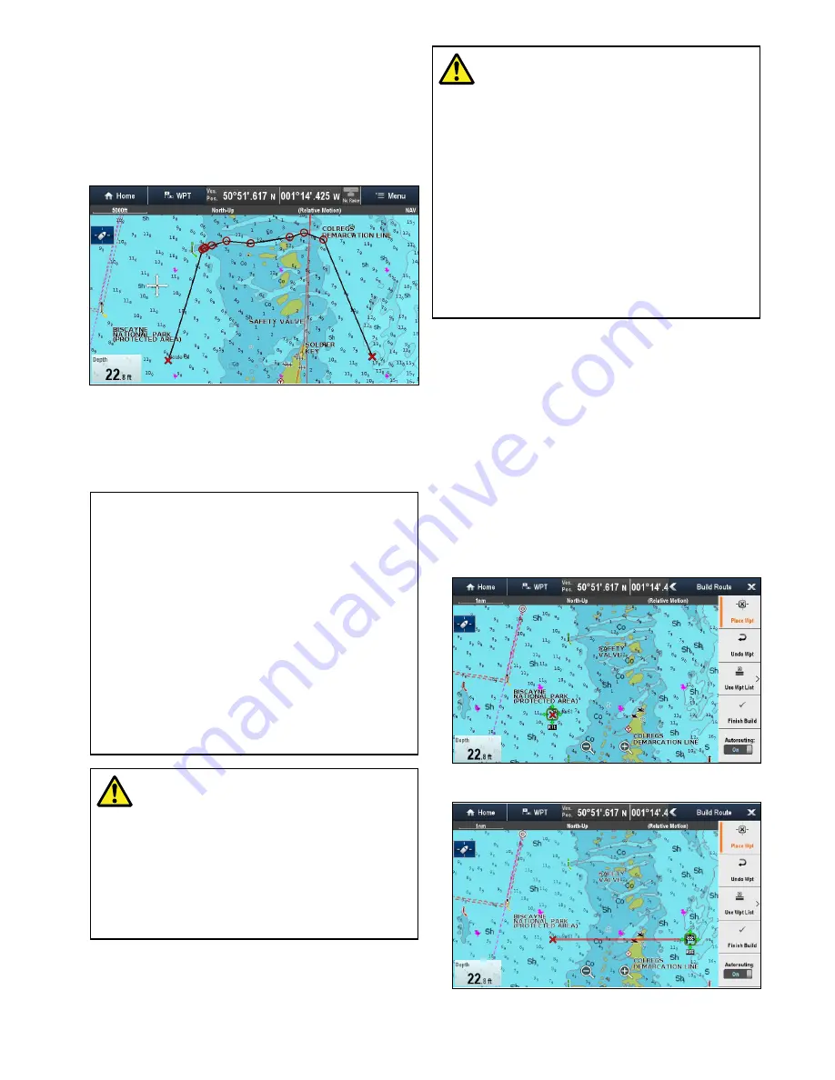
Autorouting
While building a route, the
Autorouting
feature
can be used to create the shortest route between 2
waypoints.
Autorouting
requires
Navionics
®
Updates
,
Navionics
®
Platinum
TM
or
Navionics
®
Platinum
TM
+
cartography.
Autorouting
can be used
when creating new routes or when adding a route
leg to an existing route.
Autorouting
generates a route based on the bottom
depth data available on compatible cartography
and the user defined
Minimum Safe Depth
setting. Waypoints automatically generated using
Autorouting
will be restricted from entering water
that is too shallow for the vessel.
Important:
When using
Autorouting
the following
restrictions apply:
•
Autorouting
can only be used when generating
routes within the area covered by your
compatible cartography.
•
Autorouting
can be used between waypoints
less than 100 nm apart.
•
Autorouting
always uses the cartography’s
minimum depth reading when calculating routes.
•
Autorouting
will fail if the generated route will
exceed the maximum waypoint or route capacity
of the MFD.
•
Autorouting
will also fail if insufficient
cartographic data is available.
Warning: Autorouting
Routes created using the
Autorouting
feature rely on Bottom Depth information
taken from compatible electronic
cartography and a user defined
Minimum
Safe Depth
value. As both of these
values are subjective the generated
route MUST be carefully checked and
if necessary edited BEFORE starting to
follow the route in the Chart application.
Warning: Autorouting — Traffic
separation
The
Autorouting
feature does not
adhere to the Traffic Separation Schemes
identified in Rule 10 of the
International
Regulations for Preventing Collisions at
Sea 1972
as amended.
Raymarine
®
therefore recommends that
you do NOT use
Autorouting
to create
any part of a route which will cross traffic
lanes or pass near to traffic separation
lines. In these situations
Autorouting
MUST be switched Off and the route
or route leg MUST be built manually,
ensuring compliance to the rules laid out
in the above regulations.
Building a route using Autorouting
Autorouting
can be used to create an entire route
or can be activated at any time when building a new
route.
From the Chart application:
1. Select
Build Route
from the chart context menu
or the
Navigate
menu.
The Build Route menu is displayed.
2. Select
Autorouting
so that On is selected.
Autorouting
can be switched On and Off at any
time during route building.
3. Select the position on the Chart where you want
the route or route leg to start.
4. Select the position on the Chart where you want
the route or route leg to end.
The system will try to automatically calculate the
shortest safe route between the 2 points.
Waypoints, Routes and Tracks
209
Содержание Raymarine gS 195
Страница 2: ......
Страница 26: ...26 gS Series...
Страница 43: ...D 36 mm 1 4 in E 39 2 mm 1 5 in F 90 mm 3 5 in Planning the installation 43...
Страница 44: ...44 gS Series...
Страница 110: ...110 gS Series...
Страница 146: ...146 gS Series...
Страница 174: ...174 gS Series...
Страница 175: ...Chapter 13 Man Overboard MOB Chapter contents 13 1 Man overboard on page 176 Man Overboard MOB 175...
Страница 178: ...178 gS Series...
Страница 181: ...Chapter 15 Fuel manager Chapter contents 15 1 Fuel manager overview on page 182 Fuel manager 181...
Страница 196: ...196 gS Series...
Страница 218: ...218 gS Series...
Страница 328: ...328 gS Series...
Страница 362: ...362 gS Series...
Страница 411: ...Chapter 31 Technical specification Chapter contents 31 1 Technical specification on page 412 Technical specification 411...
Страница 418: ...418 gS Series...
Страница 438: ...438 gS Series...
Страница 439: ......
Страница 440: ...www raymarine com...


