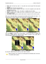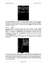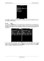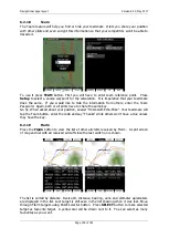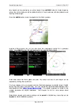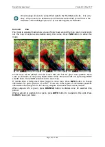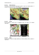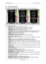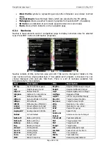
Navigational page layout
Version 6.03, May 2017
Page 151 of 192
curFlaps
Current Flaps
tETA
Task estimated time of arrival
cWind
Head/Tail wind component
tETE
Task estimated time enroute
Date
Local date
Th.E
Thermal glide ratio
Description
Target description
thE
Theoretical glide ratio
Dew.Temp
Dew point temperature
Thermal
Last thermal vertical speed
Dis
Distance to target
Time
Local time
E
Current glide ratio
tmAlt
Team partner altitude
Elevation
Target elevation
tmBrg
Team partner bearing
Emc
MacCready glider ratio
tmCode
Team code of my position
ETA
Estimated time of arrival
tmDist
Team partner distance
ETE
Estimated time en route
tmName
Team partner name
Fin.Elev
Task finish elevation
tmRelAlt
Relative altitude of teammate
FL
Flight level
tmTo
Relative bearing of teammate
Flarm
Flarm RXTX
tmVario
Team partner vario
FlIGC
Flight level(IGC)
tmWptcode
Teamcode for waypoint
FltTime
Flight Time
To
Steering course to target
Frequency
Target frequency
toWind
Head/tail Wind to target
g-load
Current g-load
tRemain
Task remaining time
g-max
Max. g-load
tReq.Mc
Task required MacCready
g-min
Min. g-load
tReq.Sp
Task required speed
Gnd
Terrain elevation
Tri
Optimized FAI triangle or just
largest triangle
GS
Groundspeed
Trk
Groundtrack
Hdg
Heading
trqSTF
Task STF for required MacCready
Humidity
Relative humidity
Tsk.Sp
Task speed
IAS
Indicated airspeed
tskE
Task required glide ratio
LON/LAT
Longitude and Latitude
tVario
Average vario for task
Mc
MacCready Value
UTC
UTC time
METAR
Target parsed METAR
VarA
Averaged vertical speed
METAR
Target raw METAR
Vario
Current vertical speed of a glider
Netto
Current Netto-vertical speed
of the airmass
VarioFL
Average vario for flight
OAT
Outside temperature
Waypoint
Nearest Waypoint
OLC.Sp.60'
OLC 60' Speed
Wind
Current wind
Opt
Optimized distance
WindX
Side Wind Component
OptHome
Optimized distance to home
XPDR
XPDR Transponder
Pot.Temp
Potential temperature
xTrk
Task cross track distance
Radial
Radial from target
Rain age
Shows the time of last
received rain picture
Rain time
Shows relative time of the
rain picture
RawIGC
Altitude raw (IGC)
6.3.1.1
Detailed description of NAVBOXES
Title
Description
E
Current glide ratio calculated over 3 minutes. Total altitude is taken into
account and distance is calculated over one point.
Emc
Best glide ratio for given MacCready, same as displayed in
MacCready/Ballast/Bugs dialog
Req.Mc
Required MacCready to reach selected goal at safety altitude. If this value is
negative, arrival altitude is shown.


