Auxiliary Functions
ProMARK X
4-9
If DOWNLOAD DATA was selected, you may choose which type of data
will be downloaded. First, start the logging equipment or initiate the
LOG submodule of the PPSW. Next, press the
DOWN ARROW
to scroll
through waypoints, averaged positions, POS data buffer, almanac, or
ephemeris data. When the desired data type is displayed, press
ENTER
to begin downloading data.
NOTE
Only position and raw data are output when POS is pressed —
an ephemeris needs to be downloaded at a later date.
Transferring data is described more fully in the
PPSW User Guide.
The display returns to the Dif Timer ON/OFF screen. The timer is on and
set.
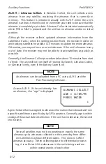
AUX 6 — Waypoint Projection.
The ProMARK X can calculate the
coordinates of a remote destination based on a relative distance, bearing,
and altitude that you enter.
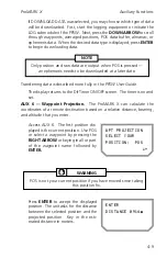
Access AUX 6. The first position dis-
played is the current position. Use POS
or select a waypoint by pressing the
RIGHT ARROW
or keying in all or part
of the waypoint name followed by
ENTER.
WPT PROJECTION
SELECT YOUR
POSITION: POS
~!
ENTER
DISTANCE 0914m
WARNING
POS is not your current position if you have moved since taking
this position fix.
Press
ENTER
to accept the displayed
position. The unit asks for the distance
between the selected position and the
projected position. Key in the esti-
mated distance in meters.
Summary of Contents for GPS PROMARK X
Page 4: ......
Page 10: ...vi...
Page 14: ...Introduction ProMARK X 1 4...
Page 92: ...Attributes ProMARK X 6 8...
Page 188: ......

