Operating Procedures: Stage Control
5-27
C O N F I D E N T I A L
– limited rights
User Manual
Revision A
Feb 2018
Double-clicking anywhere in the circle area marks a new location (
10
) and moves the stage to that position.
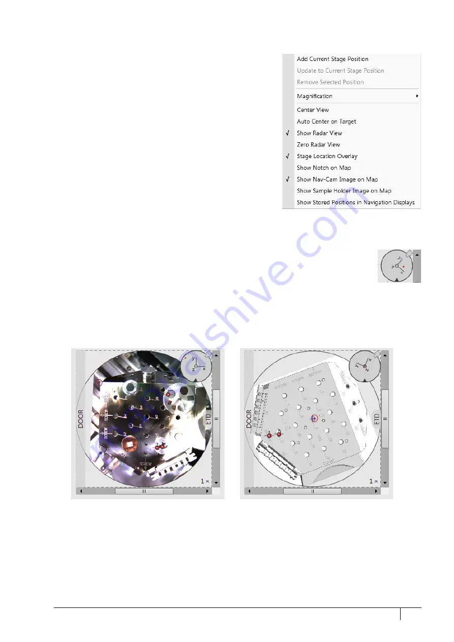
Right-clicking on the Map area provides a context menu.
•
Add Current Stage Position
– adds a new Location
list entry, using
the actual position. The new entry is named
Position
(
X)
(X = 1,
2, 3…). When renaming and the name already exists, a number
increment is added after the name.
The
Add
button has the same functionality.
•
Update to Current Stage Position
– stores the (edited) coordinate
values under the selected name (an overwriting confirmation
dialog appears).
The
Update
button has the same functionality.
•
Remove Selected Position
– deletes the selected location(s) from
the map and from the Location list.
The
Remove
button has the same functionality.
•
Magnification
– provides a menu allowing the
Map
area
magnification factor (
4
– from 1× to 100×) to be selected. Scroll
bars (
3
) appear if necessary to move over the whole Map area.
•
Center view
– brings the actual stage position (
10
) to the map
area center (
9
).
•
When the
Auto Center on Target
item is ticked, the actual stage position (
10
) remains in the map area center (
9
).
•
Show Radar View
(
7
) – switches the radar view show in the map area On / Off.
•
Zero Radar View
– resets the Radar view X / Y axes rotation representation to 0°.
The radar view conveys the stage rotation at any time either by the stage axes or by the notch.
To rotate the stage, click on the notch (black triangle), drag it around the radar view perimeter,
and release the mouse button at the desired position – the stage rotates accordingly.
•
Stage Location Overlay
(
5
) – toggles the representation of the detector(s), chamber door, and
CCD camera in a mutual relationship.
•
Show Notch on Map
(6) – switches representation of the black triangle in the map area On / Off; it gives quick
information about the stage rotation.
•
Show Nav-Cam Image on Map
– switches representation of the Nav-Cam image in the map area On / Off
•
Show Sample Holder Image on Map
– switches the sample holder schema representation in the map area
•
Show Stored Positions in Navigation Displays
– switches representation of stored positions in navigation displays
On / Off.


