Street Atlas USA® 2009 User Guide
76
3.
To change the Show Roads status, click Show Roads to toggle the option.
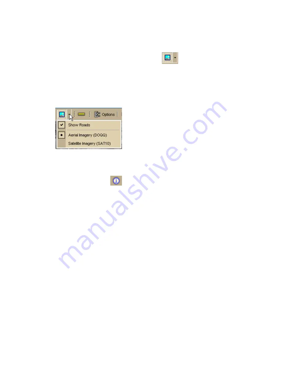
To Change the Raster Data Type
1.
Click the arrow next to the Imagery button
on the toolbar to open
the Imagery menu.
All of the connected, compatible raster data types are listed under the Show
Roads and Show Imagery options.
The active raster data type has a black dot next to it . In the graphic below,
Aerial Imagery is the active raster data type.
2.
To change the raster data type, click a different data type in the list.
Note Only one raster data type is displayed at a time.
To Get Information About a Location
Use the Information button
on the toolbar to click a point, symbol, feature,
measurement line, track, or area on the map to identify it and view detailed
information about it.
Use the following steps to get information about a particular map feature.
1.
Click the Information button.
2.
Click the map feature you want information for, such as a road, town,
measurement line, waypoint, track, draw symbol, or point of interest.
The Info tab opens and displays a list of information categories.
Note Descriptive information may include a name or feature type,
length/area, ZIP/Postal Code, town name, county name, state/province,
coordinates, and Standard Industrial Classification categories.
3.
Click the plus sign next to each of the information categories to expand the
category to view more detailed information.
OR
Right-click in the information box and click Expand All to expand all of the
information categories. Right-click in the information box again and click
Collapse All to minimize all of the information categories.
4.
Optional. Repeat steps 1–3 to get information about another location.
5.
Optional. Right-click in the information box and click Print in the shortcut
menu to print your map feature information.
Notes
•
You can also get information about a location using right-click functionality. Just
right-click the location and click Info in the shortcut menu.
Содержание Street Atlas USA 2009
Страница 1: ...Street Atlas USA 2009 User Guide ...
Страница 2: ......
Страница 44: ......
Страница 56: ...Street Atlas USA 2009 User Guide 44 NavMode in 3 D ...
Страница 70: ...Street Atlas USA 2009 User Guide 58 Step 8 Exit the MapShare Wizard Click Close to exit the MapShare Wizard ...
Страница 74: ...Street Atlas USA 2009 User Guide 62 Step 6 Create your maps Click Next to create the maps ...
Страница 78: ......
Страница 90: ......
Страница 120: ......
Страница 146: ......
Страница 168: ......
Страница 228: ......
Страница 271: ...Using Voice Navigation and Speech Recognition 259 Last leg Approaching finish Off route ...
Страница 272: ......
Страница 290: ......
Страница 294: ......
Страница 298: ......
Страница 376: ......
Страница 388: ......


