12.4. USING PINPOINT-GIS WEB
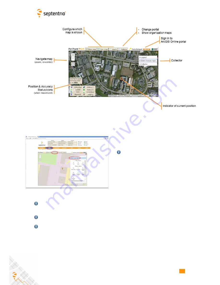
Figure 12-3:
Functions within PinPoint-GIS Web
Access your maps from the Altus NR2
•
Connect to your Altus NR2 receiver
•
Go to the GNSS/PinPoint-GIS Web tab where you
should see a basic map
Your browser should be connected to the
internet (See Section 12.3).
•
Sign-in to ArcGIS online using the ‘Sign in’ button
and enter your own user/password
•
Clicking on ‘User maps’ will show the maps stored
in your account.
•
Select your map of choice.
The Altus NR2
position will be shown and you can now start data
collection with accurate positioning.
You can use the ArcGIS Online toolsets to perform analytics, administration, reports, web
apps and much more benefiting of the precise and accurate collected data from the APS-
NR2: http://www.arcgis.com/features/features.html
While position passed to ArcGIS Online is accurate enough you will need to make sure your
Esri layer is prepared in the correct Datum as output from the GNSS receiver.
Please contact Esri for any questions on getting an ArcGIS Online account: www.arcgis.com
60
Содержание Altus NR2
Страница 1: ...Altus NR2 User Manual ...
Страница 26: ...5 2 SET UP THE CELLULAR MODEM Figure 5 4 Cellular Status Connected 26 ...
Страница 72: ...14 1 CONFIGURATION Figure 14 2 Save to Boot pop up 72 ...
Страница 78: ...15 2 FRONT PANEL LEDS 15 2 Front Panel LEDs Figure 15 1 Front panel LED behaviour 78 ...

