12.4. USING PINPOINT-GIS WEB
Table 12.4-4:
Type conversion for auto filled GNSS attributes
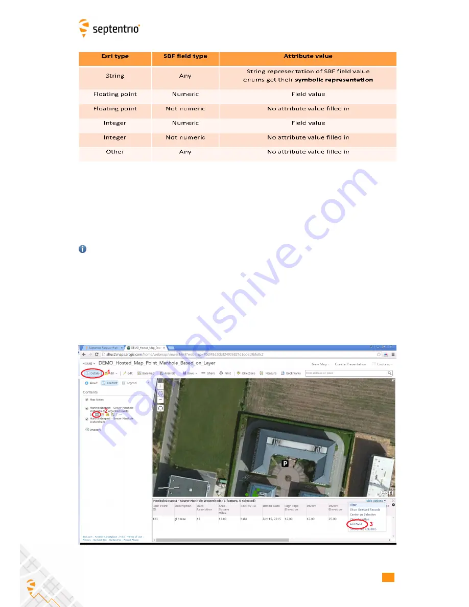
To be able to add extra attributes to a GIS database will need to use either ArcGIS Online
or ArcGIS PRO Desktop SW. The step below explain how to prepare a map for auto filling of
GNSS data using ArcGIS Online. Note that you need to have an Esri account which allows
editing of the Feature class. In ArcGIS Online, open a User map which includes the Feature
Class you want to use for the auto-filled GNSS data and follow steps below:
Public accounts do not allow new attributes in the layer to be defined. Extra attributes are
useful for demonstrating how PinPoint-GIS automatically pushes not only position data but
also any other metadata which might be important (e.g. accuracy, height, Positioning Mode,
etc.). If you need this functionality you will need a payable Esri account.
1. Select the in the Details menu the Feature class you want to edit
2. Click on the table view icon which will allow you to visualize all the fields of the Feature
class
3. Click on the Table Options menu and select the option Add a field
Figure 12-4:
Adding a GNSS attribute in a feature class
62
Содержание Altus NR2
Страница 1: ...Altus NR2 User Manual ...
Страница 26: ...5 2 SET UP THE CELLULAR MODEM Figure 5 4 Cellular Status Connected 26 ...
Страница 72: ...14 1 CONFIGURATION Figure 14 2 Save to Boot pop up 72 ...
Страница 78: ...15 2 FRONT PANEL LEDS 15 2 Front Panel LEDs Figure 15 1 Front panel LED behaviour 78 ...


