7.2 Cartography overview
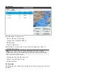
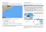
The Chart app includes a basic world base map. To use the Chart app for
navigation purposes, compatible, detailed Electronic Navigational Charts
(ENC) or Raster Navigational Charts (RNC) are required.
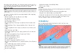
•
Raster Navigational Chart (RNC)
— A Raster chart is a digital image
of a paper chart and therefor the available information is limited to the
information available on the paper equivalent.
•
Electronic Navigational Chart (ENC)
— ENCs are Vector based charts
and include information that is not available on paper or Raster charts.
Objects and features on Vector charts can be selected to obtain databased
information that otherwise would not be readily available. Object and
features can also be enabled and disabled or customized.
Note:
• The level of detail and features available on charts is dependent on
vendor, chart type, subscription level and geographic region. Prior to
purchasing charts check the vendor’s website to establish what level of
detail is available on the charts you want to purchase.
• The information relating to available chart detail and settings in this
manual should be treated as guidance only as it is subject to change that
is not under Raymarine’s control.
The Chart app range scale will also effect the level of detail shown onscreen.
Generally more detail is available at lower ranges. The chart scale in use is
indicated by the scale indicator, the value displayed is the distance that the
line represents across the screen.
You can remove and insert chart cards at any time. The chart screen is
automatically redrawn when the system detects that a compatible chart card
has been inserted or removed.
Different cartography types can be viewed simultaneously using an app page
that includes multiple instances of the Chart app.
Supported electronic navigational charts
MFDs running the LightHouse Sport operating system can utilize the
electronic navigational charts (ENC) listed below.
• Next generation LightHouse™ charts
• Retired LightHouse™ vector, raster and NC2 charts.
• Navionics charts
• C-Map
Refer to the Raymarine website for the latest list of supported chart cards:
To check the current availability of Navionics chart cards and types, please
visit
To check the current availability of C-MAP
®
chart cards and types, please
visit:
.
3rd party raster charts
Raster navigational charts from the 3rd party vendors listed below are
supported.
Note:
Raster charts are created by scanning paper charts, each segment of the
paper chart is turned into a digital image. The detail available on raster
charts is limited to the detail on the paper chart it was created from. Raster
charts do not offer dynamic content that is typically available on vector
based electronic charts.
•
Standard mapping
— USA only.(For details visit:
)
•
CMOR Mapping
— USA only.(For details visit:
)
•
Strike Lines Charts
— USA only.(For details visit:
)
Note:
For assistance using these charts refer to the chart vendor.
70

