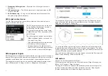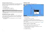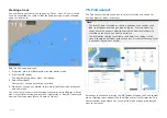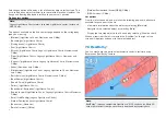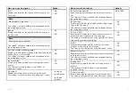
Menu item and description
Options
[Chart boundaries]
Enables and disables the display of chart boundary
lines.
This setting is always available and not dependent on
the cartography in use.
•
On
•
Off
[High res bathy]
Enables and disables display of High Resolution
Bathymetry charts which provides improved bottom
detail, contours and structure.
This setting is available when using C-MAP® charts.
• On
• Off
[Sports fishing]
Allows you to display easy-to-use information pages
about fishing locations including fish type, size, depth
and reef and bottom composition.
This setting is available when using C-MAP® charts.
• On
• Off
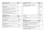
View & Motion tab
Menu item and description
Options
[Chart motion:]
Chart motion controls how the chart and boat are drawn
in relation to each other.
This setting is always available and not dependent on
the cartography in use.
•
Relative
motion
•
True motion
•
Auto range
[Chart orientation:]
The orientation of the chart affects the alignment of the
chart relative to either your vessel heading, your course
or North.
This setting is always available and not dependent on
the cartography in use.
•
North-up
•
Head-up
•
Course-up
[Boat position]
Adjust the boat position to allow more or less ‘look
ahead’ space in front of your boat.
This setting is always available and not dependent on
the cartography in use.
•
Center
•
Partial offset
•
Full offset
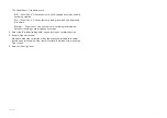
Menu item and description
Options
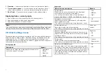
[Boat type:]
The icon used to represent your vessel can be
customized to better reflect your vessel.
This setting is always available and not dependent on
the cartography in use.
•
Inboard Speed
Boat
•
Outboard
Speed Boat
•
Power Cruiser
•
Pro Fishing
Boat
•
RIB
• Sail Cruiser
• Race Sail
• Catamaran
•
Kayak
•
Pontoon
[Icon type:]
The type of icon used to represent your vessel can be
customized.
This setting is always available and not dependent on
the cartography in use.
•
Icon (large)
•
Icon (small)
•
Outline
•
Teardrop
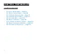
Depths tab
Menu item and description
Options
[Show soundings]
Enables and disables the display of depth soundings on
the chart. When set to
[Manual]
, depth soundings will be
shown from
[Zero to]
the maximum depth you specify.
This setting is always available and not dependent on
the cartography in use.
•
None
•
Manual
•
All
[Show contours]
Enables and disables the display of depth contours on
the chart. When set to
[Manual]
, contours will be shown
from
[Zero to]
the maximum depth you specify.
This setting is available when using LightHouse™,
C-MAP® and Navionics® charts.
•
None
•
Manual
•
All
88

