Glossary
961 Operations and Reference Manual Rev. D
Page G-5
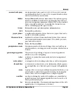
nautical mile (nm
)
An international unit equal to 6,076.115 feet (1,852 meters)
used officially in the U.S. since 1959. A nautical mile is about
800 feet more than a statute mile.
NMEA
N
ational
M
arine
E
lectronics
A
ssociation. The industry group
that has established standards for exchanging data between
electronic navigation equipment. NMEA 0183 is the standard
that’s currently in wide use. It specifies the format for sen-
tences containing specific types of data.
NOAA
N
ational
O
ceanic and
A
tmospheric
A
dministration.
NOS
N
ational
O
cean
S
ervice.
paper plotter
A traditional navigation device that uses a paper chart and a
needle to determine position.
Phantom loran
Northstar’s exclusive loran-simulation feature that converts
GPS position information into Loran-C TDs—while you navi-
gate with GPS or DGPS.
PPNM
P
ulses
P
er
N
autical
M
ile.
precipitation static
Precipitation-induced electrical charge that can build up on
antenna surfaces, creating poor radio reception. Also known as
P-Static.
queueing waypoints
The process of specifying a trip one or more waypoints in
advance—as you’re navigating.
radar
A device or system that emits radio waves for navigational
purposes.
radar plotter
A navigation device tracking radar data as well as waypoints.
rhumb line
A constant, true direction to your destination, which appears
as a straight line on a Mercator grid. Compare with
great cir-
cle
.
route
A group of two or more pre-defined waypoints that form a con-
nected path to and/or from specific locations. In its simplest
form, a route can be a straight line to a single waypoint.
satellite
An object orbiting the earth. GPS satellites are controlled by
ground stations, and transmit signals that can be used to cal-
culate position and speed.
SA
S
elective
A
vailability. The intentional degradation of the GPS
signal by the U.S. Department of Defense.
Содержание 961X
Страница 1: ...961 961 GPS Chart Navigator Operations and Reference Manual P N GM1700 Revision D X XD ...
Страница 8: ...Page viii 961 Operations and Reference Manual Rev D ...
Страница 10: ...Page x 961 Operations and Reference Manual Rev D ...
Страница 58: ...Chapter 2 Introducing the 961 Page 2 16 961 Operations and Reference Manual Rev D ...
Страница 140: ...Chapter 5 Understanding Position Coordinates Page 5 12 961 Operations and Reference Manual Rev D ...
Страница 172: ...Chapter 7 Creating Avoidance Points Page 7 16 961 Operations and Reference Manual Rev D ...
Страница 198: ...Chapter 8 Creating Routes Page 8 26 961 Operations and Reference Manual Rev D ...
Страница 262: ...Chapter 12 Alarms TideTrack and Currents Page 12 16 961 Operations and Reference Manual Rev D ...
Страница 348: ...Chapter 14 Service and Maintenance Functions Page 14 20 961 Operations and Reference Manual Rev D ...
Страница 374: ...Index Page I 12 961 Operations and Reference Manual Rev D ...


