Glossary
961 Operations and Reference Manual Rev. D
Page G-3
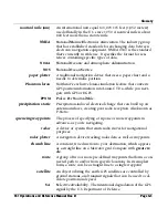
ETE
E
stimated
T
ime
E
nroute to the next waypoint, as calculated by
the 961, according to your present speed and distance to the
waypoint.
fathom
A depth measurement that equals six feet of water.
GPS
G
lobal
P
ositioning
S
ystem. Developed by the U.S. Department
of Defense, GPS is a satellite navigation system that computes
your position by using signals from a system of 24 earth-orbit-
ing satellites. Tracking the location of the satellites is a GPS
receiver, which loads this data, and uses it to calculate your
position. This system provides high accuracy anywhere in the
world, at any time of day, under all weather conditions. How-
ever, civilian accuracy is limited to about 100 meters. See also
DGPS
.
great circle
The shortest possible path between two points on the surface
of a sphere.
GMT
G
reenwich
M
ean
T
ime.
GRI
G
roup
R
epetition
I
nterval. The identifying time period of sig-
nals emitted by each loran transmitting chain. The code identi-
fier 9960 (Northeast U.S.) indicates that the gap between the
start of any two adjacent master signals is 99,600 microsec-
onds. GRI code varies depending on geographic location. All
loran stations in one loran chain have the same GRI. The 961
displays GRI next to a pair of Loran-C TDs.
HCRF
H
ydrographic
C
hart
R
aster
F
ormat.
heading
The compass direction toward which the longitudinal axis of a
vessel points.
HDOP
H
orizontal
D
ilution
o
f
P
recision.
interference
The electromagnetic interruption of a radio signal that causes
a poor signal reception. Interference may originate from exter-
nal sources (such as radio transmitters) or from the vessel itself
(such as alternator noise or precipitation static—see definition
of “P-Static” below).
knot
One nautical mile per hour.
latitude
Imaginary lines on the earth's surface running East/West and
expressed in degrees (0-90) north or south of the Equator.
Содержание 961X
Страница 1: ...961 961 GPS Chart Navigator Operations and Reference Manual P N GM1700 Revision D X XD ...
Страница 8: ...Page viii 961 Operations and Reference Manual Rev D ...
Страница 10: ...Page x 961 Operations and Reference Manual Rev D ...
Страница 58: ...Chapter 2 Introducing the 961 Page 2 16 961 Operations and Reference Manual Rev D ...
Страница 140: ...Chapter 5 Understanding Position Coordinates Page 5 12 961 Operations and Reference Manual Rev D ...
Страница 172: ...Chapter 7 Creating Avoidance Points Page 7 16 961 Operations and Reference Manual Rev D ...
Страница 198: ...Chapter 8 Creating Routes Page 8 26 961 Operations and Reference Manual Rev D ...
Страница 262: ...Chapter 12 Alarms TideTrack and Currents Page 12 16 961 Operations and Reference Manual Rev D ...
Страница 348: ...Chapter 14 Service and Maintenance Functions Page 14 20 961 Operations and Reference Manual Rev D ...
Страница 374: ...Index Page I 12 961 Operations and Reference Manual Rev D ...


