CPT7 and CPT7700 Installation and Operation User Manual v12
189
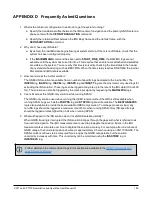
APPENDIX D Frequently Asked Questions
1. What is the minimum configuration I need to do to get the system running?
a. Specify the translational offset between the IMU center of navigation and the primary GNSS antenna
phase center with the
SETINSTRANSLATION
command.
b. Specify the rotational offset between the IMU Body frame and the Vehicle frame, with the
SETINSROTATION
command.
2. Why don’t I have any INS data?
a. By default, the raw IMU data begins flowing at system start up. If there is no INS data, check that the
system has been configured properly.
b. If the
INSCOMMAND
command has been set to
START_FINE_TIME
, the RAWIMU logs are not
available until the system has solved for time. This requires that an antenna is attached and satellites
are visible to the system. You can verify that time is solved by checking the time status in the header
of any standard header log such as BESTPOS. When the time status reaches FINETIME, the inertial
filter starts and IMU data is available.
3. How can I access the inertial solution?
The GNSS+INS solution is available from a number of specific logs dedicated to the inertial filter. The
INSPOS
log,
INSPVA
log,
INSVEL
log,
INSSPD
log and
INSATT
log are the most commonly used logs for
extracting the INS solution. These logs can be logged at any rate up to the rate of the IMU data (100 or 400
Hz). The solution can also be triggered by the mark input signal by requesting the
MARKxPVA
logs.
4. Can I still access the GNSS-only solution while running SPAN?
The GNSS only solution used when running the OEM7 receiver without the IMU is still available when
running SPAN. Logs such as the
PSRPOS
log and
RTKPOS
log are still available. The
BESTGNSSPOS
log is also available to provide the best available GNSS only solution. To manage processor load, any
non-INS logs should be logged at a maximum rate of 5 Hz when running SPAN. Only INS-specific logs
should be logged at rates higher than 5 Hz when running SPAN.
5. What will happen to the INS solution when I lose GNSS satellite visibility?
When GNSS tracking is interrupted, the INS solution bridges through the gaps with what is referred to as
free-inertial navigation. The IMU measurements are used to propagate the solution. Errors in the IMU
measurements accumulate over time to degrade the solution accuracy. For example, after one minute of
GNSS outage, the horizontal position accuracy is approximately 2.5 m when using an HG1700 AG58. The
SPAN solution continues to be computed for as long as the GNSS outage lasts, but the solution
uncertainty increases with time. This uncertainty can be monitored using the
INSSTDEV
log or
INSSTDEVS
log.
Further details on the command and logs in this section are available in the


