2. PLOTTER
2-5
estimated trip time is based on the speed entered at [Route Planning Speed] in
the [Settings] => [Routes] menu => [Routes] tab.
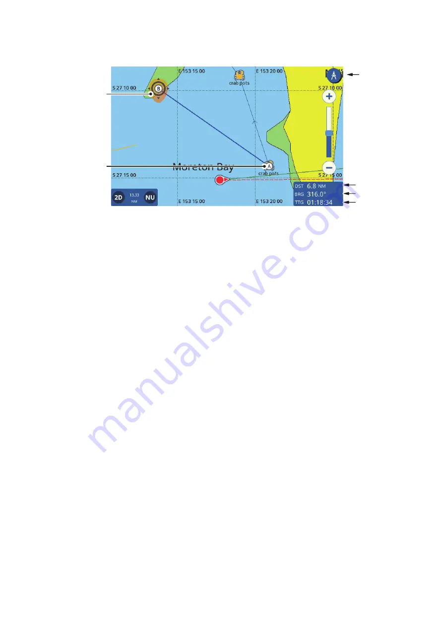
5. To move the end point “B”, drag the icon to the new location.
Note:
You can relocate the first point “A”. Long-tap the point to activate the editing
mode, then drag the point to the new location.
6. When measurements are completed, tap the [Ruler] icon at the top-right corner of
the screen to return to normal operations.
2.9
Chart Display Angle
You can view your charts in either "birds-eye-view" (2D), or at a user-defined angle
(PS or 3D).
Note:
If your chart card has 3D imagery, the "PS" indication is replaced with "3D".
To switch between the 2D chart and PS/3D chart
, drag the chart upwards with two
fingers. You can also press the 2D/3D icon at the bottom-left corner of the screen.
To change the viewing angle
in either PS or 3D, swipe the chart left or right with two
fingers.
2.10
C-MAP Chart Information
If your chart card is a C-MAP chart card, you can view detailed chart information.
To show the chart information, tap the location you want information for, then tap Chart
Info in the pop up window.
Ruler
button
Distance
Bearing
Start point “A”
End point “B”
Estimated
trip time


