

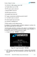
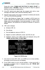
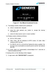


Section 2 System Overview
1
st
Ed Nov 2018
IDU-450 EFIS Software Version 8.0H (Rotorcraft)
2-11
VPL
Vertical Protection Level
V
PROC
Procedure Speed
V
R
Rotation speed
VR
Heading to Radial Termination (ARINC-424 Leg)
V
REF
Landing reference speed or threshold crossing speed
VS Vertical
Speed
VSI
Vertical Speed Indicator
VTF
Vectors to Final
V
TOS
Minimum speed for a positive rate of climb with one engine
inoperative
WAAS
Wide Area Augmentation System
WGS84
World Geodetic System 1984
WPT Waypoint
WX Weather
XFILL Crossfill
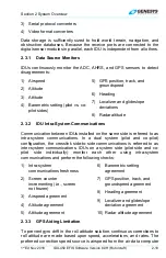
2.2 System
Overview
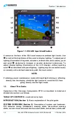
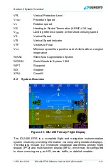
Figure 2-1: IDU-450 Primary Flight Display
The IDU-450 EFIS is a complete flight and navigation instrumentation
system intuitively providing information via computer-generated displays.
The displays include 3-D, enhanced situational awareness primary flight
display (PFD) and multi-function display (MFD), which may be configured
to show a moving map, an HSI, terrain, traffic, or datalink weather.