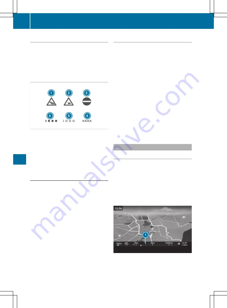
Displaying the traffic map
The multimedia system can show certain traffic
incidents on the map. The displays can be
shown in the map scales from 20 m to 20 km.
The display shows the entire affected route sec-
tion with the corresponding symbols, regardless
of how long the incident actually is. The traffic
symbols are placed on the side of the carriage-
way affected by the incident.
:
Traffic jam on the route
;
Slow-moving traffic on the route
=
Road blocked
?
Road blocked
A
Slow-moving traffic (yellow squares along
the affected route)
B
Traffic jam (red squares along the affected
route)
Displaying traffic incidents
Requirements
R
For Live Traffic Information: the vehicle must
be equipped with a communication module
with an activated, integrated SIM card.
R
The communication module automatically
establishes an Internet connection when the
vehicle is started. The traffic data are availa-
ble shortly after.
Multimedia system:
X
+
Navi
Navi
X
Select
Traffic
Traffic
.
If network coverage is not available for Live
Traffic Information or FM RDS-TMC, or there
are no traffic reports, you will see a message
to this effect.
Reading out traffic reports
Multimedia system:
X
+
Navi
Navi
*
Traffic
Traffic
X
Select
Messages on the route
Messages on the route
.
The multimedia system reads out the mes-
sages in sequential order.
If there are no reports for the route:
Mes‐
Mes‐
sages on the route
sages on the route
is inoperative.
X
To cancel the read-aloud function: select
Cancel read-aloud function
Cancel read-aloud function
.
The current traffic report is read out to the end
and then the function is deactivated.
i
The multimedia system interrupts the read-
aloud function automatically as it recalculates
the route following a new traffic report.
To read out messages automatically:
X
Select
Read traffic announcements
Read traffic announcements
automatically
automatically
.
The function is switched on
O
or off
ª
.
Map and compass
Setting the map scale
Requirements
R
The map is in full-screen mode, and the menu
is hidden.
The lower left-hand section of the map shows
the currently set map scale and compass nee-
dle.
Right-hand-drive vehicles: the currently set
map scale and compass needle are displayed
in the lower right-hand section of the map.
144
Navigation (COMAND Online)
Mu
ltim
ed
ia
sys
te
ms


