6. NAV DATA DISPLAY
6-2
6.1.2
Abbreviated nav data display
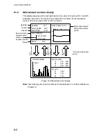
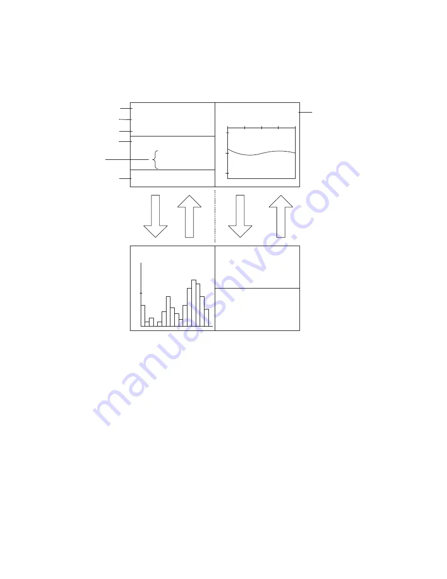
This display appears at the top right-hand corner when the history, ES 1 and ES
2 displays are active. The items shown depend on whether the fish estimate
mark or net shoot mark is ON or OFF as below.
Fish
estimate mark
ON
WATER TEMP 10.3
°
C*
8
12
10
0
10
20MIN
HEADING
321
°
*
SHIP COURSE 335
°
*
SHIP SPEED
12.5kt*
LAT/LON[DGPS]*
32
°
52.150N*
132
°
12.150E*
DEPTH
321m
Fish
estimate mark
OFF
Net shoot
ON
Net shoot
OFF
WATER CURRENT*
C1
1.2kt
342
°
C2
0.8kt
298
°
C3
0.4kt
256
°
NET DEPTH*
S1
134m
S2
178m
S3
213m
1
FISH HISTOGRAM
SCAN
Heading*
Course*
Speed*
Depth
Water temperature*,
Water temperature
graph*
* Requires appropriate
sensor
Nav data format,
navigator name*
Latitude and
longitude position*
Figure 6-2 Abbreviated nav display
Note:
Nav data may be turned on/off and format selected. For further details see
Chapter 8.
Summary of Contents for FSV-24
Page 1: ...COLOR SCANNING SONAR FSV 24 ...
Page 12: ...This page is intentionally left blank ...
Page 112: ...This page is intentionally left blank ...
Page 126: ...This page is intentionally left blank ...
Page 144: ...This page is intentionally left blank ...
Page 162: ...This page is intentionally left blank ...

