SV-MAP-270 Navigation Mapping Software
SkyView Classic Pilot’s User Guide –
Revision Z
7-80
In software version 12.2 or later, once SkyView has a GPS fix, it will load all the
active ADS-B weather and all active/upcoming TFRs from the last two hours before
the display was powered off. This gives the pilot access to weather and TFR
information that is still valid when SkyView is turned on and acquires time via GPS
lock.
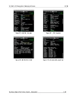
METARs (Aviation Routine Weather Reports)
Routine weather reports at airports that are updated at least hourly. SPECI (aviation special
weather report) information that augments METAR information during times of significant
weather deterioration or improvement is aggregated into SkyView’s weather reporting
capability.
TAFs (Terminal Area Forecasts)
TAFs are future weather forecasts, centered on many (but not all) airports and include the
predicted future weather conditions.
Winds Aloft Forecast
The most recent winds aloft forecast from the nearest station for your airport (or the closest
within 200mn that has a forecast) is displayed in SkyView’s A
irport WX Info window. The winds
and temperature aloft forecasts wind direction relative to true north, wind speed (knots), and
temperature (Celsius) for specific altitudes in feet above mean sea level.
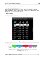
NEXRAD Radar Imagery
NEXRAD radar transmits short high-frequency beams of radio energy into the atmosphere from
the ground at various angles and receives reflections of that energy back at the original site.
The return signal is then amplified, processed, and colorized for easy interpretation. Based on
the time it takes to receive the reflected energy, the radar data product conveys the
approximate location and density of precipitation at a specific location. This is then depicted
graphically on the SkyView map page.
NEXRAD radar provides high resolution local regional imagery and lower resolution imagery
that covers the entire continental US (CONUS). The FAA’s ADS
-B system transmits both of these
periodically, limiting the high resolution regional weather imagery to your locale to preserve
available ADS-B data link bandwidth. SkyView presents all this data seamlessly.
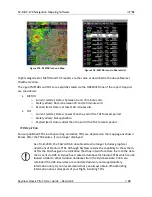
TFRs (Temporary Flight Restrictions)
SkyView can graphically depict FAA temporary flight restrictions (TFRs) that restrict GA aircraft
movement.
Weather options
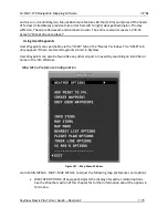
Go to MAIN MENU > MAP > MAP MENU> WEATHER OPTIONS to adjust the following weather
preferences and options. These only apply when the weather layer is turned on:

