CP590
Page 87
(reduces the information on the display to simulate items that would be shown on a RADAR
display. Please note this function is not actually showing RADAR information it is only showing
what typically would be shown by a separate dedicated RADAR display) and Tides modes.
Besides, the Custom mode is available as default and it is configurable by the user.
The table below shows the selections for each mode.
To change to one of the pre-programmed settings
1. Press
[MENU]
, move the ShuttlePoint knob to highlight
SETUP MENU
and press
[ENT]
.
2. Move the ShuttlePoint knob to highlight
CHART CONFIGURATIONS
and press
[ENT].
3. Move the ShuttlePoint knob to highlight
DISPLAY MODE
and press
[ENT].
4. Move the ShuttlePoint knob up or down to select the preset and press
[ENT]
.
5. Press
[CLR]
until the Chart Page is shown.
CHART
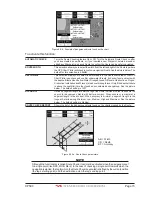
Figure 12.0.6 - Display Mode settings
The table below shows the selections for each mode:
Setting
Full
Medium
Low
Radar
Tides
Custom
(Default values)
Place Names
On
On
On
On
On
On
Name Tags
On
Off
Off
Off
Off
Off
Nav Aids & Light Sectors
On
No Sectors
No Sectors
No Sectors
Off
On
Attention Areas
On
On
Off
Off
Off
Off
Tides & Currents
On
Off
Off
Off
On
On
Seabed Type
On
Off
Off
Off
Off
On
Ports & Services
On
On
Off
On
Off
On
Tracks & Routes
On
Off
Off
Off
Off
On
Depth Range Min
0FT
0FT
0FT
0FT
0FT
0 Ft
Depth Range Max
32804FT
32804FT
32804FT
32804FT
32804FT
32804FT
Land Elevations
On
On
Off
Off
Off
Off
Land Elevation Values
On
Off
Off
Off
Off
On
Roads
On
Off
Off
Off
Off
On
Points Of Interest
On
Off
Off
Off
Off
On
Lat/Lon Grid
On
Off
Off
Off
Off
Off
Chart Boundaries
On
Auto
Off
Off
Off
Off
Value-Added Data
On
Off
Off
Off
On
On
Chart Lock
On
On
On
On
On
On
Mixing Levels
On
On
On
On
On
On
Underwater Ob. Limit
1000FT
32FT
32FT
32FT
32FT
1000FT
Rocks
Icon + Depth
Icon
Icon
Icon
Icon
Icon
Obstructions
Icon + Depth
Icon
Icon
Icon
Icon
Icon
Diffusers
Icon + Depth
Icon
Icon
Icon
Icon
Icon
Wrecks
Icon + Depth
Icon
Icon
Icon
Icon
Icon
12.0.7 Marine Settings
To control the display on the chart of the marine features.
Summary of Contents for CP590
Page 1: ......
Page 2: ...CP590 12 WAAS GPS Chart Plotter Owner s Manual GPS Chart Plotters ...
Page 5: ...Page 6 CP590 ...
Page 33: ...Page 34 CP590 ...
Page 43: ...Page 44 CP590 ...
Page 47: ...Page 48 CP590 ...
Page 57: ...Page 58 CP590 ...
Page 73: ...Page 74 CP590 ...
Page 77: ...Page 78 CP590 ...
Page 103: ...Page 104 CP590 ...
Page 117: ...Page 118 CP590 ...
Page 123: ...Page 124 CP590 ...
Page 127: ...Page 128 CP590 ...
Page 134: ......


