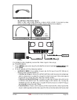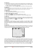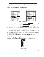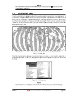
CP590
Page 23
3.0.1 The alphanumeric keys
The 10 alphanumeric keys are used for entering in alphanumeric data.
For alphanumeric input: pressing the key the first time enters the first letter, the second time
it enters the second letter, the third time it enters the third letter; the forth time it enters the
number. After a short time the entered character (letter or number) is confirmed and the
cursor is moved to the next location.
For numeric input: to enter a number in a Lat Lon: press the key of the number you wish to
enter, continue pressing the numbered keys until the Lat Lon is entered. The cursor is
moved to the next position. Pressing the ShuttlePoint knob up/down changes the value;
pressing the ShuttlePoint knob left/right moves the cursor to the previous/next location.
3.1
GETTING STARTED
The Getting Started section will take you through the frequently used operations and assist
you to customize the look of the GPS Chart Plotter.
3.1.0 Power On, Off and ShuttlePoint Knob operation
1. Press and hold
[PWR]
until the display shows the Start-Up page (see the following
picture). To turn Off, press and hold
[PWR]
until the display turns Off.
C 590
P
GPS Chart Plotter
Figure 3.1.0 - Start-Up page
2. When the power is first turned on, two pages the start-up page and the Caution pages are
briefly shown before the GPS Status page.
WARNING-LIMITATIONS ON USE
This product, including the C-MAP by Jeppesen charts, is intended to be used only
as an aid to navigation. It should facilitate use of official government charts, not
replace them. Only Official Government Charts and Notices to Mariners contain all
the current information needed for safe navigation. This product’s features cannot
be relied on as complete or accurate and may vary depending on location. It is the
captain’s responsibility to use official government charts, notices to mariners,
caution, sound judgment and proper navigational skills when operating their boat
using this product.
This product supports C-MAP by Jeppesen electronic charts. Their use is subject
to a separate Jeppesen Data License Agreement which can also be found at
www.jeppesen.com, where users may also register to receive regular product
safety information.
The built- in C-MAP by Jeppesen background charts of this product contain a
limited version of chart datasets only for general awareness.
By pressing ENTER, you confirm that you:
1. acknowledge the above warning and accept the limitations of this product and
the C-MAP by Jeppesen charts
2. have read the documentation for this product, including its notes, and the
Jeppesen Data License Agreement, and agree to be bound by the terms of the
Jeppesen Data License Agreement.
WARNING
This product contains a limited set of built-in C-MAP by
Jeppesen Charts.
Contact your dealer or Jeppesen for upgrade options.
Register with Jeppesen to receive
regular product safety information.
Press ENTER to proceed.
Figure 3.1.0a - Caution pages
NOTE
The Caution page on the left is shown only if the data C-CARD is over one year old.
Summary of Contents for CP590
Page 1: ......
Page 2: ...CP590 12 WAAS GPS Chart Plotter Owner s Manual GPS Chart Plotters ...
Page 5: ...Page 6 CP590 ...
Page 33: ...Page 34 CP590 ...
Page 43: ...Page 44 CP590 ...
Page 47: ...Page 48 CP590 ...
Page 57: ...Page 58 CP590 ...
Page 73: ...Page 74 CP590 ...
Page 77: ...Page 78 CP590 ...
Page 103: ...Page 104 CP590 ...
Page 117: ...Page 118 CP590 ...
Page 123: ...Page 124 CP590 ...
Page 127: ...Page 128 CP590 ...
Page 134: ......


