File Menu
P/N 7010-0781
3-15
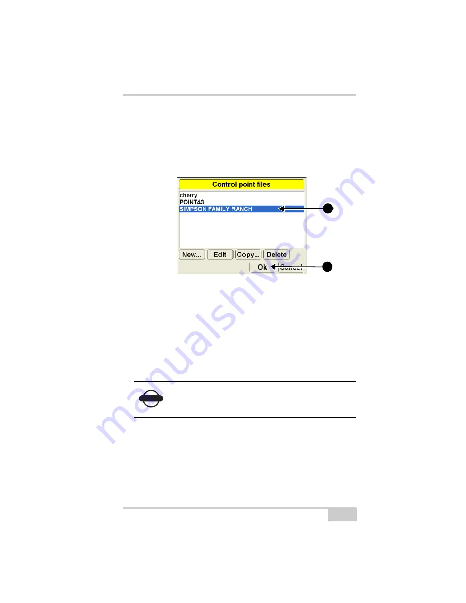
Selecting a Control Point File
1. When the 3DMC main screen displays, press
Topcon Logo
File
Control
.
2. Select the control point file for the jobsite and press
Ok
Figure 3-10. Applying a Control Point File
Creating a Control Point File
This section describes how to create the Control Point file using
existing control point information. The control point file created here
may be tentative, but provides a beginning from which to create a
more thorough file later.
When creating a control point file, neither the MC-2.5 Receiver Box
nor any sensors need to be attached or ready to use at this stage.
1. Turn on the control box.
2. When the 3DMC main screen displays, press
Topcon Logo
File
Control
.
3. Press
New
and enter a name for the control point file, press
Ok
,
on the keyboard, then press
OK
again
NOTICE
The accuracy of measurements for local site
coordinates of a control point directly affects the
quality of grade.
2a
2b
Summary of Contents for mmGPS 3D Paver
Page 1: ...MM 03 0AVER 2EFERENCE ANUAL...
Page 2: ......
Page 4: ...ECO 3067...
Page 34: ...Introduction mmGPS 3D Paver Reference Manual Notes 1 20...
Page 70: ...Setting up the Jobsite and Pocket 3D mmGPS 3D Paver Reference Manual Notes 2 36...
Page 208: ...Getting Started mmGPS 3D Paver Reference Manual Notes 5 32...
Page 252: ...Safety Information mmGPS 3D Paver Reference Manual Notes A 4...
Page 278: ...Glossary mmGPS 3D Paver Reference Manual Notes E 6...
Page 285: ...Index P N 7010 0781 Index definition 3 23 display options 3 25...
Page 286: ...mmGPS Paver 3D Reference Manual Notes Index...
Page 287: ......


