Navigation Tools
Radar/Chart Radar User Guide
6-26
65900010
Creating Geo Shapes
Geo shapes include a number of geometric objects such as arcs, circles,
lines, squares etc. that may be created.
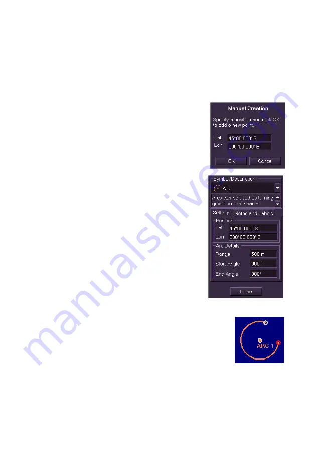
To create a geo shape and specify its parameters, do the following:
1. With
Geo Shapes
selected in the
Type
drop down list, select the
type of geo shape from the
Symbol/Description
drop down list.
2. Click
the
Manually Create
button, a
window prompts to specify a Lat/Lon
position for the object point. Either enter a
Lat/Lon position and click
OK
, or click the
OK
button and move the cursor into the
video circle. The screen cursor displays
MO EDIT
.
3. Click in the area of the screen where you
want the symbol positioned. If the shape is
closed (circle, square etc.) the object
appears on the video circle and the
Settings tab displays the shape’s Lat/Lon
position and default parameters. If the
shape is a line or polygon click at the first
point position, click in the video circle to
generate other line or polygon points.
4. To move the shape to another position left
click in the
Lat/Lon
position fields and edit
the co-ordinates using the screen keypad.
5. To change the shape details (rotation,
range, radius, segment type etc.) enter
data in the Settings tab.
6. If required, enter notes on the shape in the
Notes and Labels
tab.
If a name is entered in the
Display Label
field,
the name will be displayed underneath the origin
point of the shape.
7. To create new types of geo shapes repeat the
above process.
Summary of Contents for VisionMaster FT
Page 1: ...Radar Chart Radar User Guide Northrop Grumman Sperry Marine B V Part Number 65900010 ...
Page 2: ......
Page 4: ...Radar Chart Radar User Guide 65900010 ii Intentionally Blank ...
Page 24: ...Overview Radar Chart Radar User Guide 1 2 65900010 Single System ...
Page 42: ......
Page 114: ......
Page 212: ......
Page 304: ......
Page 370: ......
Page 450: ......
Page 462: ......
Page 502: ......
Page 516: ......
Page 532: ......
Page 533: ......


