C
HAPTER
16
162
Viper/Viper 4+ Installation & Operation Manual
STREET MAPS
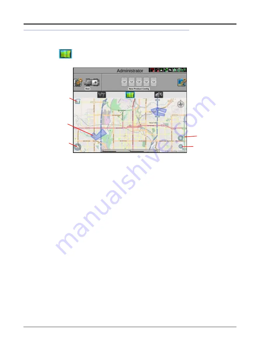
Street maps provides an aerial map view of an area along with available field boundaries in the area. To open
street maps, press
. A window will open showing the street view as well as field boundaries (shown in blue)
in the area.
DOWNLOADING MAPS
Before using street maps, a map must be downloaded from the Slingshot portal. The downloaded map will only
show the area selected by the user (in mile radius) and does not automatically update based on location. Since
street maps is offline, it will only show areas imported to the field computer.
FILTERING
If desired, press the filter in the top left corner of the map to filter visible field boundaries by grower, farm, field, or
job type. The field boundaries can also be filtered by most recent, name, etc.
ZOOM
Use the magnifying glass icons to zoom in or out on the map.
FOLLOW
Press the arrow icon in the lower left corner of the screen to either have the map follow the machine or be able to
pan and navigate around the map.
SELECTING A JOB
On the map, field boundaries will be visible as blue shapes on the screen. Pressing the desired job will highlight
the field boundary and open a window with a list of available jobs for that field boundary. Select the desired job to
start an existing job or press Start Job to start a new job.
Field Boundaries
Zoom In
Zoom Out
Follow Machine/
Pan
Filter
Summary of Contents for viper
Page 16: ...CHAPTER 2 8 Viper Viper 4 Installation Operation Manual ...
Page 48: ...CHAPTER 6 40 Viper Viper 4 Installation Operation Manual ...
Page 67: ...File Manager 59 FILE MANAGER ...
Page 68: ...CHAPTER 7 60 Viper Viper 4 Installation Operation Manual ...
Page 112: ...CHAPTER 9 104 Viper Viper 4 Installation Operation Manual ...
Page 174: ...CHAPTER 16 166 Viper Viper 4 Installation Operation Manual ...
Page 176: ...CHAPTER 17 168 Viper Viper 4 Installation Operation Manual ...


