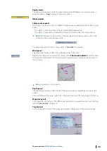
Tools panel
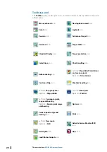
The Tools panel consists of the following tabs:
•
Legend
•
Editors
•
Radar
•
Weather
•
Active leg
Click on the tab name to switch between Tool panels.
Legend panel
The
Legend
panel displays information about the loaded ENC cells or raster chart under the
ship’s position and indicate some alerts.
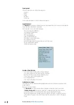
It also enables users to view the following:
•
The vector type (True/Relative)
•
The depth and height units
•
Quality of the data
•
The sounding datum
•
Safety depth information
•
The safety contour information
•
The magnetic variation
•
Edition number and cell name in the center of the screen
•
The last applied ENC update
•
Indications and warnings
Quality of the ENC data
•
A11: Chart of 5m accuracy with sea floor coverage
•
A21: Chart of 20m accuracy with sea floor coverage
•
B01: Chart of 50m accuracy from standard survey
•
C01: Low accuracy or incomplete chart
•
D01: Unreliable chart
•
U01: Chart with quality not assessed
Indications warnings
The warnings can be indicated with highlighted texts and icons that are displayed in the
Legend panel.
Warnings can be as follows:
•
An
Overscale
message indication that is displayed when the chart is overscaled.
•
A
Better chart exists
warning message that is displayed when the ship position is
covered by an ENC at a scale larger than the scale provided for the display.
•
When the displayed area includes waters for which no HO ENC is available, the area is
symbolized with green color which means that the mariner has to refer to the paper
charts.
24
The user interface
| ECDIS900 Operator Manual

