11-51
190-01004-03 Rev. P
GTN 625/635/650 Pilot’s Guide
Weather
11.4.2.1 Radar Data Animations
NOTE:
Animated NEXRAD functionality is available in software v6.00 and
later.
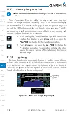
To depict trending weather movements over time, an animation
function stitches the last three to six received radar images
together in sequence, from oldest to newest, and replays them on
a continuous loop.
Play and stop controls are active when three or more NEXRAD
images are available for playback.
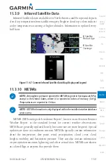
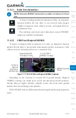
11.4.2.2 CONUS and Regional NEXRAD
To depict trending weather movements over time, an animation function
stitches the last three to six received radar images together in sequence, from
oldest to newest, and replays them on a continuous loop.
CONUS &
Regional
Selected on
NEXRAD Key
Out Of CONUS
NEXRAD Coverage
NEXRAD Weather
Shown
Regional NEXRAD
Boundary Shown
Figure 11-79 FIS-B CONUS and Regional NEXRAD Combined
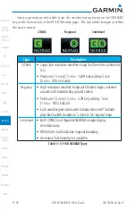
Depending on the locations of received FIS-B ground stations, Regional
NEXRAD coverage can extend as far as 250 nm around an aircraft’s position.
Aircraft flying at higher altitudes typically receive data from more ground
stations than aircraft flying at low altitudes.
FIS-B NEXRAD does not differentiate between liquid and frozen precipitation
types.
Содержание GTN 625
Страница 608: ...This page intentionally left blank ...
Страница 609: ......
Страница 610: ...190 01004 03 Rev P ...


