10-52
GTN 625/635/650 Pilot’s Guide
190-01004-03 Rev. P
Terrain
10.8.3 Displaying TAWS-A Data
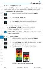
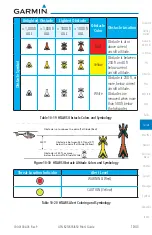
TAWS-A uses yellow (caution) and red (warning) to depict terrain and
obstacle (with a height greater than 200 feet above ground level, AGL) alerts
relative to aircraft altitude. Depictions of obstacles more than 200 feet below the
aircraft are removed. Colors are adjusted automatically as the aircraft altitude
changes. The colors and symbols in Figure 10-11 and Tables 10-7 and 11-12 are
used to represent terrain, obstacles, and threat locations.
Threat Location
Unlighted Obstacle
Projected Flight Path
1000 ft
100 ft Threshold
Terrain more than 1000 ft below the aircraft altitude (Black)
Terrain between 100 ft and 1000 ft below the
aircraft altitude (Yellow)
Terrain above or
within 100 ft
below the aircraft
altitude (Red)
Figure 10-34 Terrain Altitude/Color Correlation for TAWS-A
Alert Level
Annunciator Text
Threat Location
Indicator
Example Visual Annunciation
Warning
White text on red
background
Caution
Black text on yellow
background
Informational Black text on white
background
Not Applicable
Table 10-22 TAWS-A Alert Colors and Symbology
Tower
Windmill
Windmill in Group
Power Line
Table 10-23 Obstacle Icon Types
Grouped obstacles are shown with an asterisk (as shown in the Windmill in
Group example above). The color of the asterisks is tied to the relative altitude
of the highest obstacle in the group, not other obstacles within that group.
Obstacles are grouped when they would otherwise overlap.
Содержание GTN 625
Страница 608: ...This page intentionally left blank ...
Страница 609: ......
Страница 610: ...190 01004 03 Rev P ...


