18-10
GTN 625/635/650 Pilot’s Guide
190-01004-03 Rev. P
Appendix
•
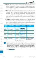
Terrain
- The terrain database contains terrain mapping data. The terrain
database is required for the TAWS and HTAWS functions. Systems using
HTAWS require a 2.5 arc second database while non-HTAWS applications
can use a 9 arc-second database.
•
FliteCharts
- FliteCharts resemble the paper version of AeroNav Services
(Formerly named National Aeronautical Charting Office) terminal
procedures charts. The charts are displayed with high-resolution and in
color for applicable charts. The GTN depiction shows the aircraft position
on the moving map in the plan view of the approach charts and on airport
diagrams.
•
Chartview
- ChartView resembles the paper version of Jeppesen terminal
procedure charts. The charts are displayed in full color with high-resolution.
The GTN depiction shows the aircraft position on the moving map in the
plan view of approach charts and on airport diagrams.
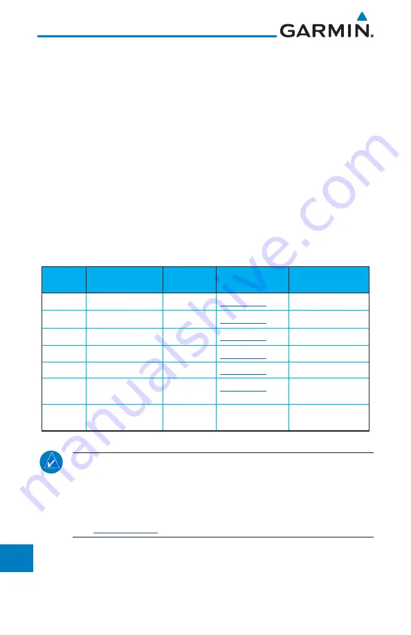
Database
Name
Where Stored
Update Cycle
Provider
Notes
Navigation
Internal memory
28 days
Basemap
Internal memory
As required
SafeTaxi
Internal memory
56 days
Obstacle
Internal memory
56 days
Terrain
Database card
As required
FliteCharts
Database card
28 days
Disables 180 days after
expiration date.
Chartview
Database card
14 days
Contact Jeppesen
Disables 70 days after
expiration date.
Table 18-1 Database List
NOTE:
Garmin requests that the flight crew report any observed
discrepancies related to database information. These discrepancies could
come in the form of an incorrect procedure, incorrectly identified terrain,
obstacles and fixes, or any other displayed item used for navigation or
communication in the air or on the ground. To report a database error,
visit
Содержание GTN 625
Страница 608: ...This page intentionally left blank ...
Страница 609: ......
Страница 610: ...190 01004 03 Rev P ...


