Version 15.0
AF-5000 Series Pilot Guide
80
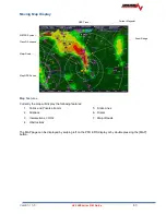
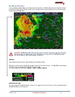
Moving Map Display
GPS Track
METAR Symbol
Class D Airspace
Major Road
Map GPS Source
Map Features
Currently the map will display the following features:
1. Public and Private airports
2. Airspace
3.
Intersections, VOR’s
4. Obstructions
5. State Lines
6. Rivers
7. Major Roads
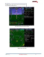
The MAP page can be displayed by swiping left on the PFD EFIS display or by double pressing the [MAP]
button.
Zoom Range
Current Waypoint
Содержание AF-5400
Страница 36: ...Version 15 0 AF 5000 Series Pilot Guide 36 Analog Instrument Page EFIS ANALOG AF 5400 SET EFIS ANALOG...
Страница 58: ...Version 15 0 AF 5000 Series Pilot Guide 58 Flowchart Pitch Axis IAS Hold Procedure...
Страница 60: ...Version 15 0 AF 5000 Series Pilot Guide 60 Altitude Capture Procedure Part 1 of 2 Part 2 of 2...
Страница 62: ...Version 15 0 AF 5000 Series Pilot Guide 62 Autopilot Settings Defaults...
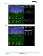
Страница 73: ...Version 15 0 AF 5000 Series Pilot Guide 73 FREQ Tab RCNT Tab...
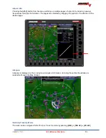
Страница 88: ...Version 15 0 AF 5000 Series Pilot Guide 88 VFR Sectional Full Screen Mode Split Screen Mode...
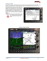
Страница 89: ...Version 15 0 AF 5000 Series Pilot Guide 89 IFR Low Altitude Chart Airport Diagrams...


