Version 15.0
AF-5000 Series Pilot Guide
63
EFIS Flight Director
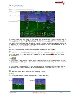
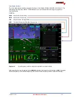
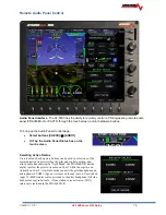
The flight director is turned on and off using the FD button.
The wings that come up when the flight director is enabled will show the
aircraft positioning to follow. All the pilot has to do is keep the triangle in the
wings as they move to follow the commanded source. A change in heading or
track will command the wings to bank in the direction to acquire the new
heading or track. A command to climb or descend to a new altitude will cause
the wings to move up or down.
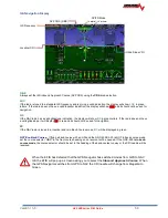
The Flight Director Wings are color coded based on the command source.
The wing bar color will show the horizontal steering source and the triangle tip
color shows the vertical steering source.
Gray
No Source
Red
Source Flagged
Yellow
Heading / Altitude Bug
Cyan
GPS Track Bug
Magenta
GPS
Green
VOR / ILS
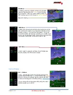
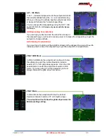
Teal
LEVEL
Autopilot and Flight Director controlled by Heading and Altitude Bugs
Horizontal = GPS and Vertical = Altitude Bug
Autopilot and Flight Director controlled by CDI source = GPS
Autopilot and Flight Director controlled by CDI source = NAV (VOR or ILS)
Vertical = Minimums Bug
The Autopilot and Flight Director will level the aircraft at the Minimums Bug and not fly below it. 200 feet
above the Minimums Bug the FD tips will turn Orange and a MINIMUMS warning on the EFIS screen will
display.
Содержание AF-5400
Страница 36: ...Version 15 0 AF 5000 Series Pilot Guide 36 Analog Instrument Page EFIS ANALOG AF 5400 SET EFIS ANALOG...
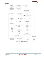
Страница 58: ...Version 15 0 AF 5000 Series Pilot Guide 58 Flowchart Pitch Axis IAS Hold Procedure...
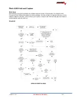
Страница 60: ...Version 15 0 AF 5000 Series Pilot Guide 60 Altitude Capture Procedure Part 1 of 2 Part 2 of 2...
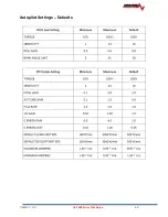
Страница 62: ...Version 15 0 AF 5000 Series Pilot Guide 62 Autopilot Settings Defaults...
Страница 73: ...Version 15 0 AF 5000 Series Pilot Guide 73 FREQ Tab RCNT Tab...
Страница 88: ...Version 15 0 AF 5000 Series Pilot Guide 88 VFR Sectional Full Screen Mode Split Screen Mode...
Страница 89: ...Version 15 0 AF 5000 Series Pilot Guide 89 IFR Low Altitude Chart Airport Diagrams...

