iSXblue/SXBlue II GNSS Series Technical Reference Manual
39
The BER number indicates the number of unsuccessfully decoded symbols in a moving window of 2048
symbols. Due to the use of forward error correction algorithms, one symbol is composed of two bits. The
BER value for both SBAS receiver channels is available in the RD1 NMEA data message described in
detail in chapter 4.
A lower BER indicates that data is being successfully decoded with fewer errors, providing more
consistent throughput. The bit error rate has a default, no-lock value of 500 or more. As the receiver
begins to successfully acquire the signal, it will result in a lower bit error rate. For best operation, this
value should be less than 150 and ideally less than 20.
Space-Based Augmentation Systems broadcast an ionospheric map on a periodic basis that may take up to
5 minutes to receive upon startup. The iSXBlue/SXBlue II GNSS uses the GPS broadcast ionospheric
model until it has downloaded the SBAS map, which can result in lower performance as compared to
when the map has been downloaded. This will be the case for any GPS product supporting SBAS
services. The G-Dif feature is also dependent on the SBAS ionospheric map and the GLONASS satellites
will not be included in the solution before the SBAS map is downloaded.
Caution – When the map has been downloaded, you may observe a position jump due to the
potential difference between the GPS ionospheric model and the ionospheric SBAS map. To
minimize the impact of this issue on your use of the iSXBlue/SXBlue II GNSS, you may wish to wait
up to five minutes before using the receiver or issue the $JQUERY,GUIDE<CR><LF> message to
‘ask’ the iSXBlue/SXBlue II GNSS if it feels performance will be sufficient for operation. G-Dif will
also coincide with the positive response of the above command.
To improve upon the ionospheric map provided by SBAS, the receiver extrapolates information from the
broadcast ionospheric coverage map, extending its effective coverage. This allows the receiver to be used
successfully in regions that competitive products may not. Please note that the process of estimating
ionospheric corrections beyond the WAAS broadcast map would not be as good as having an extended
SBAS map in the first place. This difference may lead to minor accuracy degradation.
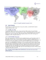
Figure 2-1 shows sample grids for WAAS, EGNOS, GAGAN and MSAS systems. The inner areas are
actual broadcast grids by the satellites and the outer areas are the extrapolation the iSXBlue/SXBlue II
GNSS achieves. Note that the SBAS grid maps shown are typical as their extents constantly undergo
slight changes due to ionospheric activities and time of the day. But overall, the coverage map fairly
consistent from one day to another.

