iSXblue/SXBlue II GNSS Series Technical Reference Manual
118
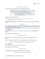
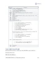
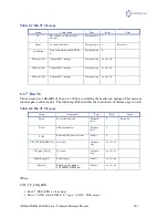
Table 5-12 GNS Data Message Defined
Field
Description
hhmmss.ss
UTC time in hours, minutes, seconds of the GNSS position
llll.ll
Latitude
s
s = N or s = S, for North or South latitude
yyyy.yy
Longitude
t
s =E or s = W, for East or West longitude
n
Mode Indicator
Number of satellites used in position computation
pp.p
HDOP =0.0 to 9.9
saaaa.aa
Antenna altitude
M
Altitude units, M = meters
±
xxxx.xx
Geoidal separation (needs geoidal height option)
M
Geoidal separation units, M = meters
sss
Age of differential corrections in seconds
aaa
Reference station identification
*cc
Checksum
<CR><LF>
Carriage return and line feed
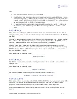
5.9.2
GGA Data Message
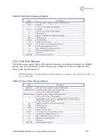
The GGA message contains detailed GPS position information, and is the most frequently used NMEA
data message. In the table below, the GGA data message is broken down into its components. This
message takes the following form:
$GPGGA,hhmmss.ss,ddmm.mmmm,s,dddmm.mmmm,s,n,qq,pp.p,saaaaa.aa,M,
±
xxxx.xx,M,sss,a
aaa*cc<CR><LF>
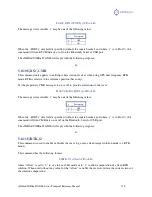
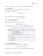
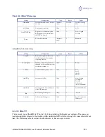
Table 5-13 GGA Data Message Defined
Field
Description
hhmmss.ss
UTC time in hours, minutes, seconds of the GPS position
ddmm.mmmmm
Latitude in degrees, minutes, and decimal minutes
s
s = N or s = S, for North or South latitude
dddmm.mmmmm
Longitude in degrees, minutes, and decimal minutes
s
s =E or s = W, for East or West longitude
n
Quality indicator: 0 = no position, 1 = undifferentially corrected position, 2 =
differentially corrected position, 4 = fixed RTK solution, 5 = float solution, 9=
position computed using almanac
Number of satellites used in position computation
pp.p
HDOP =0.0 to 9.9
saaaa.aa
Antenna altitude
M
Altitude units, M = meters
±
xxxx.xx
Geoidal separation (needs geoidal height option)
M
Geoidal separation units, M = meters
sss
Age of differential corrections in seconds
aaa
Reference station identification
*cc
Checksum
<CR><LF>
Carriage return and line feed

