There are two different types of roads in the map
database. Fully attributed roads allow for a destination
to be set and turn-by-turn guidance to be provided to the
exact location of the address. In Process Data (IPD)
roads contain only street name and address information.
Other information such as turn restrictions and direction
of travel is not included for these IPD roads. Therefore,
turn-by-turn guidance cannot be provided to the
exact address. When trips are planned that include an
IPD destination, turn-by-turn guidance will be provided
on the fully attributed roads closest to the destination.
When nearing the end of the highlighted route, the
system will state “Enroute to your destination, some
roads contain incomplete data. Turn guidance will not be
provided in this area.” As you reach the end of the
highlighted route, the system will state “Turn guidance
will not be provided in this area. Please use the direction
arrow and distance indicator to proceed to your
destination.” You should refer to the direction and
distance information in the lower center area of the
screen to navigate to the destination or refer to
the information in the waypoint box for a waypoint. A
purple highlighted route will appear on the IPD
roads. This is only a suggested route due to the lack of
traffic restriction information on the IPD roads. Special
attention should be paid to the existing traffic conditions,
such as one-way streets and prohibited turns on IPD
and fully attributed roads. Always follow the existing
traffic restrictions in both IPD and fully attributed roads.
Once your vehicle is near your destination, the system
will state “You’ve arrived at your destination, ending
route guidance.”
Traveling Across Regions
If you plan a trip that exceeds 5,000 miles (8 046 km) in
straight line distance from the vehicle’s current
position, you will receive a message stating
Destination/waypoint exceeds maximum distance. To
avoid this, plan your trip in smaller segments. Select a
closer destination that you would like to travel through
on your way to your final destination.
Colors on the Screen
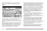
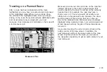
When a route has been planned, it will be highlighted
on the screen in blue. If you have set a waypoint(s) for
your route, the colors on the screen will change. The
highlighted route to the next waypoint or destination will
be blue. All highlighted routes to further waypoints or
destinations will be maroon.
Different colors are also used to distinguish between
interstate freeways, state highways, county roads, major
streets and secondary streets. Highways will be
shown as a thicker line than a general street will.
2-34
Summary of Contents for 2006 CTS
Page 4: ...Overview Navigation System Overview 1 2...
Page 18: ...NOTES 1 16...
Page 56: ...NOTES 2 38...
Page 57: ...Navigation Audio System 3 2 CD DVD Player 3 26 Section 3 Navigation Audio System 3 1...
Page 78: ...Road work Construction Alert Road condition Road visibility Other 3 22...
Page 85: ...Voice Recognition 4 2 Voice Recognition CTS 4 2 Section 4 Voice Recognition 4 1...
Page 132: ...NOTES 5 40...

