


190-00726-00 Rev. J
Garmin G900X Pilot’s Guide
355
HAZARD AVOIDANCE
SY
STEM
O
VER
VIEW
FLIGHT
INSTRUMENTS
EIS
AUDIO P
ANEL
& CNS
FLIGHT
MANA
GEMENT
HAZARD
AV
OID
ANCE
AFCS
ADDITIONAL
FEA
TURES
APPENDICES
INDEX
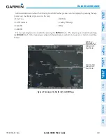
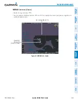
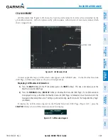
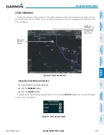
FREEZING LEVELS
Freezing Level data shows the color-coded contour lines for the altitude and location at which the first
isotherm is found (Figure 6-30). If the system has not received data for a given altitude, or the information
is out-of-date, the system does not display data for that altitude.
Figure 6-30 Freezing Level Data
Displaying Freezing Level information:
1)
Select the Weather Data Link (XM) Page.
2)
Press the
MORE WX
Softkey.
3)
Press the
FRZ LVL
Softkey.
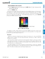
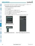
To display the Freezing Level legend (Figure 6-31), press the
LEGEND
Softkey when Freezing Level data
is selected to be displayed.
Figure 6-31 Freezing Level Legend