Chapter 5
GTD-110/150
Basic Operation
5-10
0093151542-06
Fix zooming:
Press the FIX SCL key to select the map scale. Each press of the key toggles Scale 1, Scale 2 and
Scale 3. The following table shows default map scales in nm and km unit systems.
Table 5.1 Default map scale
Map scale 1
Map scale 2
Map scale 3
Map scale in nm
700 nm
60 nm
3 nm
Map scale in km
1300 km
120 km
6 km
To change map scale settings, select “SYSTEM” and then “SETTING”. For detail, refer to Para 6.6
“System Settings”.
5.5.4 Displaying a ship’s track
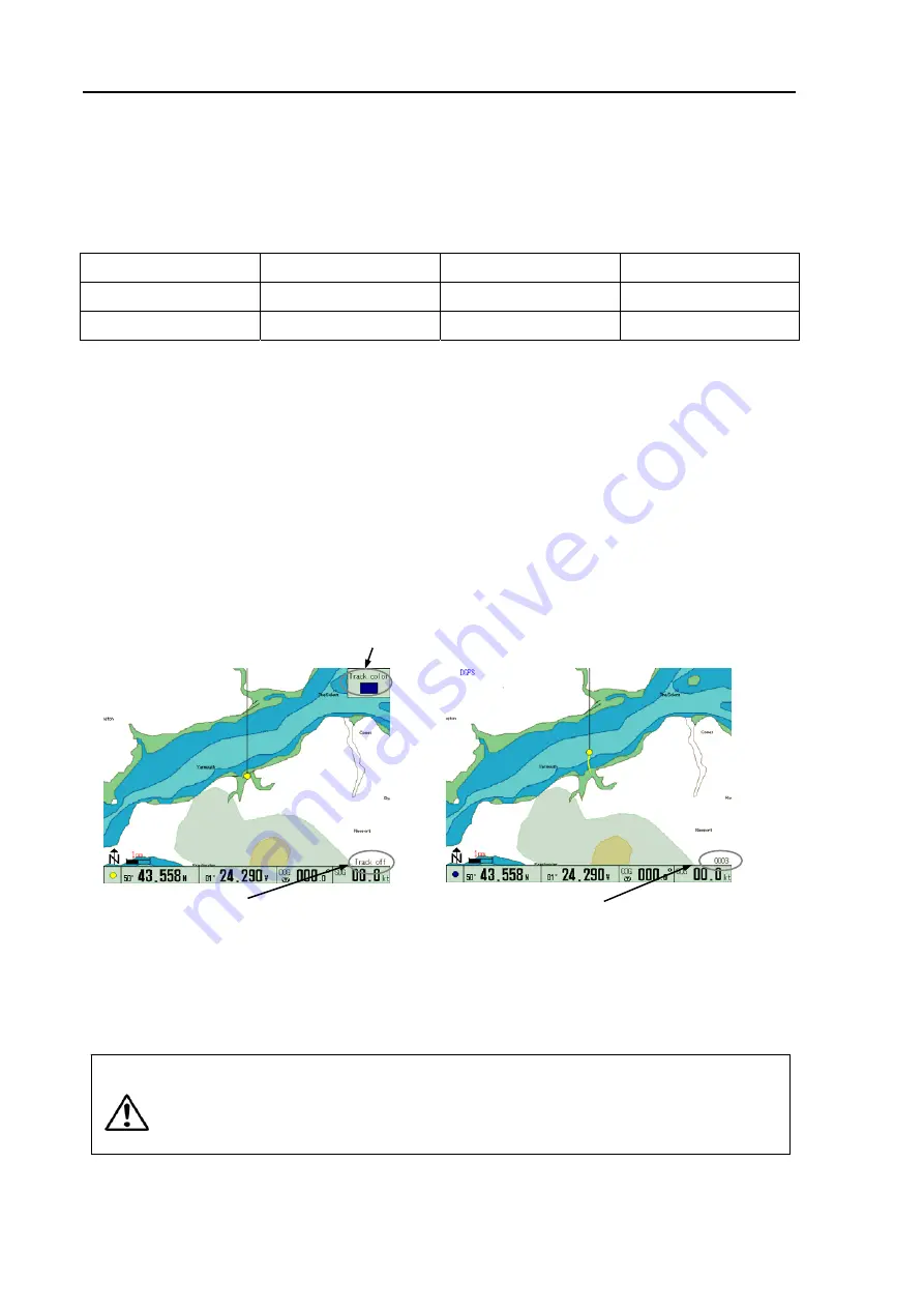
(1) Select a ship’s track color using the COLOR TRACK selection switch. Available colors are shown in
code on the control panel as follows:
G: Gray, R: Red, Y: Yellow, C: Cobalt-Blue, B: Blue, P: Pink, W: White
(2) Press the TRACK ON/OFF key to store the ship’s track. The number of ship’s track plots is shown
in the lower right corner of the screen.
NOTE: Frequent pressing of the ROUTE key toggles the ship’s track line display between ON and OFF.
For setting plotting intervals, select “SYSTEM” and then “SETTING”. For detail, refer to Para 6.6
“System Settings”.
The color of the ship’s track can be changed even if the ship’s track plotting is in progress. When no
track line function is required, press the TRACK ON/OFF key to turn the track line off.
(3) Press the TRACK ON/OFF key to turn off the ship’s track.
CAUTION
Maximum plot number of ship’s track is 7,000 points.
If the plot number exceeds this limit,
the first plot will be over-written. Record important data separately, referring to Para 6.3.3
“Storing the ship’s track line”.
Figure 5.7 Displaying the ship’s track line
TRACK OFF is shown here when track line is off
Number of map plots is shown here
The selected color display
NO TRACK
TRACK ON


