INTRODUCTION
–––––––––––––––––––––––––––––––––––––––––––––––––––––––––––––––––––––––––––––
11
V
Viis
su
ua
all d
diis
sp
plla
ay
y o
off tth
he
e m
ma
ap
p
You can use the visual display of maps to
e
en
ntte
err tth
he
e d
de
es
sttiin
na
attiio
on
n and during the
g
gu
uiid
de
e tto
o d
de
es
sttiin
na
attiio
on
n.
The selection of a destination on the map
is done on a screen with a rectangular
selector and menu fields.
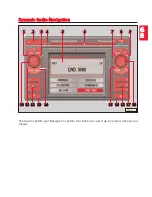
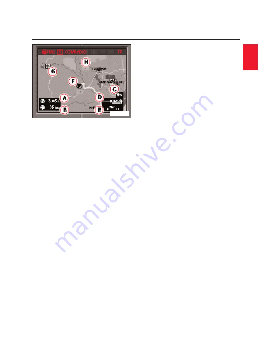
The m
ma
ap
p shows either duration of travel
or time of arrival A
A, distance to destina-
tion B
B, direction north C
C, status of the Jam
function D
D, actual scale of map E
E, vehicle
position F
F, symbols G
G and map contents
H
H.
The symbols for service stations, rest
areas on motorways, airports, SEAT
Service Centres and city centres are
entered automatically. Furthermore, you
can select other symbols, car parks, ser-
vice stations, railway stations.
You can visualize the map menu from the
map mode while being guided to destina-
tion by pressing selector knob/ key 1
18
8.
The map menu automatically provides
automatic orientation either in travel,
North or destination direction. According
to the map type you can select if, for
example, the current vehicle position
should be displayed together with the
destination. Travel mode allows you to
look at neighbouring map sections. With
the segment fields you can modify the
scale of the map. In the menu field "sym-
bols" you can switch from map display to
symbol display.
DYNAMIC RADIO-NAVIGATION
V
Viis
su
ua
all d
diis
sp
plla
ay
y o
off tth
he
e m
ma
ap
p a
an
nd
d s
sy
ym
mb
bo
olls
s
G
G
B
B
ķ
RNH-082


