93
Section 4
GPS Navigation
GPS Settings
General Tab
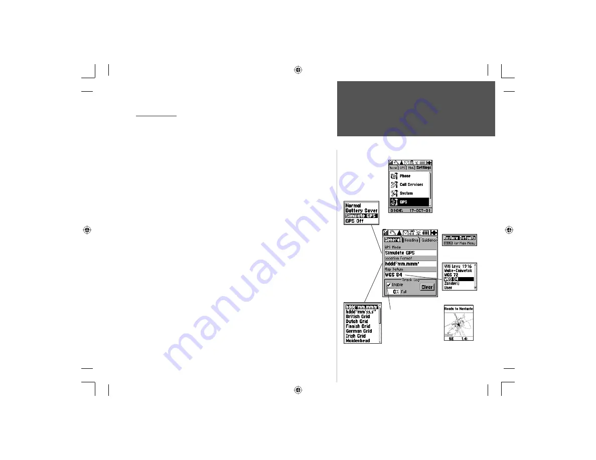
GPS Mode
Options Menu
Map Datum
Options List
Location Format
Options List
GPS Settings
These features are best used by individuals with a working knowledge of
map grids and datums. To learn more about these subjects, visit the National
Imagery and Mapping Agency at http://www.nima.mil or inquire at your library.
General Settings Tab
GPS Mode -
Allows you select Normal GPS operation for navigation
and position reporting, Battery Saver which slows the satellite updating
process to save power, Simulate GPS to save power and yet use GPS
features to plan routes, etc. and GPS Off for maximum power savings.
Location Format -
Allows you to choose from different grid formats.
The default location format ‘hddd
o
mm.mmm’ displays the latitude and
longitude in degrees and minutes and is the one most commonly used.
Selecting a location format will cause the map datum to match that format.
Map Datum -
Offers a selection of nearly all map datums in common
use. Every map is based on a map datum (a reference model of the
earth’s shape) and is usually listed in the title block of the map. If you
are comparing GPS coordinates to a paper map, chart, or other refer-
ence, the map datum in this field must match the horizontal map datum
used to generate the map or other reference. The default datum is WGS
84 (World Geodetic Survey 1984) and should only be changed when
using maps or charts specifying a different datum. If a map does not
specify a datum, use the list to find datums applicable to the region of
the map, select the one that provides the best positioning at a known
point. You may also choose the ‘User’ datum for custom designed grids.
Enable/Disable and Clear Track Log -
As you move about the unit
creates an automatic track log of your movements which can be viewed for
later reference when saved to MapSource. The ‘CLEAR’ button, allows you
to record a new track logs when the current log is full.
Settings Tab - GPS
General Page
Options Menu
Highlight the ‘Enable Track
log’ box and press ENTER
to record a track of your
movements. Highlight the
on-screen ‘CLEAR’ button
and press ENTER to clear
the track log from your unit.
Recorded tracks can be
saved to MapSource..
Track on
Map Page
NOTE: Whenever
GPS is fi rst turned
On, a “Warning“
message will
display.
Press ENTER to
acknowledge.
NvTlkGSMManual copy.indd 93
12/2/2002, 8:43:17 AM


