


GNS 530(A) Pilot’s Guide and Reference
190-00181-00 Rev. G
SECTION 16 – MESSAGES,
ABBREVIATIONS, & NAV TERMS
16-13
ETA (estimated time of arrival)
- The
estimated time at which the aircraft will reach the
destination waypoint, based upon current speed
and track.
ETE (estimated time enroute)
- The time it
will take to reach the destination waypoint, from
present position, based upon current ground
speed.
FF (fuel flow)
ÊÊ/ iÊvÕiÊyÜÊÀ>Ìi]ÊiÝ«ÀiÃÃi`ÊÊ
vÕiÊÕÌÃÊ«iÀÊÌiÊi°}°]Ê}>ÃÊ«iÀÊ ÕÀ®°
FOB (fuel on board)
- The total amount of
usable fuel on board the aircraft.
GS (ground speed)
- The velocity the aircraft is
travelling relative to a ground position.
HDG (heading)
- The direction an aircraft is
pointed, based upon indications from a magnetic
compass or a properly set directional gyro.
IND (indicated)
- Information provided by
properly calibrated and set instrumentation in the
>ÀVÀ>vÌÊ«>iÊi°}°]ʼ`V>Ìi`Ê>ÌÌÕ`i½®°
LFOB (left-over fuel onboard)
- The amount of
fuel remaining on board after the completion of a
iÊÀÊÀiÊi}ÃÊvÊ>Êy} ÌÊ«>ÊÀÊ>Ê`ÀiVÌÌ®°
LRES (left-over fuel reserve)
- The amount of
fuel remaining on board after the completion of a
iÊÀÊÀiÊi}ÃÊvÊ>Êy}
ÌÊ«>ÊÀÊ>Ê`ÀiVÌÌ®]Ê
iÝ«ÀiÃÃi`ÊÊÌiÊ>`ÊL>Ãi`ÊÕ«Ê>ÊÜÊvÕiÊ
VÃÕ«ÌÊyÜ®ÊÀ>Ìi°
MSA (minimum safe altitude)
ÊÊ1ÃiÃÊÀ`Ê
ÕÊ"vvÀÕÌiÊÌÌÕ`iÃÊÀ`Ê",îÊÌÊ
determine a safe altitude within ten miles of the
«ÀiÃiÌÊ«ÃÌ°ÊÊÀ`Ê",ÃÊ>ÀiÊiÊ`i}ÀiiÊ
>ÌÌÕ`iÊLÞÊiÊ`i}ÀiiÊ}ÌÕ`iÊÊÃâiÊ>`ÊVi>ÀÊ
all reference points within the grid by 1000 feet in
areas where the highest reference point is 5000
viiÌÊ-ÊÀÊÜiÀ°ÊÊvÊÌ
iÊ
}
iÃÌÊÀiviÀiViÊ«ÌÊ
ÃÊ>LÛiÊxäääÊviiÌ]ÊÌ
iÊÀ`Ê",ÊÜÊVi>ÀÊÌ
iÊ
}
iÃÌÊÀiviÀiViÊ«ÌÊLÞÊÓäääÊviiÌ°
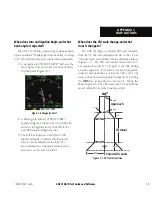
TKE (track angle error)
- The angle difference
between the desired track and the current track.
Ê>ÀÀÜÊ`V>ÌiÃÊÌ
iÊ«À«iÀÊ`ÀiVÌÊÌÊÌÕÀÊÌÊ
Ài`ÕViÊ/ÊÌÊâiÀ°
TRK (track)
- The direction of movement relative
ÌÊ>Ê}ÀÕ`Ê«ÃÌ°ÊÊÃÊÀiviÀÀi`ÊÌÊ>Ãʼ
ground
track’.
VSR (vertical speed required)
- The vertical
speed necessary to descend/climb from current
position and altitude to a defined target position
and altitude, based upon the current ground
speed.
XTK (crosstrack error)
- The distance the
aircraft is off a desired course in either direction,
left or right.
Summary of Contents for GNS 530
Page 1: ...GNS 530 A Pilot s Guide and Reference...
Page 2: ......
Page 10: ...GNS 530 A Pilot s Guide and Reference 190 00181 00 Rev G viii WARRANTY Blank Page...
Page 36: ...GNS 530 A Pilot s Guide and Reference 190 00181 00 Rev G 2 6 SECTION 2 COM Blank Page...
Page 116: ...GNS 530 A Pilot s Guide and Reference 190 00181 00 Rev G SECTION 6 PROCEDURES 6 34 Blank Page...
Page 142: ...GNS 530 A Pilot s Guide and Reference 190 00181 00 Rev G 7 26 SECTION 7 WPT PAGES Blank Page...
Page 190: ...GNS 530 A Pilot s Guide and Reference 190 00181 00 Rev G 10 30 SECTION 10 AUX PAGES Blank Page...
Page 280: ...GNS 530 A Pilot s Guide and Reference 190 00181 00 Rev G I 6 INDEX Blank Page...
Page 281: ......