


GPS Chart Plotters
Page 61
R
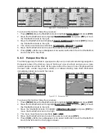
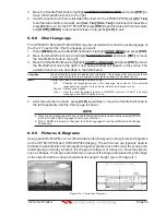
When the picture is shown, it is possible to fit it to screen by pressing
[ENT]
, to change the
contrast by pressing
[ZOOM IN]
or
[ZOOM OUT]
and to display the next picture associated,
if any, by moving the ShuttlePoint knob left or right.
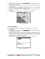
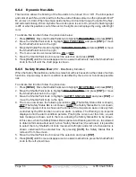
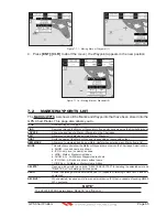
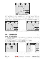
6.0.10 Enhanced Port Info
Optional C-MAP B
Y
J
EPPESEN
MAX C-Cards include additional Port Services that were not
present before.
Additional attributes of Port Areas and Port Marinas have been included as Location,
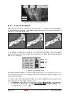
Country, Region, State, Harbour master telephone number etc., see the following figure.
POR
T
icon
1
1
WAAS 3D
Figure 6.0.10 - Example of enhanced Port Info
Содержание CP180
Страница 1: ...CP180 CP180i CP300 CP300i Owner s Manual Color GPS Chart Plotters R ...
Страница 4: ...Page 6 GPS Chart Plotters R ...
Страница 12: ...Page 14 GPS Chart Plotters R ...
Страница 38: ...Page 40 GPS Chart Plotters R ...
Страница 48: ...Page 50 GPS Chart Plotters R ...
Страница 60: ...Page 62 GPS Chart Plotters R ...
Страница 68: ...Page 70 GPS Chart Plotters R ...
Страница 76: ...Page 78 GPS Chart Plotters R ...
Страница 80: ...Page 82 GPS Chart Plotters R ...
Страница 108: ...Page 110 GPS Chart Plotters R ...
Страница 118: ...Page 120 GPS Chart Plotters R ...
Страница 120: ...Page 122 GPS Chart Plotters R ...
Страница 126: ...Page 128 GPS Chart Plotters R ...
Страница 130: ...Page 132 GPS Chart Plotters R ...


