


GPS Chart Plotters
Page 57
R
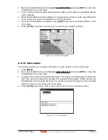
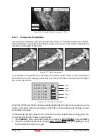
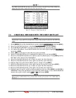
WAAS 3D
1
2
3
4
5
6
4
2
1
6
3
5
N
ormal:
U. Zoom:
O
. Zoom:
C
hart Lock:
w
hen the chart is disp
l
ayed at norma
l
sca
l
e
.
red
w
hen the chart is under
-
zoomed out
more than t
w
ice norma
l
sca
l
e, gray other
w
ise
.
red
w
hen the chart is o
v
er
-
zoomed in
more than t
w
ice norma
l
sca
l
e, gray other
w
ise
.
red
w
hen the chart is zoomed in
more than t
w
ice norma
l
sca
l
e, gray other
w
ise
.
Red
w
hen a more detai
l
ed chart is a
v
ai
l
ab
l
e under
the cursor position
.
Red
w
hen at
l
east one of the fo
ll
o
w
ing ob
j
ects or
l
ayers is turned off (by the user) Depths
/
soundings
;
Wrecks
/
obstructions
; T
racks
/
routes
;
Attention Areas
;
Na
v-
Aids
.
Disp
l
ays red
w
hen c
l
earing o
v
er
l
apping ob
j
ects
.
Red
w
hen
"
Guardian
T
echno
l
ogy
"
detects one of the fo
ll
o
w
ing ob
j
ects
:
Land,
I
ntertida
l
, Depth
Area, Rocks, Obstructions, Shore
l
ine Constructions,
F
ishing
F
aci
l
ity, Wrecks, Dragged area,
Diffusion area, Mooring faci
l
ities, Pingos and Production insta
ll
ations
.
Red
w
hen
"
Guardian
T
echno
l
ogy
"
detects cautionary or restricted area
.
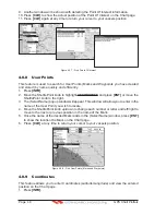
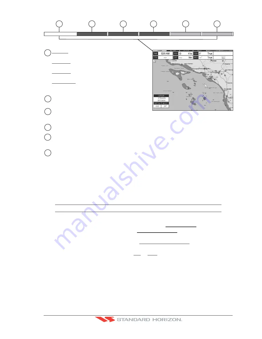
Safety Status Bar
O
.Z
OO
M
D
AN
GE
RS
CA
U
T
I
ONS
BE
ST
M
AP
D
ATA O
FF
DE
C
LU
T
.
Figure 6.0.5 - Safety Status Bar
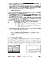
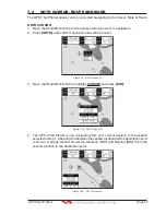
6.0.6 Satellite Imagery
This function allows to overlay the Satellite image for background map. When it is set On,
the Palette is set to Normal to display the proper colors.
NOTE
The satellite image is only shown on 100NM, 50NM and 20NM scales.
To activate this function follow the procedure below:
1. Press
[MENU]
. Move the ShuttlePoint knob to highlight
SETUP MENU
and press
[ENT]
.
2. Move the ShuttlePoint knob to highlight
MAX FUNCTIONS
and press
[ENT]
or move
the ShuttlePoint knob to the right.
3. Move the ShuttlePoint knob to highlight
SATELLITE IMAGERY
and press
[ENT]
or
move the ShuttlePoint knob to the right.
4. The menu now shows two selections,
ON
or
OFF
.
5. Move the ShuttlePoint knob to select the selection and press
[ENT]
.
6. Press
[CLR]
until the menu disappears or an easier method is to move the ShuttlePoint
knob to the left until the Chart page is shown.
Содержание CP180
Страница 1: ...CP180 CP180i CP300 CP300i Owner s Manual Color GPS Chart Plotters R ...
Страница 4: ...Page 6 GPS Chart Plotters R ...
Страница 12: ...Page 14 GPS Chart Plotters R ...
Страница 38: ...Page 40 GPS Chart Plotters R ...
Страница 48: ...Page 50 GPS Chart Plotters R ...
Страница 60: ...Page 62 GPS Chart Plotters R ...
Страница 68: ...Page 70 GPS Chart Plotters R ...
Страница 76: ...Page 78 GPS Chart Plotters R ...
Страница 80: ...Page 82 GPS Chart Plotters R ...
Страница 108: ...Page 110 GPS Chart Plotters R ...
Страница 118: ...Page 120 GPS Chart Plotters R ...
Страница 120: ...Page 122 GPS Chart Plotters R ...
Страница 126: ...Page 128 GPS Chart Plotters R ...
Страница 130: ...Page 132 GPS Chart Plotters R ...


