


GPS Chart Plotters
Page 43
R
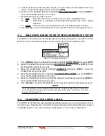
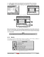
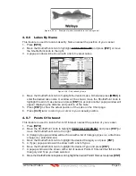
5. Another window will be shown detailing the selected Tide Station information.
6. Press
[CLR]
to show the actual position of the Tide Station on the Chart page.
7. Press
[CLR]
again at any time to return your cursor to your vessels position.
WAAS 3D
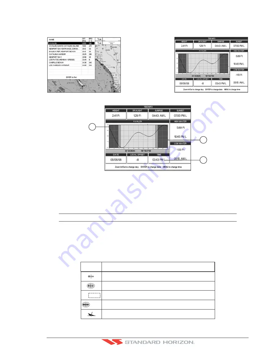
Figure 4.0.2 - Tide Stations
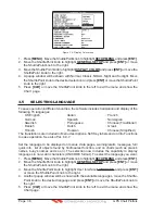
2
1
3
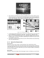
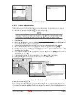
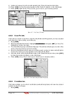
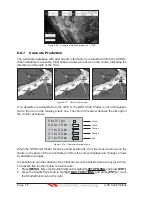
Figure 4.0.2a - Tide Graph page
Refer to the image above. The time (3) displayed corresponds to the location of the cross-
hair cursor (2) in the Tide Graph (1). Moving the ShuttlePoint knob to the left or right changes
the time, moving the ShuttlePoint knob up or down selects the Tide height and Tide draught
on the Tide Graph.
NOTE
The Local Offset matchs the Time Offset entered in the Time Setup menu (see Par. 3.2)
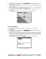
4.0.3 Wrecks
This feature is used to locate Wrecks nearest the position of your vessel. A Wreck is
represented with an icon on the chart, see the following table:
non
-
dangerous
w
reck
dangerous
w
reck
distributed remains of
w
reck
w
reck sho
w
ing mast
/
masts
w
reck sho
w
ing any portion of hu
ll
or superstructure
I
CON
DE
SCR
I
PT
I
ON
Masts
#
F o u l
Figure 4.0.3 - Wreck icons Table
Содержание CP180
Страница 1: ...CP180 CP180i CP300 CP300i Owner s Manual Color GPS Chart Plotters R ...
Страница 4: ...Page 6 GPS Chart Plotters R ...
Страница 12: ...Page 14 GPS Chart Plotters R ...
Страница 38: ...Page 40 GPS Chart Plotters R ...
Страница 48: ...Page 50 GPS Chart Plotters R ...
Страница 60: ...Page 62 GPS Chart Plotters R ...
Страница 68: ...Page 70 GPS Chart Plotters R ...
Страница 76: ...Page 78 GPS Chart Plotters R ...
Страница 80: ...Page 82 GPS Chart Plotters R ...
Страница 108: ...Page 110 GPS Chart Plotters R ...
Страница 118: ...Page 120 GPS Chart Plotters R ...
Страница 120: ...Page 122 GPS Chart Plotters R ...
Страница 126: ...Page 128 GPS Chart Plotters R ...
Страница 130: ...Page 132 GPS Chart Plotters R ...


